
La Vega Province facts for kids
La Vega is a Dominican province, located in the central part of the country. Its capital city is La Vega. It was one of the first provinces created in the Dominican Republic, established by the country's first constitution in 1844. Its name has always been La Vega.
Quick facts for kids La Vega |
||
| Province | ||
|
||
| Country | ||
|---|---|---|
| Development region | Cibao Sur (II) | |
| Capital | La Vega | |
| - elevation | 101 m (331 ft) | |
| - coordinates | 19°13′12″N 70°31′48″W / 19.22000°N 70.53000°W | |
| Area | 2,292.5 km² (885 sq mi) | |
| Population | 447,905 | |
| Density | 195 /km² (505 /sq mi) | |
| Province since | 1844 | |
| Subdivisions | 4 municipalities 8 municipal districts |
|
| Congresspersons | 1 Senator 8 Deputies |
|
| Timezone | EST (UTC-4) | |
| Area code | 1-809 1-829 1-849 | |
| ISO 3166-2 | DO-13 | |

Contents
Name of the Province
The province is named after its capital and most important city: Concepción de la Vega. People usually call the city just La Vega. The name "La Vega" means "The Valley" in Spanish.
History of La Vega
The province of La Vega was created in 1844. At first, it included the areas of La Vega, San Francisco de Macorís, and Cotuí. In 1855, Moca also became a part of the province.
Over the years, the province's boundaries and towns changed. By 1959, it included the municipalities of La Vega, Constanza, Jarabacoa, and Monseñor Nouel (which is now Bonao). Concepción de La Vega remained its capital.
In 1982, the province had the municipalities of La Vega, Constanza, and Jarabacoa, along with the municipal district of Jima Abajo. Jima Abajo later became a full municipality in 1996. Other areas like Tireo, Rincón, Río Verde Arriba, El Ranchito, La Sabina, Buena Vista, Manabao, and Tavera became municipal districts between 1993 and 2010.
Where is La Vega Located?
The La Vega province is in the central part of the Dominican Republic. It shares borders with several other provinces:
- To the north: Santiago and Espaillat provinces.
- To the east: Hermanas Mirabal, Duarte, and Sánchez Ramírez provinces.
- To the south: Monseñor Nouel and San José de Ocoa provinces.
- To the west: Azua and San Juan provinces.
 |
Santiago | Espaillat | Hermanas Mirabal Duarte |
|
| San Juan | Sánchez Ramírez | |||
| Azua | San José de Ocoa | Monseñor Nouel |
Population of La Vega
According to the last national census in 2014, about 447,905 people lived in La Vega province. Out of these, 185,101 people lived in towns and cities. This means the province has about 195.4 people per square kilometer.
La Vega is the 5th most populated province in the Dominican Republic. Its population makes up about 4.74% of the country's total population.
As of 2016, the estimated population of the province was 405,510 people. The largest city in the province is La Vega, which is also its capital. In 2014, La Vega city had 202,864 inhabitants.
Geography and Landscape
.jpg)
The La Vega province covers a total area of about 2,292.5 km2 (885.1 sq mi). This makes it the 6th largest province in the Dominican Republic. It covers about 4.7% of the country's total area.
The capital city, Concepción de la Vega, is about 101 m (331 ft) above sea level.
The western part of the province is home to the Cordillera Central, which is a large mountain chain. The eastern part of the province is in the "Valle de la Vega Real," also known as the "Royal Valley." This is the eastern part of the Cibao Valley.
In the mountains, there are several fertile valleys. These valleys are important for growing vegetables and fruits. The three most important valleys are:
- Constanza
- Jarabacoa
- Tireo
The highest mountain in the province is Alto Bandera, which is 2,872 m (9,423 ft) high.
The main rivers flowing through the province are the Yaque del Norte and the Camú rivers.
La Vega also has important protected natural areas. These include the Scientific Reserve Ébano Verde and the Scientific Reserve Valle Nuevo.
Climate
The climate in La Vega province is generally tropical. This means it is hot for most of the year. However, it gets cooler in the mountain areas.
Municipalities and Districts
La Vega province is divided into 4 main municipalities and 8 municipal districts. These are smaller areas that help manage the province.

| Municipality (code) |
Municipal Districts (code) | Population (2010) |
Area (km2) |
Density | Altitude (m) |
|---|---|---|---|---|---|
| La Vega (130101) | 202,864 | 410.9 | 493.7 | 89 | |
| Río Verde Arriba (130102) | 23,109 | 67.2 | 343.9 | 154 | |
| El Ranchito (130103) | 9,626 | 48.0 | 200.5 | 52 | |
| Tavera (130104) | 12,490 | 115.9 | 107.8 | 380 | |
| Concepción de la Vega (130100) | 248,089 | 642.1 | 386.4 | ||
| Constanza (130201) | 34,687 | 261.7 | 132.5 | 1177 | |
| Tireo (130202) | 15,349 | 295.3 | 52.0 | 1233 | |
| La Sabina (130203) | 9,016 | 293.4 | 30.7 | 1740 | |
| Constanza (130200)) | 59,052 | 850.4 | 69.4 | ||
| Jarabacoa (130301) | 40,556 | 313.6 | 129.3 | 536 | |
| Buena Vista (130302) | 12,232 | 98.0 | 124.8 | 557 | |
| Manabao (130303) | 4,015 | 262.4 | 1.8 | 922 | |
| Jarabacoa (130300) | 56,803 | 673.9 | 84.3 | ||
| Jima Abajo (130401) | 16,267 | 58.0 | 280.5 | 72 | |
| Rincón (130403) | 13,994 | 68.1 | 205.5 | 86 | |
| Jima Abajo (130400) | 30,261 | 126.1 | 240.0 | ||
| La Vega province (130000) | 447,905 | 2,292.4 | 195.4 | ||
Economy of La Vega
The main way people make a living in La Vega province is through agriculture. Farmers grow different crops depending on the area.
- In the mountains, coffee is a major product.
- In the southern and eastern parts of the province, rice is widely grown.
- In the lower mountains and parts of the valley near the mountains, cacao (used to make chocolate) is important.
- The valleys in the mountains are also known for producing many kinds of vegetables and fruits.
Another important economic activity is raising cattle. There are also several industries in La Vega, especially those that make textiles (fabrics) and food products.
Recently, Tourism has become a very important part of the economy, especially in the towns of Jarabacoa and Constanza, which are popular for their natural beauty.
Images for kids
-
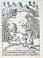
Battle of Santo Cerro.
-
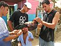
People in countryside of La Vega, Dominican Republic.
.jpg)

See also
 In Spanish: Provincia de La Vega para niños
