Bonao facts for kids
Quick facts for kids
Bonao
|
||
|---|---|---|
|
City
|
||
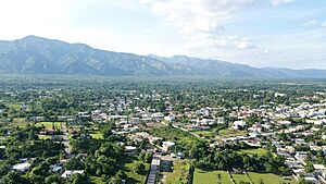
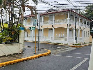
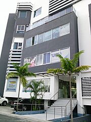
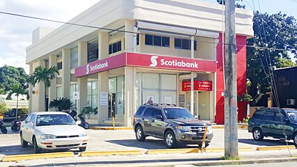
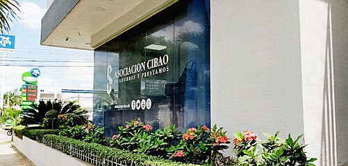
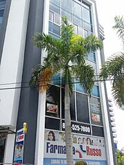
View of Bonao city, Dominican Republic
|
||
|
||
| Country | ||
| Province | Monseñor Nouel | |
| Founded | 1495 | |
| Municipality since | 1865 | |
| Area | ||
| • Total | 664.37 km2 (256.51 sq mi) | |
| Elevation | 173 m (568 ft) | |
| Population
(2012)
|
||
| • Total | 158,034 | |
| • Density | 237.8705/km2 (616.082/sq mi) | |
| • Urban | 60,044 | |
| Distance to – Santo Domingo |
85 km |
|
| Municipal Districts | 5 |
|
| Climate | Af | |
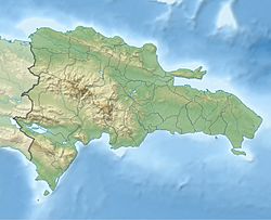
Bonao is a lively city in the Cibao region of the Dominican Republic. It is the main city and capital of the Monseñor Nouel province. You can find Bonao right in the middle of the country, northwest of the capital city, Santo Domingo.
People often call Bonao "Villa de las Hortensias," which means "the town of hydrangeas." This is because the beautiful hydrangea flower is a special symbol of Bonao.
Contents
A Look Back: Bonao's History
When the Spanish explorers first arrived, the land where Bonao now stands belonged to the Taino people. Their leader was a chief named Maguá. In 1495, Bartolomé Colón (Christopher Columbus's brother) explored the island. He ordered a fort to be built here. This fort was meant to help fight against the local Taino people, who were led by a chief also named Bonao.
The first fort was called Bonao Abajo. Later, a Spanish soldier named Francisco Roldán took over this fort. Roldán and about 70 rebels fought against the Columbus family's rule in 1497. Their rebellion ended in October 1498. Many of the rebels stayed in the area, and this helped the town of Bonao to grow.
On December 7, 1508, Bonao officially became a town. It even got its own coat of arms (a special symbol). At first, the main way people made money was by mining gold. When there wasn't much gold left, two sugar mills were built in Bonao. But sugar production wasn't enough to keep many Spaniards interested. By 1528, the town had become much smaller.
After the Dominican Republic became independent in the mid-1800s, Bonao was a military outpost. In 1865, it became a proper municipality (a self-governing town) called San Antonio de Bonao. For a long time, the town was quite isolated and only had about 5,000 people.
Bonao started to grow again in the 1920s. This happened when the Duarte Highway opened. This highway connected Santo Domingo with the Cibao region. Bonao became a popular stop for travelers going between the capital and Santiago. Cars and buses would refuel, and passengers could rest, eat, and drink. Many restaurants opened during this time.
Old Neighborhoods of Bonao
In 1920, the first national count of people (census) showed that Bonao had only 1,069 residents. By 1935, it grew to 2,129 people. In 1950, the population was 10,536. The most recent census from 2010 showed that the municipality of Bonao had 125,338 people.
How Bonao Makes Money
Bonao's economy relies on local businesses and farms. A big part of its income also comes from a mining company called Americano Níquel (also known as Falcondo).
Most of Bonao's farms (80%) grow rice. The rest of the farmland is used for growing cocoa and coffee. There are also important companies that provide jobs, like Bonao Industrial and Hanesbrands Dos Rios Textiles, Inc.
Learning and New Technology
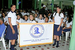
Bonao has many schools for different ages. There are public and private schools for basic and secondary education. Some well-known schools include Elías Rodríguez Secondary School and Francisco Antonio Batista García School. There are also polytechnic schools like Francisco Antonio Batista García Polytechnic, which teaches computer science, business, nursing, and industrial skills. Other schools are Ing. José Delio Guzmán and Pedro Antonio Frías. Private schools include San Antonio de Padua, Bonao Educational Center, Colegio San Pablo, and Colegio Juan Pablo Duarte.
For higher education, Bonao has a branch of the state university, the Autonomous University of Santo Domingo (CURCE-UASD).
Near the Dominican Agrarian Institute in Bonao, the first syngas plant in the country was built. This plant creates energy from plant materials like rice straw and banana peels. It was named after Engineer Quilvio Cabrera, who was a big supporter of using technology in farming.
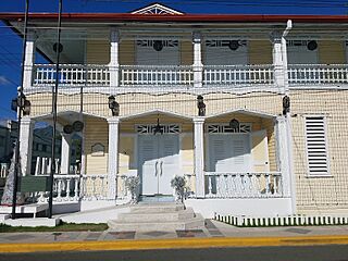
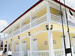
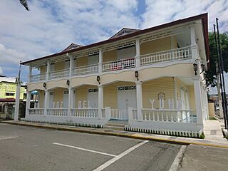
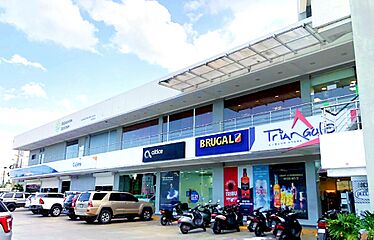
Views of Bonao City
Staying Connected: Telecommunications
Bonao has many local ways to get news and entertainment. This includes TV channels, radio stations, and online news. The Telecasa company offers different TV channels for Bonao and other towns in the province.
Bonao is also famous for being the original home of La Voz Dominicana. This was the official radio and TV station of the Dominican Republic for many years. It started as a local radio station called La Voz del Yuna in 1943. Later, Jose Trujillo, the brother of President Trujillo, bought the station. He convinced his brother to get the equipment needed to turn it into a radio and TV station. In the early 1950s, it became Radio Television Dominicana (RTVD). At that time, only a few countries in Latin America had TV stations.
Bonao's Weather
Bonao has a tropical rainforest climate. This means it gets a lot of rain all year round. There isn't a dry season, as every month averages more than 100 millimeters (about 4 inches) of rain. However, May and the months from August to November (when hurricanes can happen) are usually much wetter.
| Climate data for Bonao (1961-1990) | |||||||||||||
|---|---|---|---|---|---|---|---|---|---|---|---|---|---|
| Month | Jan | Feb | Mar | Apr | May | Jun | Jul | Aug | Sep | Oct | Nov | Dec | Year |
| Record high °C (°F) | 35.2 (95.4) |
36.3 (97.3) |
37.5 (99.5) |
36.8 (98.2) |
37.5 (99.5) |
38.9 (102.0) |
39.2 (102.6) |
38.9 (102.0) |
38.9 (102.0) |
38.9 (102.0) |
37.1 (98.8) |
36.5 (97.7) |
39.2 (102.6) |
| Mean daily maximum °C (°F) | 29.5 (85.1) |
29.9 (85.8) |
30.8 (87.4) |
31.3 (88.3) |
31.7 (89.1) |
32.9 (91.2) |
33.0 (91.4) |
33.0 (91.4) |
33.1 (91.6) |
32.6 (90.7) |
31.2 (88.2) |
29.5 (85.1) |
31.5 (88.7) |
| Mean daily minimum °C (°F) | 18.1 (64.6) |
18.1 (64.6) |
18.7 (65.7) |
19.5 (67.1) |
20.1 (68.2) |
20.9 (69.6) |
21.1 (70.0) |
21.0 (69.8) |
20.6 (69.1) |
20.3 (68.5) |
19.6 (67.3) |
18.7 (65.7) |
19.7 (67.5) |
| Record low °C (°F) | 12.0 (53.6) |
12.2 (54.0) |
14.5 (58.1) |
14.8 (58.6) |
15.8 (60.4) |
17.0 (62.6) |
17.2 (63.0) |
16.5 (61.7) |
17.0 (62.6) |
16.3 (61.3) |
13.2 (55.8) |
12.4 (54.3) |
12.0 (53.6) |
| Average rainfall mm (inches) | 107.2 (4.22) |
108.3 (4.26) |
117.7 (4.63) |
204.1 (8.04) |
333.3 (13.12) |
138.8 (5.46) |
176.3 (6.94) |
203.9 (8.03) |
180.2 (7.09) |
251.8 (9.91) |
248.2 (9.77) |
146.4 (5.76) |
2,216.2 (87.25) |
| Average rainy days (≥ 1.0 mm) | 9.5 | 8.3 | 9.2 | 11.6 | 14.0 | 9.6 | 13.6 | 13.5 | 12.1 | 13.7 | 14.5 | 12.4 | 142.0 |
| Source: NOAA | |||||||||||||
Life in Bonao
Motorcycles, especially mini-bikes and scooters (called 'PASOLA'), are the most common way to get around the city. You can also find taxi services and places to rent cars. The main highway, DR-1 (Autopista Duarte), goes around the east side of the city.
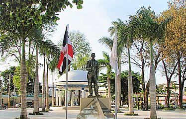
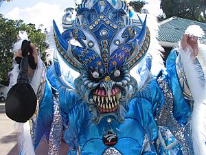
A very popular event each year is the Carnival. Groups that take part in the Carnival often start in "caves" (which are usually blocked-off streets) where loud music plays. The costumes are sometimes a bit scary or demonic-looking. During Carnival season, there's often a concert in the town square (El Parque Duarte) on Saturday nights.
Famous People from Bonao
Many talented people come from Bonao! Some well-known baseball players include former pitcher Carlos Mármol, catcher Deivy Grullón, and relief pitchers Hansel Robles and Joel Peralta. Third baseman Juan Francisco, known as "Baby Huey," is also from Bonao.
In music, the famous singer and composer Hector Acosta, known as 'El Torito', is a big star from Bonao. Luis Días, who wrote the popular song "Baile en la Calle," was also born here.
Aniana Vargas, an important female activist during the 1965 Civil War, grew up in Bonao.
See also
 In Spanish: Bonao para niños
 | George Robert Carruthers |
 | Patricia Bath |
 | Jan Ernst Matzeliger |
 | Alexander Miles |


