
Monseñor Nouel Province facts for kids
Quick facts for kids Monseñor Nouel |
|||
| Province | |||
|
|||
| Country | |||
|---|---|---|---|
| Development region | Cibao Sur (II) | ||
| Capital | Bonao | ||
| - elevation | 173 m (568 ft) | ||
| - coordinates | 18°57′0″N 70°24′36″W / 18.95000°N 70.41000°W | ||
| Area | 992.0 km² (383 sq mi) | ||
| Population | 203,183 (2014) | ||
| Density | 205 /km² (531 /sq mi) | ||
| Province since | 1982 | ||
| Subdivisions | 3 municipalities 7 municipal districts |
||
| Congresspersons | 1 Senator 3 Deputies |
||
| Timezone | EST (UTC-4) | ||
| Area code | 1-809 1-829 1-849 | ||
| ISO 3166-2 | DO-28 | ||


Monseñor Nouel is a province in the central part of the Dominican Republic. Its capital city is Bonao. This province was created in 1982. Before that, it was a part of the La Vega province.
Contents
Name of the Province
The province is named after Archbishop Adolfo Alejandro Nouel. He was the President of the Dominican Republic from 1912 to 1913.
History of Monseñor Nouel
The valley where Monseñor Nouel province is located was called Sabana de Bonao by the Spanish conquistadors. "Bonao" was the original Taíno name for this area.
Between 1495 and 1497, Bartholomew Columbus, who was Christopher Columbus's younger brother, built a fort here. Bonao quickly became one of the most important cities on the Hispaniola island during the early years of the Spanish colony.
Later, the city was left empty for a while. It was founded again during the Haitian occupation and was called "Paraje del Yuna." In 1859, it became a military post within the municipality of La Vega. In 1936, it officially became a municipality of La Vega province and was named Monseñor Nouel.
The Monseñor Nouel province was officially created in 1982. It included the municipality of Monseñor Nouel and the municipal districts of Piedra Blanca and Maimón. In 2005, the name of the main municipality was changed to Bonao, though it had been known by that name since 1960.
Over time, more areas became official municipalities or municipal districts. Maimón became a municipality in 1982, and Piedra Blanca became the third municipality in 1991. Other areas like Villa Sonador, Sabana del Puerto, Juan Adrián, Juma Bejucal, Arroyo Toro-Masipedro, and Jayaco became municipal districts between 1999 and 2006.
Where is Monseñor Nouel Located?
The Monseñor Nouel province is surrounded by other provinces. To its north and west is the La Vega province. To the east, it borders the Sánchez Ramírez and Monte Plata provinces. To the south, it is next to the San Cristóbal and San José de Ocoa provinces.
 |
La Vega | |
||
| La Vega | Sánchez Ramírez | |||
| San José de Ocoa | San Cristóbal | Monte Plata |
Population of the Province
In 2014, which was the last national census, about 203,183 people lived in Monseñor Nouel province. Out of these, 112,305 people lived in towns and cities. This means the province has a population density of about 204.8 people per square kilometer.
The province's population makes up about 2.15% of the total population of the Dominican Republic. It is the 17th most populated province out of 31 provinces and the National District.
As of 2016, the estimated total population for the province is 171,040 people.
The largest city in the province is Bonao, which is also its capital. In 2014, Bonao had a population of 76,241 people.
Geography of Monseñor Nouel
The Monseñor Nouel province covers a total area of 992.0 km2 (383.0 sq mi). This is about 2.1% of the total area of the Dominican Republic. It is the 24th largest province in the country.
The city of Bonao, the capital, is located about 176 m (577 ft) above sea level.
The province is mostly a valley surrounded by mountains. The Cordillera Central (Central mountain range) is to the north, west, and south. The Sierra de Yamasá (Yamasá mountain range), which is part of the Cordillera Central, is to the east.
The most important river in the province is the Yuna River. It is one of the largest rivers in the Dominican Republic and on the Hispaniola island.
Climate
The climate in Monseñor Nouel province is tropical. This means it is hot for most of the year.
Municipalities and Districts
Monseñor Nouel province has three main municipalities and seven smaller areas called municipal districts (M.D.).

| Municipality (code) |
Municipal Districts (code) | Population (2010) |
Area (km2) |
Density | Altitude (m) |
|---|---|---|---|---|---|
| Bonao (280101) | 76,241 | 142.8 | 533.9 | 176 | |
| Sabana del Puerto (280102) | 10,049 | 133.1 | 75.5 | 147 | |
| Juma Bejucal (280103) | 22,545 | 72.2 | 312.3 | 181 | |
| Arroyo Toro - Masipedro (280104) | 2,851 | 103.1 | 27.7 | 922 | |
| Jayaco (280105) | 8,051 | 29.5 | 272.9 | 184 | |
| La Salvia - Los Quemados (280106) | 5,601 | 197.4 | 28.4 | 452 | |
| Bonao (280100) | 125,338 | 678.1 | 184.8 | ||
| Maimón (280201) | 18,952 | 82.6 | 229.4 | 124 | |
| Maimón (280200)) | 18,952 | 82.6 | 229.4 | ||
| Piedra Blanca (280301) | 10,615 | 117.6 | 90.3 | 220 | |
| Villa de Sonador (280302) | 7,028 | 53.2 | 132.1 | 190 | |
| Juan Adrián (280303) | 3,291 | 60.5 | 54.4 | 391 | |
| Piedra Blanca (280300)) | 20,934 | 231.4 | 90.5 | ||
| Monseñor Nouel (280000) | 203,183 | 992.0 | 204.8 | ||
Economy of the Province
The main ways people make a living in Monseñor Nouel province are through farming and mining. They mostly mine for nickel using surface mining methods.
The province is also important for growing rice. Raising Cattle is another big activity, especially for producing milk.
Images for kids
-
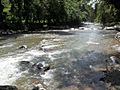
River in Monseñor Nouel Province.
-
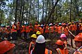
Workers in Monseñor Nouel province.

.jpg)
See also
 In Spanish: Provincia de Monseñor Nouel para niños
