
Monte Plata Province facts for kids
Monte Plata is a province in the Dominican Republic. Its main city, also called Monte Plata, is the capital. This province was created in 1982 from a part of the San Cristóbal province.
Contents
What's in a Name?
The province is named after its capital city, Monte Plata. Long ago, during the time of colonial rule, people from two towns, Monte Cristi and Puerto Plata, were told by the Spanish king to move and live in this area. They combined parts of their old town names to create "Monte Plata" for their new home.
A Look at History
After the Dominican Republic became independent from Haiti in 1844, this area was part of the old Santo Domingo Province. During the Restoration War (1861-1865), which was a fight against Spain, many important battles happened here.
In 1932, this region became part of the new San Cristóbal province. Later, it was made its own province called Monte Plata. For a short time, its name was changed to Monseñor Meriño to honor Archbishop Fernando Arturo de Meriño, who was President of the Dominican Republic from 1880 to 1882.
Then, in 1944, the province became part of San Cristóbal province again. Finally, in 1982, the new Monte Plata province was officially created. It included the municipalities of Monte Plata, Sabana Grande de Boyá, Yamasá, and Bayaguana. In 2004, Peralvillo also became a municipality.
Over the years, several areas became municipal districts. These include Don Juan (1987), Gonzalo (1997), Los Botados (1998), Majagual (2001), Chirino (2002), Boyá (2004), and Mamá Tingó (2010).
Where is Monte Plata?
The Monte Plata province is located right in the middle of the Dominican Republic.
- To the north, it shares borders with the Sánchez Ramírez, Duarte, and Samaná provinces.
- To the east, you'll find the Hato Mayor and San Pedro de Macorís provinces.
- To the south, it borders the Santo Domingo province.
- To the west, it's next to the San Cristóbal and Monseñor Nouel provinces.
 |
Sánchez Ramírez | Duarte | Samaná | |
| Monseñor Nouel | Hato Mayor | |||
| San Cristóbal | Santo Domingo | San Pedro de Macorís |
People and Population
In 2014, the last time a national count was done, there were about 222,641 people living in Monte Plata province. About 91,838 of these people lived in towns and cities.
The population density was about 85.6 people for every square kilometer. This means how many people live in a certain area.
Monte Plata's population makes up about 2.36% of the country's total population. It is the 15th most populated province out of 31, plus the National District.
As of 2016, it's estimated that the province has about 189,166 people living there.
The biggest city in the province is Bayaguana. In 2014, about 20,303 people lived in its urban part. The capital city, Monte Plata, had about 16,115 people living in its urban area.
Geography and Landscape
The Monte Plata province covers a total area of about 2,601.6 km2 (1,004.5 sq mi). This is about 5.4% of the total area of the Dominican Republic. It is the 5th largest province in the country.
The capital city, Monte Plata, is about 53 m (174 ft) above sea level.
The Sierra de Yamasá mountain range is located to the east and north of the province. There's also a special karstic region called Los Haitises in the northwestern part. Most of this area is now a national park, protecting its unique landscape.
The Ozama River is the most important river in the province. Other rivers include Yabacao, Yamasá, Comate, Mijo, and Guanuma. These are all tributaries, meaning they flow into the Ozama River.
Climate
Monte Plata province has a tropical wet climate. This means it's usually warm and moist all year round, without a dry or cold season.
Local Divisions: Municipalities
The province is divided into five main areas called municipalities. It also has seven smaller areas known as municipal districts.

| Municipality (code) |
Municipal Districts (code) | Population (2010) |
Area (km2) |
Density | Altitude (m) |
|---|---|---|---|---|---|
| Monte Plata (290101) | 26,192 | 264.4 | 99.1 | 53 | |
| Don Juan (290102) | 7,313 | 102.9 | 71.1 | 61 | |
| Chirino (290103) | 7,951 | 127.2 | 62.5 | 20 | |
| Boyá (290104) | 5,267 | 136.7 | 38.5 | 91 | |
| Monte Plata (290100) | 46,723 | 631.1 | 74.0 | ||
| Bayaguana (290201) | 31,889 | 873.0 | 36.5 | 50 | |
| Bayaguana (290200)) | 31,889 | 873.0 | 36.5 | ||
| Sabana Grande de Boyá (290301) | 23,630 | 216.9 | 108.9 | 286 | |
| Gonzalo (290302) | 5,222 | 207.7 | 25.1 | 295 | |
| Majagual (290303) | 2,244 | 102.6 | 21.9 | 211 | |
| Sabana Grande de Boyá (290300)) | 31,096 | 527.3 | 59.0 | ||
| Yamasá (290401) | 29,198 | 260.3 | 112.2 | 52 | |
| Los Botados (290402) | 16,228 | 68.5 | 236.9 | 106 | |
| Mamá Tingó (290403) | 9,922 | 105.5 | 94.0 | 137 | |
| Yamasá (290400)) | 55,348 | 434.2 | 127.5 | ||
| Peralvillo (290501) | 20,900 | 136.0 | 153.7 | 121 | |
| Peralvillo (290500)) | 20,900 | 136.0 | 153.7 | ||
| Monte Plata (290000) | 222,641 | 2,601.6 | 85.6 | ||
Economy and Farming
The most important way people make a living in Monte Plata province is through farming. Farmers grow many important crops here. These include sugar cane, cacao (used to make chocolate), and various fruits like oranges.
Raising Cattle is also a very important part of the economy in Monte Plata.
Images for kids
-
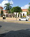
A street in Monte Plata, Dominican Republic.
-

People enjoying a public pool in Monte Plata, Dominican Republic.

.jpg)
See also
 In Spanish: Provincia de Monte Plata para niños
Quick facts for kids Monte Plata |
||
| Province | ||
 A street in Monte Plata
|
||
|
||
| Country | ||
|---|---|---|
| Development region | Higuamo (IX) | |
| Largest city | Bayaguana | |
| Capital | Monte Plata | |
| - elevation | 53 m (174 ft) | |
| - coordinates | 18°48′36″N 69°47′24″W / 18.81000°N 69.79000°W | |
| Area | 2,601.6 km² (1,004 sq mi) | |
| Population | 222,641 (2014) | |
| Density | 86 /km² (223 /sq mi) | |
| Province since | 1982 | |
| Subdivisions | 5 municipalities 7 municipal districts |
|
| Congresspersons | 1 Senator 4 Deputies |
|
| Timezone | EST (UTC-4) | |
| Area code | 1-809 1-829 1-849 | |
| ISO 3166-2 | DO-29 | |

