Great Kei River facts for kids
Quick facts for kids Great Kei River |
|
|---|---|
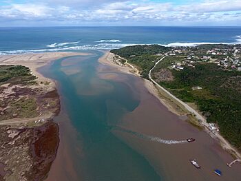
Aerial photograph of the mouth of the Great Kei River as it meets the Indian Ocean. The river ferry allowing vehicles and passengers to cross the river can be seen in the foreground.
|
|
|
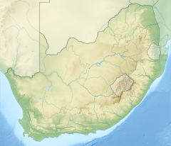
Location of the Great Kei River mouth
|
|
| Other name(s) | Groot-Keirivier |
| Country | South Africa |
| Province | Eastern Cape Province |
| Physical characteristics | |
| Main source | Stormberg Mountains Eastern Cape, South Africa 1,500 m (4,900 ft) |
| River mouth | Indian Ocean By Kei Mouth, South Africa 0 m (0 ft) 32°40′34″S 28°22′51″E / 32.67611°S 28.38083°E |
| Length | 320 km (200 mi) |
| Basin features | |
| Tributaries |
|
The Great Kei River is an important river in the Eastern Cape province of South Africa. It starts where two rivers, the Black Kei River and the White Kei River, join together. This meeting point is northeast of a town called Cathcart.
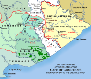
The Great Kei River flows for about 320 kilometres (200 miles). It finally reaches the Indian Ocean at a place called the Great Kei Estuary. An estuary is where a river meets the sea. On the west side of the river mouth is a small town called Kei Mouth. Long ago, the Great Kei River marked the southwestern edge of a region known as the Transkei. It was also once called the Nciba River.
Contents
Where the Great Kei River Flows
The Great Kei River has a winding path, meaning it twists and turns a lot. It begins where the Black Kei River and the White Kei River meet. This is in the Enoch Mgijima Local Municipality, northeast of Cathcart. From there, the Great Kei River flows southeast for about 225 kilometres (140 miles). It follows many bends until it reaches the Indian Ocean at the Great Kei estuary. This is near Kei Mouth, a popular holiday spot by the coast.
The longest river that flows into the Great Kei is the Tsomo, located to the north. The name "Kei" comes from a Khoisan word for river, meaning 'sand'. This name has been used since at least 1752.
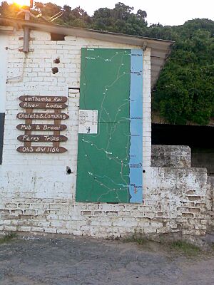
The Great Kei River used to form the southwestern border of the Transkei region. You can cross the river using a special ferry called the 'Pont'. This is one of only two car-carrying river ferries in South Africa. The Pont is still used today, helping cars and people cross from the southwestern side to the northeastern side, which leads into the Wild Coast.
Climate Around the River
The areas where rivers like the Great Kei meet the ocean, from here all the way to southern Mozambique, have a subtropical climate. This means the water is usually warm, often above 16 degrees Celsius. The weather is warm and humid for most of the year. Even in winter, the lowest temperatures are usually between 12 and 14 degrees Celsius. This area also gets rain throughout the year.
Plants and Animals of the Great Kei
The parts of the Great Kei River that are further inland flow through areas with thick bushes and forests. As the river gets closer to the ocean, it passes through coastal bushland. The mouth of the Kei River is special because it has the most southerly natural mangrove forests in Southern Africa. Mangroves are unique trees that grow in salty water.
North of the Mngazana estuary, you can find swamp forests. South of the Great Kei estuary, there are salt marshes. The Great Kei river mouth is a popular place for people who like to fish. This is because many different types of fish live in the estuary. However, some fish, like the South African Cob and White steenbras, are in danger of disappearing. Many coastal birds also live here, such as the African oystercatcher, sandpipers, and kingfishers.
The Great Kei Rail Bridge
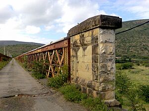
Building a bridge over the Kei River was a big project that started in 1877. Materials for the bridge were brought from Britain to East London by ship. From there, they were moved by ox wagon and train. Work on the bridge was stopped several times because of conflicts in the area, including the 9th Frontier War. During this time, workers had to leave the area for safety. Some British soldiers were even killed by Xhosa warriors at a nearby hill called Moordenaarskop (Murderers’ Hill).
From 1907 to 1917, a railway line crossed the Great Kei River on a wooden bridge. This wooden bridge was destroyed by a flood. The railway line was then moved to a new road bridge next to it. This bridge was taken apart in 1946 and put back together in 1947. It took two and a half years to finish building the bridge. Today, the bridge is still used by local people and farmers. The Great Kei Bridge is located in the Amathole District Municipality and is about 0.46 kilometres long.
Dams in the Great Kei River Area
Several dams have been built in the area where the Great Kei River and its tributaries flow. These dams help to store water.
- The Xonxa Dam is on the White Kei River.
- The Wriggleswade Dam is on the Kubusi River.
- The Bongolo Dam is on the Komani River. The Komani River is a tributary of the Klaas Smits River, which then flows into the Black Kei River.
The Great Kei Pass
The N2 road, a major highway, goes through the towns of Komga and Butterworth. This part of the road is known as the Great Kei Pass or Kei Cuttings. It is famous for having many accidents. This is often due to mist and cattle wandering onto the road. This section of the N2 crosses over the Great Kei River. The Kei Cuttings are inland from places like Kei Mouth, Morgans Bay, and Chintsa West.
See also
- List of rivers of South Africa
- List of estuaries of South Africa
 | Claudette Colvin |
 | Myrlie Evers-Williams |
 | Alberta Odell Jones |


