Mozambique facts for kids
Quick facts for kids
Republic of Mozambique
República de Moçambique (Portuguese)
|
|
|---|---|
|
|
|
|
Anthem: Pátria Amada (Portuguese)
"Beloved Homeland" |
|
| Capital and largest city
|
Maputo 25°57′S 32°35′E / 25.950°S 32.583°E |
| Official languages | Portuguese |
| Recognised regional languages | Makhuwa, Sena, Tsonga, Lomwe, Swahili |
| Ethnic groups
(2017)
|
|
| Religion
(2020)
|
|
| Demonym(s) | Mozambican |
| Government | Unitary dominant-party semi-presidential republic under an authoritarian government |
| Daniel Chapo | |
| Vacant | |
| Legislature | Assembly of the Republic |
| Formation | |
|
• Independence from Portugal
|
25 June 1975 |
|
• Admitted to the United Nations
|
16 September 1975 |
| 1977–1992 | |
|
• Current constitution
|
21 December 2004 |
| Area | |
|
• Total
|
801,590 km2 (309,500 sq mi) (35th) |
|
• Water (%)
|
2.2 |
| Population | |
|
• 2024 estimate
|
34,881,007 (45th) |
|
• Density
|
28.7/km2 (74.3/sq mi) |
| GDP (PPP) | 2023 estimate |
|
• Total
|
|
|
• Per capita
|
|
| GDP (nominal) | 2023 estimate |
|
• Total
|
|
|
• Per capita
|
|
| Gini (2019) | ▼ 50.4 high |
| HDI (2022) | low · 183rd |
| Currency | Metical (MZN) |
| Time zone | UTC+2 (CAT) |
| Date format | dd/mm/yyyy |
| Driving side | left |
| Calling code | +258 |
| ISO 3166 code | MZ |
| Internet TLD | .mz |
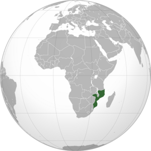
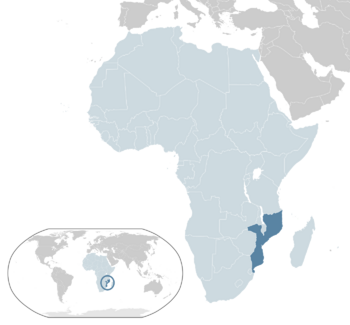
Mozambique is a country in southeast Africa. It has a long coastline along the Indian Ocean to the east. Its neighbors are Tanzania to the north, Malawi and Zambia to the northwest, Zimbabwe to the west, and Eswatini and South Africa to the south. The Mozambique Channel separates it from the Comoros, Mayotte, and Madagascar. The capital and largest city is Maputo.
Mozambique has about 34.8 million people. Most of them are Bantu peoples. The only official language is Portuguese. Many people in cities speak it as their first or second language. It is also a common language for younger Mozambicans who go to school. Important local languages include Tsonga, Makhuwa, Sena, Chichewa, and Swahili.
Contents
Naming Mozambique
The Portuguese named the country Moçambique after the Island of Mozambique. This name came from an Arab trader called Mussa Bin Bique (or similar names). He visited the island and lived there. Vasco da Gama met him in 1498. The island town was the capital of the Portuguese colony until 1898. Then, the capital moved south to Lourenço Marques, which is now Maputo.
History of Mozambique
Between the 7th and 11th centuries, many Swahili port towns grew along the coast. These towns helped create a unique Swahili culture and language. Later, traders from Somalia, Ethiopia, Egypt, Arabia, Persia, and India visited these towns.
In 1498, Vasco da Gama arrived, marking the start of Portuguese influence. Portugal began to colonize and settle the area in 1505. After more than 400 years of Portuguese rule, Mozambique became independent in 1975. It was then called the People's Republic of Mozambique.
Just two years after gaining independence, the country faced a long civil war. This war lasted from 1977 to 1992. In 1994, Mozambique held its first elections with many political parties. Since then, it has been a fairly stable republic with a president. However, there are still some small conflicts in the northern regions where Islam is common.
Geography and Climate
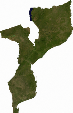
Mozambique is the world's 35th-largest country, covering about 801,590 square kilometers (309,496 square miles). It is located on the southeast coast of Africa.
The Zambezi River divides the country into two main land areas. North of the Zambezi, there is a narrow coastal strip. This strip leads to hills and low plateaus further inland. Even further west are rugged highlands. These include the Niassa, Namuli, Angonia, Tete highlands, and the Makonde plateau. These areas are covered with miombo woodlands.
South of the Zambezi, the lowlands are wider. Here you can find the Mashonaland plateau and the Lebombo Mountains in the far south.
Rivers and Lakes
Five main rivers and several smaller ones flow through Mozambique. The Zambezi River is the largest and most important. The country also has four important lakes in the north: Lake Niassa (also called Malawi), Lake Chiuta, Cahora Bassa, and Lake Shirwa.
Major cities in Mozambique include Maputo, Beira, Nampula, Tete, Quelimane, Chimoio, Pemba, Inhambane, Xai-Xai, and Lichinga.
Mozambique's Climate
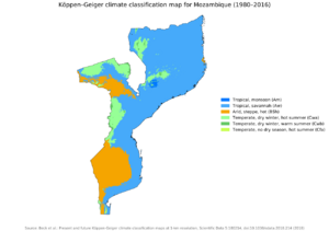
Mozambique has a tropical climate with two seasons. The wet season is from October to March, and the dry season is from April to September. The weather can change depending on how high up a place is.
Rainfall is heavy along the coast. It becomes less in the north and south. The country gets about 500 to 900 millimeters (20 to 35 inches) of rain each year. On average, it gets about 590 millimeters (23 inches). Cyclones are common during the wet season.
In Maputo, the average temperature in July is from 13 to 24 degrees Celsius (55 to 75 degrees Fahrenheit). In February, it ranges from 22 to 31 degrees Celsius (72 to 88 degrees Fahrenheit).
In 2019, Mozambique was hit by two very strong cyclones, Idai and Kenneth. This was the first time two cyclones struck the country in one season. These storms caused floods and a lot of damage. They destroyed many crops and affected millions of people.
Wildlife and Nature
Mozambique is home to many animals. There are about 740 different bird species. This includes 20 species that are globally threatened. There are also over 200 mammal species that live only in Mozambique. Some of these are the critically endangered Selous' zebra and Vincent's bush squirrel. There are also 13 other endangered or vulnerable species.
The country has many protected areas. These include thirteen forest reserves, seven national parks, and six nature reserves. There are also three frontier conservation areas and three wildlife or game reserves. These areas help protect Mozambique's amazing nature.
Government and Politics
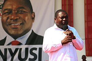
Mozambique's constitution says that the President of the Republic is the head of state and head of government. The president is also the leader of the armed forces and a symbol of national unity. People vote directly for the president every five years. If no one gets more than half the votes in the first round, the top two candidates have a second vote.
The president chooses the prime minister. The prime minister's jobs include leading the council of ministers (the cabinet) and helping the president run the country.
The Assembly of the Republic is Mozambique's parliament. It has 250 members who are elected for five-year terms. The country's legal system includes a Supreme Court and other courts in provinces, districts, and cities.
Mozambique has a small military called the Mozambique Defence Armed Forces. They handle the country's defense.
Administrative Divisions
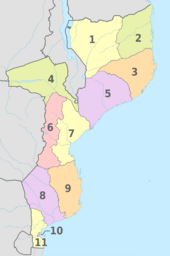
Mozambique is divided into ten provinces and one capital city that has provincial status. These provinces are then split into 129 districts. The districts are further divided into 405 "administrative posts" (postos administrativos). These posts are led by secretaries. The smallest level of government is called "localities" (localidades). There are also 53 "municipalities" (municípios).
 |
Economy and Resources
Mozambique is one of the world's poorest countries. Its official money is the metical. Other currencies like the U.S. dollar, South African rand, and the euro are also used for business. The minimum legal salary is about US$60 per month.
Mozambique is part of the Southern African Development Community (SADC). This group aims to make trade easier by removing taxes and other barriers between countries in Southern Africa.
Natural Resources
In 2010–2011, large amounts of natural gas were found off the coast of northern Cabo Delgado Province. This discovery could make Mozambique one of the biggest producers of liquefied natural gas (LNG) in the world. Exports of LNG are expected to start globally in 2024.
Tourism in Mozambique
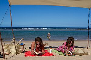
Mozambique has beautiful nature, wildlife, and historical sites. These offer chances for beach trips, cultural experiences, and eco-tourism. The country has a lot of potential for its economy to grow through tourism.
The northern beaches have clear water and are great for tourists. This is especially true for places far from cities, like the Quirimbas Islands and the Bazaruto archipelago. The Inhambane Province attracts divers from around the world. This is because of its rich marine life, including whale sharks and manta rays. There are also several national parks, such as Gorongosa National Park.
Transportation
Mozambique has over 30,000 kilometers (18,641 miles) of roads, but many are not paved. Like its neighbors in the Commonwealth of Nations, traffic drives on the left side of the road.
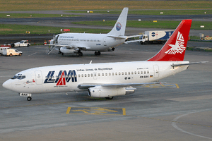
There is an international airport in Maputo. There are also 21 other paved airports and over 100 airstrips with unpaved runways. The country has 3,750 kilometers (2,330 miles) of rivers and lakes that boats can use.
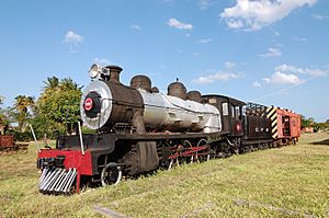
There are also rail links that connect major cities and link Mozambique with Malawi, Zimbabwe, and South Africa. These railways were often attacked during the Mozambican Civil War. Now, they are being repaired.
People and Languages
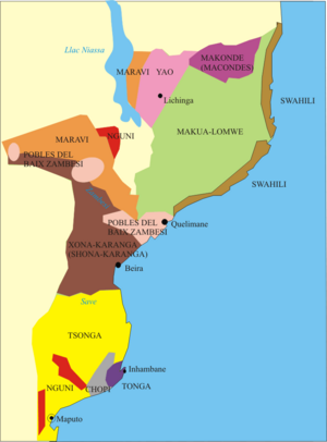
The north-central provinces of Zambezia and Nampula have the most people, about 45% of the total population. The Makua are the largest group in the north. The Sena and Shona are common in the Zambezi valley. The Tsonga and Shangaan people live mostly in southern Mozambique.
Other groups include Makonde, Yao, Swahili, Tonga, Chopi, and Nguni. About 97.8% of the population are Bantu peoples. The rest are people of Portuguese background, mixed African and Portuguese heritage (called mestiço), and Indians. About 45,000 people of Indian descent live in Mozambique.
Many people of Portuguese descent lived in Mozambique during colonial rule. About 360,000 of them lived there when Mozambique became independent in 1975. Many left the country after independence. There are also between 7,000 and 12,000 people of Chinese heritage in Mozambique.
In 2011, a survey showed that women in Mozambique had an average of 5.9 children. This number was higher in rural areas (6.6) than in cities (4.5).
Major Cities
|
Largest cities or towns in Mozambique
According to the 2017 Census |
||
|---|---|---|
| Rank | Name | Pop. |
| 1 | Maputo | 1,080,277 |
| 2 | Matola | 1,032,197 |
| 3 | Nampula | 663,212 |
| 4 | Beira | 592,090 |
| 5 | Chimoio | 363,336 |
| 6 | Tete | 307,338 |
| 7 | Quelimane | 246,915 |
| 8 | Lichinga | 242,204 |
| 9 | Mocuba | 240,000 |
| 10 | Nacala | 225,034 |
Languages Spoken
Portuguese is the official language and is spoken by over half of the population. About 50% of people in Maputo speak Portuguese as their first language.
Many different Bantu languages are spoken in Mozambique. These languages are not always well-known or written down. Swahili is spoken in a small area near the Tanzanian border. South of this, Kimwani (a dialect of Swahili) is used. Further inland, you find Makonde and Yao languages.
The eMakhuwa group of languages are a bit different. Many nouns in these languages start with a vowel. For example, epula means "rain." This group includes eMakhuwa, eLomwe, and eChuwabo.
In the lower Zambezi area, Sena is spoken. This language is similar to Nyanja. Further upriver, people speak CiNyungwe and CiSenga.
A large area near the Zimbabwe border speaks a Shona language. This was once called Ndau. South of this area are languages from the Tsonga group. These include XiTswa, XiTsonga, and others. This language area extends into South Africa.
Other related languages are GiTonga, BiTonga, and CiCopi (or Chopi). These are spoken north of the Limpopo River's mouth. XiRonga (or Ronga) is spoken around Maputo. There are also small areas where Swazi and Zulu are spoken near the borders with Eswatini and South Africa.
Arabs, Chinese, and Indians in Mozambique mostly speak Portuguese. Some also speak Hindi. Indians from Portuguese India might also speak Portuguese-based creole languages.
Religions in Mozambique
According to 2018 information, about 28% of the people are Catholic Christians. About 18% are Muslim, mostly Sunni. Another 15% are Zionist Christians, and 12% are Protestants. About 7% belong to other religious groups, and 18% do not follow a religion.
Mozambican Culture
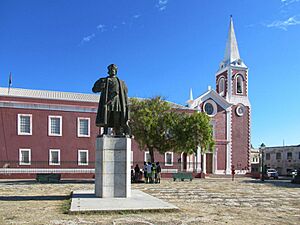
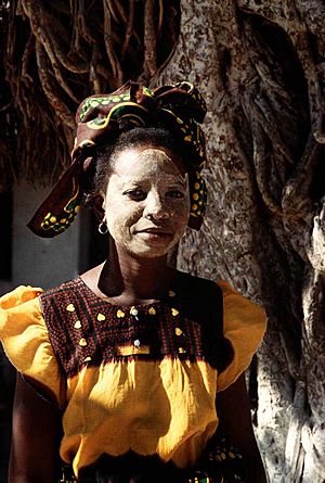
Mozambique was ruled by Portugal for a long time. Because of this, Portuguese is the main language and Roman Catholicism is a main religion. However, most people in Mozambique are Bantus, so much of the culture is native to Africa. In cities, there is more Portuguese influence. Mozambican culture has also influenced Portuguese culture.
Arts and Music
The Makonde people are famous for their wood carvings and detailed masks. These masks are often used in traditional dances. There are two main types of wood carvings:
- Shetani: These are carvings of evil spirits. They are usually made from heavy ebony wood. They are tall, curved, and have symbols and unusual faces.
- Ujamaa: These are totem-like carvings that show realistic faces of people and different figures. They are often called "family trees" because they tell stories of many generations.
After Mozambique became independent in 1975, modern art changed. It began to show the country's struggles, like the civil war, suffering, and hunger. Two very famous Mozambican artists are the painter Malangatana Ngwenya and the sculptor Alberto Chissano.
Dances in Mozambique are often complex and have a long history. Different tribes have their own types of dances, which are usually part of rituals. For example, the Chopi people act out battles while wearing animal skins. Makua men wear colorful outfits and masks. They dance on stilts around the village for hours. In the north, groups of women perform a traditional dance called tufo to celebrate Islamic holidays.
Music of Mozambique
Music in Mozambique is used for many things, from religious expression to traditional ceremonies. Musical instruments are usually made by hand. Some instruments include drums made of wood and animal skin. The lupembe is a woodwind instrument made from animal horns or wood. The marimba is a type of xylophone that is native to Mozambique and other parts of Africa. The Chopi people, known for their musical skills and dance, love to play the marimba.
Mozambican Food
The Portuguese lived in Mozambique for almost 500 years, and they greatly influenced the country's food. Foods like cassava (a starchy root) and cashew nuts were brought by the Portuguese. Mozambique was once the largest producer of cashew nuts. Pãozinho, which are Portuguese-style buns, were also introduced.
The Portuguese also brought spices and seasonings like bay leaves, chili peppers, fresh coriander, garlic, onions, paprika, red sweet peppers, and wine. Other foods they introduced include maize, potatoes, rice, and sugarcane. Popular Portuguese dishes commonly eaten in Mozambique today include espetada (meat on a skewer), inteiro com piripiri (whole chicken in piri-piri sauce), prego (steak roll), pudim (pudding), and rissóis (battered shrimp).
National Holidays
Mozambique celebrates several national holidays throughout the year. These days are important for remembering key events and people in the country's history.
| Date | National holiday designation | Notes |
|---|---|---|
| 1 January | Universal fraternity day | New year |
| 3 February | Mozambican heroes day | In tribute to Eduardo Mondlane |
| 7 April | Mozambican women day | In tribute to Josina Machel |
| 1 May | International workers day | Workers' Day |
| 25 June | National Independence day | Independence proclamation in 1975 (from Portugal) |
| 7 September | Victory Day | In tribute to the Lusaka Accord signed in 1974 |
| 25 September | National Liberation Armed Forces Day | In tribute to the start of the armed fight for national liberation |
| 4 October | Peace and Reconciliation | In tribute to the General Peace Agreement signed in Rome in 1992 |
| 25 December | Family Day | Christians also celebrate Christmas |
Sports in Mozambique
Football (futebol) is the most popular sport in Mozambique. The national team is the Mozambique national football team. Track and field and basketball are also very popular. Roller hockey is well-liked, and the national team finished fourth at the 2011 FIRS Roller Hockey World Cup. The women's beach volleyball team came in second at the 2018–2020 CAVB Beach Volleyball Continental Cup. The Mozambique national cricket team also represents the country in international cricket.
Related pages
Images for kids
-
Mozambican dhow
-
Arab-Swahili slave traders and their captives on the Ruvuma River
-
The Island of Mozambique is a small coral island at the mouth of Mossuril Bay on the Nacala coast of northern Mozambique, first explored by Europeans in the late 15th century.
-
Portuguese troops during the Portuguese Colonial War, some loading FN FAL and G3
-
A US helicopter flying over the flooded Limpopo River during the 2000 Mozambique flood
-
Traditional sailboat in Ilha de Moçambique
-
Headquarters of Rádio Moçambique in KaMpfumo district of Maputo (photo 2009)
See also
 In Spanish: Mozambique para niños
 | Toni Morrison |
 | Barack Obama |
 | Martin Luther King Jr. |
 | Ralph Bunche |


