Mayotte facts for kids
Quick facts for kids
Mayotte
|
||
|---|---|---|
|
Overseas department, region and single territorial collectivity of France and outermost region of the European Union
|
||
| Department of Mayotte Département de Mayotte (French) |
||
|
||
| Anthem: La Marseillaise ("The Marseillaise") |
||
 |
||
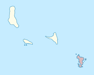
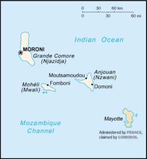
Mayotte in the Comoros
|
||
| Country | ||
| Prefecture | Mamoudzou | |
| Departments | 1 | |
| Area | ||
| • Total | 374 km2 (144 sq mi) | |
| Area rank | 18th region | |
| Population
(Jan. 2024)
|
||
| • Total | 320,901 | |
| • Density | 858.0/km2 (2,222.3/sq mi) | |
| Demonym(s) |
|
|
| GDP | ||
| • Total | €2.932 billion | |
| • Per capita | €11,300 | |
| Time zone | UTC+03:00 (EAT) | |
| ISO 3166 code |
|
|
| Currency | Euro (€) (EUR) | |
| Website | Prefecture Departmental Council |
|
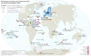
Mayotte (MY-ot) is a beautiful island in the Indian Ocean. It's officially known as the Department of Mayotte and is a special part of France. This means it's like a French region, just like those in mainland France. It's also an "outermost region" of the European Union, which is a group of countries in Europe.
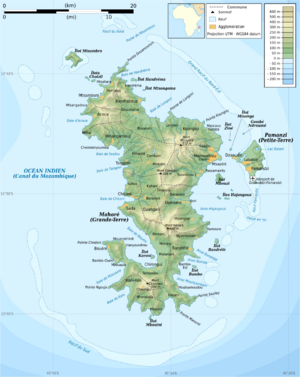
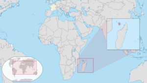
Mayotte is located in the Mozambique Channel, which is a stretch of water between Madagascar and Mozambique. The territory includes a main island called Grande-Terre (or Maore), a smaller island called Petite-Terre (or Pamanzi), and many tiny islets. Mayotte is about 374 square kilometres (144 sq mi) in size. Around 320,901 people live there, making it quite crowded. The biggest city and capital is Mamoudzou, located on Grande-Terre. The main airport is on Petite-Terre.
The official language is French. Many people also speak local languages like Shimaore and Kibushi. These languages have been influenced by Arabic and Malagasy.
Most people in Mayotte are Muslim. The islands were first settled by people from East Africa and later by Arabs, who brought Islam. In the 1800s, Mayotte became part of France. When the nearby Comoros islands became independent in 1974, Mayotte chose to stay with France. In 2011, Mayotte officially became the 101st department of France.
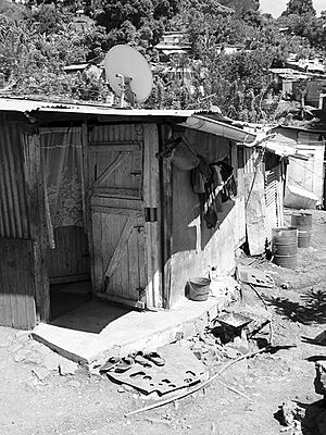
Mayotte faces some big challenges. Many people move there from nearby islands hoping for a better life. This has led to a fast-growing population, with half the people being under 17 years old. While Mayotte has French services and infrastructure, many residents still face tough living conditions. For example, some homes are simple shacks, and many don't have running water or proper toilets.
Contents
Exploring Mayotte's Geography
The name Mayotte might come from an Arabic phrase meaning "island of death," possibly because of the dangerous reefs around it. However, the local name is Mahore.
The main island, Grande-Terre, is the oldest of the Comoro Islands. It's about 39 kilometres (24 mi) long and 22 kilometres (14 mi) wide. The highest point is Mount Benara, which is 660 metres (2,165 ft) tall. The soil is rich because of volcanic rock. A coral reef surrounds most of the island, protecting ships and providing a home for fish. The capital used to be Dzaoudzi on Petite-Terre, but it moved to Mamoudzou on Grande-Terre in 1977. Petite-Terre is about 10 square kilometres (4 sq mi). The lagoon inside the reef is huge, about 1,500 square kilometres (580 sq mi), and can be up to 80 meters deep. It's known as the largest barrier-reef-lagoon system in the southwestern Indian Ocean.
Mayotte's Unique Landscape
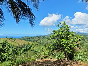
Mayotte is the oldest of the four large islands in the Comoros archipelago. It's located about 295 km (183 mi) west of Madagascar. The island is covered in lush green plants. The two biggest islands, Grande-Terre and Petite-Terre, are protected by a coral reef.
This coral reef is 160 km (99 mi) long and surrounds a lagoon of 1,100 km2 (420 sq mi). This lagoon is one of the largest and deepest in the world! Some parts of the reef even have a rare "double barrier." This reef protects Mayotte from ocean currents and big waves, except for a few openings. The lagoon is usually 5 to 10 km (3.1 to 6.2 mi) wide and can be up to 100 m (330 ft) deep.
Many small coral islets are scattered in the lagoon, like Mtsamboro. The reef is a safe place for boats and many ocean animals. The volcanic soil on the islands is very fertile.
Mayotte's total area is about 374 km2 (144 sq mi). This makes it the smallest French overseas department. The main islands are:
- Grande-Terre: 363 km2 (140 sq mi), home to Mamoudzou, the economic capital. Its highest points are Mount Bénara (660 m (2,170 ft)), Mount Choungui (594 m (1,949 ft)), and Mount Mtsapéré (572 m (1,877 ft)).
- Petite-Terre (or Pamanzi Island): 11 km2 (4.2 sq mi), where Dzaoudzi (the old capital) and the airport are located.
- Mtsamboro: The third largest island (2 km2 (0.77 sq mi)), mainly inhabited by fishermen.
- Mbouzi islet: A nature reserve.
- Bandrélé islet: The fifth largest island.
- Sable Blanc islet: Near a marine protected area.
Mayotte's Environment
Geology of Mayotte

Mayotte is a volcanic island that rises steeply from the ocean. Its highest point is Mont Bénara, at 660 metres (2,170 ft).
The island has two main volcanic areas. Volcanic activity started about 7.7 million years ago in the south and stopped around 2.7 million years ago. In the north, activity began about 4.7 million years ago and ended about 1.4 million years ago.
Recent Earthquake Swarm
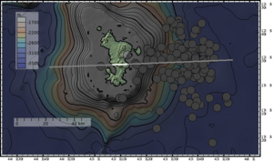
On November 11, 2018, a seismic event (like an earthquake) happened about 15 miles (24 km) off Mayotte's coast. It was so big that it was recorded by sensors all over the world, even in places like Hawaii, almost 11,000 miles (18,000 km) away! The shaking lasted for over 20 minutes, but surprisingly, no one on the island felt it.
Scientists later linked this event to a newly found undersea volcano. This volcano is located 50 km (31 mi) from Mayotte, deep under the ocean at 3,500 m (11,500 ft).
Marine Life and Coral Reefs
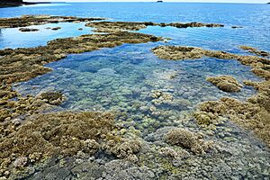
Mayotte is surrounded by a beautiful tropical coral reef. This includes a large outer barrier reef, which creates one of the world's biggest and deepest lagoons. Inside, there's also a fringing reef with many mangroves. All the waters around Mayotte are part of a National Marine Park, and many areas are protected nature reserves.
The outer coral reef is 195 km (121 mi) long. It protects 1,500 km2 (580 sq mi) of lagoon, including 7.3 km2 (2.8 sq mi) of mangroves. There are at least 250 different types of coral and 760 kinds of tropical fish! Scientists have found over 3,616 marine species, but they believe there are many more waiting to be discovered.
Land Animals and Plants
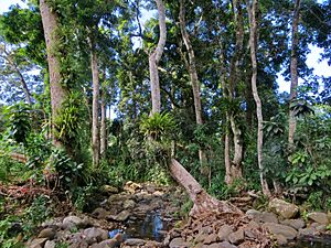
Mayotte has an amazing variety of plants. More than 1,300 species have been found, and half of them are unique to the island. This makes Mayotte one of the richest places for plant diversity compared to its size. About 15% of the island is a natural reserve. However, much of the original forest has been lost due to tree cutting.
Like many volcanic islands, Mayotte has fewer types of large mammals. The only native mammal is the flying fox (a type of bat). But there are many other animals, including 18 types of reptiles, 116 butterflies, and 150 kinds of beetles.
Protecting Mayotte's Nature
By 2021, Mayotte had 30 protected areas. These areas cover about 55 km2 (21 sq mi) of land and all of Mayotte's marine areas. Important protected places include the Mayotte Marine Natural Park and the Ilôt Mbouzi National Nature Reserve.
In 2021, the French government created the Forests of Mayotte National Nature Reserve. This reserve protects 2,801 ha (6,920 acres) of mountain forests, including Mount Mtsapéré, Mount Combani, Mount Benara, and Mount Choungui. The goal is to protect the island's remaining old forests, help new forests grow, and keep the native plants and animals safe.
Mayotte's History
Around 1500, a local kingdom called the Maore sultanate was formed on the island. In 1503, Portuguese explorers saw Mayotte but didn't settle there. Mayotte was an important part of the Swahili coast culture. However, the nearby island of Anjouan was more popular with traders, so Mayotte remained less developed and was often attacked by pirates and other groups.
In the early 1800s, Mayotte was ruled by a trading family. The island was not very populated and had people who spoke Comorian and Malagasy.
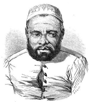
In 1832, a former king from Madagascar, Andriantsoly, took over Mayotte. The island was then conquered by other nearby sultanates. In 1836, Andriantsoly took back control, but Mayotte was weak and needed a strong friend. He started talking with the French, who were already in the nearby island of Nosy Bé.
France bought Mayotte in 1841. Soon after, slavery was ended on the island. Workers were brought in to work on farms. Many former slave owners left, and the island became even less populated. France tried to bring people back, including those who had left Mayotte. They also invited rich families from Anjouan to start businesses.
The French government tried to make Mayotte a sugar island, like some other French islands. They built 17 sugar factories and hired many workers from Africa. But sugar production wasn't very good, and the sugar industry ended by the late 1800s. Today, you can still see some old factory ruins.
At the Berlin conference in 1885, France took control of all the Comoros islands, calling the area "Mayotte and Dependencies."
In 1898, two big storms hit the island, and a disease spread, causing many deaths. Mayotte had to rebuild again. The French government brought in more workers from Mozambique, Comoros, and Madagascar. Instead of sugar, they started growing vanilla, coffee, and especially ylang-ylang, a plant used for perfumes.
When the Comoros islands voted for independence in 1974 and 1976, Mayotte was the only island that voted to stay with France. The UN General Assembly has passed resolutions saying that Mayotte should be part of the Comoros, but these are not legally binding. France has always said that Mayotte is French.
Mayotte officially became an overseas department of France on March 31, 2011. This happened after a vote in 2009 where about 95% of people wanted to become a full French department. This means Mayotte will gradually adopt the same laws and social systems as the rest of France. The Comoros still says Mayotte belongs to them.
In 2018, Mayotte experienced some community disagreements and protests, partly due to people moving from the Comoros. In December 2024, a strong storm called Cyclone Chido caused a lot of damage to Mayotte. The French President visited to help deliver food and aid.
How Mayotte is Governed
Mayotte has a government system similar to other parts of France. The President of the Departmental Council leads the local assembly. The French government also has power here.
Mayotte also sends two representatives to the French National Assembly and two senators to the French Senate in Paris.
For a long time, Mayotte's special situation was a bit tricky for France. Most people in Mayotte wanted to stay French, but some other countries disagreed. Also, Mayotte had its own traditional Muslim laws, which were different from French laws. It was also expensive to bring Mayotte's living standards up to those in mainland France.
In 2001, Mayotte's status changed to be very similar to a French department. This change was approved by 73% of voters. In 2011, after another vote, Mayotte officially became an overseas department of France. This means it will gradually adopt the same legal and social systems as the rest of France over about 20 years.
Since 2011, Mayotte has a single local assembly called the "Departmental Council." This council acts like both a regional and departmental council. In 2014, Mayotte also became an "outermost region" of the European Union.
Protecting Mayotte
The French Armed Forces are responsible for defending Mayotte. A special unit of the Foreign Legion Detachment in Mayotte is based there. New landing craft are being sent to help with coastal operations.
About 170 police officers from the National Gendarmerie are stationed in Mayotte. The Maritime Gendarmerie also operates patrol boats to watch the waters around the island.
Areas of Mayotte
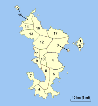
Mayotte is divided into 17 local areas called communes. It also has 13 cantons. Mayotte is the only French department without an arrondissement.
| Number on Map | Name | Area (km2) | Population | Individual map | Labelled map |
|---|---|---|---|---|---|
| 1 | Dzaoudzi | 6.66 | 17,831 |  |
 |
| 2 | Pamandzi | 4.29 | 11,442 |  |
|
| 3 | Mamoudzou | 41.94 | 71,437 |  |
|
| 4 | Dembeni | 38.8 | 15,848 |  |
|
| 5 | Bandrélé | 36.46 | 10,282 |  |
|
| 6 | Kani-Kéli | 20.51 | 5,507 |  |
|
| 7 | Bouéni | 14.06 | 6,189 |  |
|
| 8 | Chirongui | 28.31 | 8,920 |  |
|
| 9 | Sada | 11.16 | 11,156 |  |
|
| 10 | Ouangani | 19.05 | 10,203 |  |
|
| 11 | Chiconi | 8.29 | 8,295 | ||
| 12 | Tsingoni | 34.76 | 13,934 |  |
|
| 13 | M'Tsangamouji | 21.84 | 6,432 |  |
|
| 14 | Acoua | 12.62 | 5,192 |  |
|
| 15 | Mtsamboro | 13.71 | 7,705 |  |
|
| 16 | Bandraboua | 32.37 | 13,989 |  |
|
| 17 | Koungou | 28.41 | 32,156 |  |
Getting Around Mayotte
- Waterways: There's a ferry that connects Dzaoudzi and Mamoudzou.
- Roads: Mayotte has about 93 kilometres (58 mi) of roads, with most of them paved.
- Ports: The main ports are in Dzaoudzi and "Longoni" (Koungou).
- Airport: The main airport is Dzaoudzi Pamandzi International Airport.
Mayotte's Economy
The official money used in Mayotte is the euro.
In 2019, Mayotte's total economic output (GDP) was about €2.66 billion. The average income per person was €9,692. This was much higher than in the nearby Comoros, but still lower than in mainland France. Many homes in Mayotte still lack electricity, running water, or indoor toilets.
The economy of Mayotte has grown a lot since the late 1900s. This is thanks to money from the French government and improvements in public services and buildings.
Mayotte's economy grew quickly from 2001 to 2008. It slowed down a bit in 2009 due to a global financial crisis. But it bounced back quickly in 2010 because it was becoming a French department. From 2010 to 2017, the economy grew by about 6.9% each year. Growth slowed in 2018 due to community protests, but it picked up again in 2019.
Thanks to this growth, Mayotte has started to catch up with the rest of France in living standards. The average income per person in Mayotte rose from 15.4% of mainland France's level in 2000 to 27.3% in 2017.
Local farming faces challenges, partly due to safety concerns. Also, it's more expensive to grow crops in Mayotte compared to Madagascar or the Comoros. Tourism is a big potential for the island, but safety issues can sometimes make it harder.
People of Mayotte
| Historical population | ||
|---|---|---|
| Year | Pop. | ±% p.a. |
| 1958 | 23,364 | — |
| 1966 | 32,607 | +3.94% |
| 1978 | 47,246 | +3.17% |
| 1985 | 67,205 | +5.09% |
| 1991 | 94,410 | +5.81% |
| 1997 | 131,320 | +5.67% |
| 2002 | 160,265 | +4.08% |
| 2007 | 186,452 | +3.07% |
| 2012 | 212,645 | +2.63% |
| 2017 | 256,518 | +3.79% |
| 2024 | 320,901 | +3.61% |
| Official population figures from past censuses up to 2017. Last INSEE 2024 estimate. | ||
As of January 1, 2024, about 320,901 people live in Mayotte. In 2017, about 58.5% of the people living in Mayotte were born there. Another 5.6% were born in other parts of France. The remaining 35.8% were people who moved from other countries, mostly from the nearby Union of the Comoros.
Most of the people in Mayotte have a culture similar to the Comoros. The Comorian people are a mix of settlers from different places, including Arabs, Bantus, and Malagasy.
In 2017, about 75.7% of babies born in Mayotte had mothers who were born in other countries (mostly the Comoros). However, 58% of these babies had at least one French parent.
Religions in Mayotte
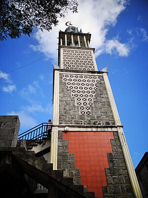
The main religion in Mayotte is Islam. While France doesn't collect religious data in its census, it's estimated that about 97% of the population is Muslim and 3% is Christian.
The small Christian community is mostly Roman Catholic. They are served by a special church area called the Apostolic Vicariate of Comoros Archipelago, which also covers the Comoros.
Languages Spoken in Mayotte
French is the only official language in Mayotte. It's used in government, schools, TV, radio, and businesses.
The native languages of Mayotte are:
- Shimaore: A dialect of Comorian, which is related to Swahili.
- Kibushi: A dialect of Malagasy (spoken in Madagascar), with influences from Shimaore and Arabic.
- Kiantalaotsi: Another Malagasy dialect also influenced by Shimaore and Arabic.
Kibushi is spoken in the south and northwest of Mayotte, while Shimaore is spoken in other areas.
Other languages spoken in Mayotte include:
- Arabic: Mostly learned in religious schools.
- Various Comorian dialects: Brought by people who moved to Mayotte from other Comoros islands since 1974.
Shimaore and the dialects of Grande Comore and Mohéli are generally not easy for speakers to understand each other. However, Shimaore and the dialect of Anjouan are very similar and easy to understand.
How Languages are Changing
Surveys show that more and more people in Mayotte are learning French, especially younger generations, because of mandatory schooling. For example, in 2007, 63.2% of people aged 14 and older could speak French. This number was much higher for young people (87.1% for ages 14-19) compared to older people (19.6% for ages 65 and older).
Many young people mix French words into Shimaore and Kibushi. Some families even speak only French at home, hoping it will help their children succeed. This has led some people to worry that the native languages of Mayotte might change a lot or even disappear over time.
Notable People from Mayotte
- Abdou Baco (born around 1965): A writer and musician.
- Toifilou Maoulida (born 1979): A French former football player.
- Manou Mansour (born 1980): A French poet.
- El Fardou Ben Nabouhane (born 1989): A Comorian football player.
Important Politicians
- Marcel Henry (1926–2021): A politician who served as a French senator.
- Soibahadine Ibrahim Ramadani (born 1949): A former senator.
- Nourdine Bourhane (born 1950): A former senior politician.
- Ibrahim Aboubacar (born 1965): A politician in the French National Assembly.
- Thomas Degos (born 1971): A former Prefect of Mayotte.
Mayotte's Culture
About 26% of adults in Mayotte, especially women, say they sometimes enter a trance state. They believe they are possessed by spirits called Djinns, who have their own personalities.
Sports in Mayotte
Mayotte takes part in the Indian Ocean Island Games, which happen every four years. Football is a very popular sport on the island.
Visiting Mayotte
Mayotte has a very diverse coastline. While it might have fewer sandy beaches than some nearby islands, it offers many different types of shores and sand colors, including black, brown, gray, red, beige, and white. Its lagoon is the largest (1,500 km2 (580 sq mi)) and deepest in this part of the world, and it has a rare double barrier reef. This reef is home to many different animals, including large whales, which is very special.
Here are some fun things to do if you visit Mayotte:
- Hike to the extinct volcano Dziani Dzaha on Petite-Terre and see its lake.
- Climb Mount Combani and Mount Choungui.
- Observe the maki lemurs on the M'Bouzy islet.
- Go diving and snorkeling on the coral reef to see tropical fish.
- In the lagoon, you can see green and hawksbill turtles (which lay eggs on the beaches), dolphins, and whales with their babies.
- Enjoy water activities or relax on Mayotte's many beaches.
- Swim and visit the isolated white sand islets in the north and south.
- Camp overnight on deserted islands.
- See the Soulou waterfall, which flows onto a beach.
- Explore the Badamiers mudflat on Petite-Terre, a marsh full of different plants and animals.
- See old shipwrecks, like the Dwyn Wen schooner.
- Take a microlight tour to see the reefs from the sky.
- Visit the MuMa museum in Dzaoudzi to learn about Mayotte's history and culture.
See also
 In Spanish: Mayotte para niños
- Administrative divisions of France
- Islands administered by France in the Indian and Pacific oceans
- Music of the Comoro Islands
 | Jessica Watkins |
 | Robert Henry Lawrence Jr. |
 | Mae Jemison |
 | Sian Proctor |
 | Guion Bluford |


