Keller, Indiana facts for kids
Quick facts for kids
Keller, Indiana
|
|
|---|---|

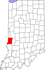
Vigo County's location in Indiana
|
|
| Country | United States |
| State | Indiana |
| County | Vigo |
| Township | Riley |
| Elevation | 571 ft (174 m) |
| Time zone | UTC-5 (Eastern (EST)) |
| • Summer (DST) | UTC-4 (EDT) |
| ZIP code |
47802
|
| Area code(s) | 812, 930 |
| GNIS feature ID | 437204 |
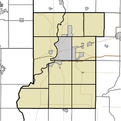
Keller is a small, quiet community located in the state of Indiana, United States. It's not a big city or town, but what is called an unincorporated community. This means it doesn't have its own local government like a city does. Keller is found in Vigo County, specifically within Riley Township. It's also considered part of the larger Terre Haute metropolitan area. Today, Keller is mainly a place where people live. While an old general store building still stands, most other businesses have been taken down.
A Look Back at Keller's History
Keller wasn't always known by its current name. Before the year 1903, this community was called Ferrell.
In 1903, a post office was opened in the area. It first operated under the name Ferrell. However, in that very same year, the community's name was officially changed to Keller. The post office continued to serve the residents of Keller for about ten years. It was eventually closed down in 1913.
Where is Keller Located?
Keller is situated in a specific spot on the map. Its exact location is at coordinates 39°21′37″N 87°19′27″W / 39.36028°N 87.32417°W. This means it's at 39 degrees, 21 minutes, 37 seconds North latitude and 87 degrees, 19 minutes, 27 seconds West longitude.
The community sits at an elevation of 571 feet above sea level. This tells us how high up it is compared to the ocean.
 | Frances Mary Albrier |
 | Whitney Young |
 | Muhammad Ali |


