
Kendalia, Texas facts for kids
Quick facts for kids
Kendalia, Texas
|
|
|---|---|

The historic Kendalia Community Church
|
|

Kendalia, Texas
Location in Texas

Kendalia, Texas
Location in the United States
|
|
| Country | United States |
| State | Texas |
| County | Kendall |
| Elevation | 1,384 ft (422 m) |
| Time zone | UTC-6 (Central (CST)) |
| • Summer (DST) | UTC-5 (CDT) |
| ZIP codes |
78027
|
| GNIS feature ID | 1339027 |
Kendalia is a small, unincorporated community located in the northeastern part of Kendall County, Texas, United States. It is known for being part of the "Texas-German belt," an area where many German immigrants settled long ago.
Where is Kendalia Located?
Kendalia sits where two roads meet: RM 473 and FM 3351. It is northeast of Boerne, which is the main town of Kendall County. The community is about 1,384 feet (422 m) above sea level.
Even though Kendalia is not a city, it has its own post office with the ZIP code 78027. In 2010, about 459 people lived in the area covered by this ZIP code. Kendalia is also considered part of the larger San Antonio metropolitan area.
The History of Kendalia
Kendalia was probably named after an early settler in the area, George Wilkins Kendall. The community was first mapped out in 1883. However, it did not get its own post office until 1895.
For a long time, the main way people made a living in Kendalia was through ranching. Today, many residents still work in ranching, but others travel to nearby cities like Blanco or San Antonio for their jobs.
In 1996, the Holy Archangels Greek Orthodox Monastery was started near Kendalia by Elder Ephraim of Arizona.
Main Roads in Kendalia
The two most important roads that pass through Kendalia are:
- Ranch to Market Road 473
- Farm to Market Road 3351
-
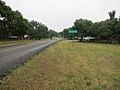
Kendalia sign on Ranch to Market Road 473 looking south
-
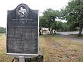
George Wilkins Kendall state historical marker
-
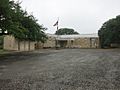
Kendalia Library on Ranch to Market Road 473
-
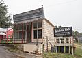
Elbel Building


.jpg)
