Keystone, Indiana facts for kids
Quick facts for kids
Keystone, Indiana
|
|
|---|---|
 |
|

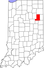
Wells County's location in Indiana
|
|
| Country | United States |
| State | Indiana |
| County | Wells |
| Township | Chester |
| Elevation | 866 ft (264 m) |
| Time zone | UTC-5 (Eastern (EST)) |
| • Summer (DST) | UTC-4 (EDT) |
| ZIP code |
46759
|
| FIPS code | 18-39654 |
| GNIS feature ID | 2830580 |
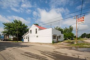
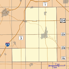
Keystone is a small place in Indiana, United States. It is an unincorporated community. This means it does not have its own local government like a city or town. Instead, it is part of Chester Township in Wells County.
History of Keystone
The name "Keystone" has an interesting story. Many of the first people who settled here came from Pennsylvania. Pennsylvania is often called the "Keystone State." This nickname came about because Pennsylvania was a central and very important state when the United States was first forming. It was like the "keystone" in an arch, holding everything together.
The community of Keystone in Indiana got its name from this connection to Pennsylvania. It was a way to honor the settlers' home state. A post office was opened in Keystone in 1871. This helped the community grow and connect with other places.
Location and Geography
Keystone is located in Wells County, Indiana. Wells County is in the northeastern part of the state. The area around Keystone is mostly flat farmland. This makes it good for growing crops. The elevation of Keystone is about 866 feet (264 meters) above sea level. This is a typical height for this part of Indiana.
Life in an Unincorporated Community
An unincorporated community like Keystone is different from a city or town. It does not have its own mayor or city council. Services like roads and schools are managed by the larger township or county government. People living in Keystone are part of the broader Wells County community. They share resources and services with nearby towns.
 | Victor J. Glover |
 | Yvonne Cagle |
 | Jeanette Epps |
 | Bernard A. Harris Jr. |


