Khairpur District facts for kids
Quick facts for kids
Khairpur District
خيرپور ضلعو
|
|
|---|---|

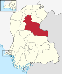
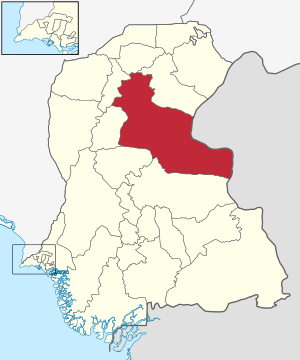
Map of Sindh with Khairpur District highlighted
|
|
| Country | Pakistan |
| Province | Sindh |
| Capital | Khairpur |
| Established | 1546 |
| Area | |
| • Total | 15,910 km2 (6,140 sq mi) |
| Population
(1998)
|
|
| • Total | 1,515,000 |
| • Density | 95.2/km2 (247/sq mi) |
| Time zone | UTC+5 (PST) |
| Number of Tehsils | 8 |
| Website | http://www.khairpur.gov.pk |
Khairpur District (Urdu: ضلع خیر پور) is an important area in the Sindh province of Pakistan. It's like a large county within the province. The district covers a big area of about 15,910 square kilometres. Its main city and headquarters is called Khairpur.
Contents
How Khairpur District Is Organized
Khairpur District is divided into smaller parts to help manage everything. These smaller areas are called Talukas, which are similar to smaller counties or sub-districts. There are eight of these Talukas in Khairpur District.
The Eight Talukas of Khairpur
Each Taluka has its own local administration. This helps to manage services and development in different parts of the district. The eight Talukas are:
- Khairpur
- Nara Tehsil
- Kot Diji Tehsil
- Sobho Dero Tehsil
- Mirwah Tehsil
- Kingri Tehsil
- Faiz Ganj Tehsil
- Gambat Tehsil
People and Language
Many people live in Khairpur District. The main language spoken by most people here is Sindhi. This language is also widely spoken across the entire Sindh province.
A Glimpse into History
Khairpur District has a long history. It was established way back in 1546. Over the centuries, it has been an important part of the region's development and culture.
 | DeHart Hubbard |
 | Wilma Rudolph |
 | Jesse Owens |
 | Jackie Joyner-Kersee |
 | Major Taylor |


