
Kumara, New Zealand facts for kids
Quick facts for kids
Kumara
|
|
|---|---|

Sign beside SH 73 on the outskirts of Kumara
|
|
| Country | New Zealand |
| Region | West Coast |
| District | Westland District |
| Ward | Northern |
| Electorates |
|
| Area | |
| • Total | 2.69 km2 (1.04 sq mi) |
| Population
(June 2023)
|
|
| • Total | 290 |
| • Density | 107.8/km2 (279/sq mi) |
| Time zone | UTC+12 (NZST) |
| • Summer (DST) | UTC+13 (NZDT) |
| Postcode |
7832
|
| Area code(s) | 03 |
| Local iwi | Ngāi Tahu |
Kumara is a small town on the West Coast of New Zealand's South Island. It is located about 30 kilometers south of Greymouth. The town is close to the western end of State Highway 73, which crosses Arthur's Pass to Christchurch. The Taramakau River flows past to the north.
In 2018, about 285 people lived in Kumara. The town's name might come from the Māori language words Kohe mara. This means the blossom of the tātarāmoa, also known as bush lawyer. Kumara Beach is also where the famous Coast to Coast multisport race begins each year.
Contents
A Look Back: Kumara's History
Gold Rush Days
Kumara became a town because of gold! Gold was found nearby in 1876, about 2 kilometers away in Dillmanstown. Soon, Kumara became one of New Zealand's main gold mining centers. A special railway line was extended to Kumara in 1877. By October 1877, the town's population grew to 4,220 people. Kumara officially became a borough, which is like a small town with its own local government, in 1877.
Important People and Changes
Kumara was the hometown of a very important politician named Richard Seddon. He was elected mayor of Kumara in 1877. Later, he became the Prime Minister of New Zealand and served from 1893 until he passed away in 1906.
Over time, the gold mining slowed down. The town once had many pubs, but most of them closed. In 2010, the last shop in town almost closed too. However, people hoped that a new New Zealand Cycle Trail would bring more visitors and help the town. This hope came true! In 2012, the Theatre Royal Hotel reopened as the only pub. In 2013, the West Coast Wilderness Trail cycleway officially opened in Kumara. This trail runs from Greymouth to Ross.
Who Lives in Kumara?
Kumara is a rural settlement. In 2018, it had a population of 285 people living in 135 homes. The average age of people in Kumara was 52.2 years old. About 13.7% of the people were under 15 years old.
Most people in Kumara are of European (Pākehā) background, about 92.6%. About 11.6% identify as Māori. People can identify with more than one ethnicity. Many people in Kumara (52.6%) said they had no religion, while 31.6% were Christian.
The Old Swimming Pool
_MRD_01.jpg)
In 1934, the community built a swimming pool using volunteer help. This was during the 1930s depression, when fewer people lived in the area. The pool was 50 yards long and 33 yards wide, with a deep end of 6.5 feet.
What makes this pool special is where it was built. It was surrounded by leftover rocks and dirt from the old gold diggings. The walls of the pool were even made from large boulders found at these diggings! Water for the pool came from a reservoir 3 kilometers away. The pipes used to bring the water were old iron pipes from historic gold mining projects. The pool was once part of a sports area with a basketball court and a cricket pitch. The pool is not used anymore, but the area is now a protected heritage site.
Cool Buildings to See
- Notable buildings
-
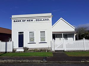
Bank of New Zealand, Kumara (2021)
-
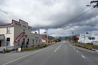
Theatre Royal Hotel
-
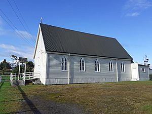
St Patrick's Catholic Church, Kumara (2021)
-
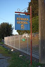
Kumara School


Bank of New Zealand
The Bank of New Zealand first opened its doors in Kumara in 1876.
St Patrick's Catholic Church
St Patrick's Catholic Church was built by the local church members in 1877.
Learning in Kumara
Kumara School is a school for students from Year 1 to Year 8. As of 2023, about 33 students attend the school. In 1997, the school celebrated 120 years of teaching children in the area.
See also
 In Spanish: Kumara (Nueva Zelanda) para niños
