L'Épine, Vendée facts for kids
Quick facts for kids
L'Épine
|
||
|---|---|---|
|
||
| Country | France | |
| Region | Pays de la Loire | |
| Department | Vendée | |
| Arrondissement | Les Sables-d'Olonne | |
| Canton | Saint-Jean-de-Monts | |
| Intercommunality | l'île de Noirmoutier | |
| Area
1
|
8.95 km2 (3.46 sq mi) | |
| Population
(Jan. 2019)
|
1,633 | |
| • Density | 182.46/km2 (472.6/sq mi) | |
| Time zone | UTC+01:00 (CET) | |
| • Summer (DST) | UTC+02:00 (CEST) | |
| INSEE/Postal code |
85083 /85740
|
|
| Elevation | 0–17 m (0–56 ft) | |
| 1 French Land Register data, which excludes lakes, ponds, glaciers > 1 km2 (0.386 sq mi or 247 acres) and river estuaries. | ||
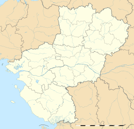
L'Épine is a small town, or "commune," located in western France. It is part of the Pays de la Loire region and can be found in the Vendée department.
Contents
About L'Épine
L'Épine is a charming place in France. It is known as a "commune," which is like a local government area or a small town.
Where is L'Épine Located?
L'Épine is situated in the western part of France. It is specifically in the Vendée department, which is part of the larger Pays de la Loire region. This area is known for its beautiful coastline and islands. L'Épine is actually located on an island called Île de Noirmoutier.
How Many People Live There?
As of January 2019, about 1,633 people lived in L'Épine. The number of people living in a town can change over time. Official groups like the National Institute of Statistics and Economic Studies keep track of these numbers.
Who is the Mayor?
The mayor of L'Épine is Jean Gautier. A mayor is the leader of a town or city. They are chosen by the people to help manage the community. Jean Gautier served as mayor from 2008 to 2014.
Geography and Nature
L'Épine is a place with interesting natural features. It has a varied landscape, from sea level to slightly higher ground.
What is the Land Like?
The land area of L'Épine is about 8.95 square kilometers. This is roughly the size of a small city park. The elevation, or how high the land is above sea level, ranges from 0 meters (at sea level) up to 17 meters. This means some parts of the commune are right by the water, while others are on slightly higher ground.
See also
 In Spanish: L'Épine (Vendée) para niños


