L'Erable, Illinois facts for kids
Quick facts for kids
L'Erable, Illinois
|
|
|---|---|

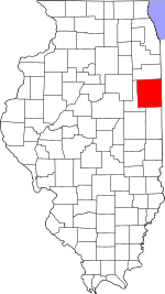
Iroquois County's location in Illinois
|
|
| Country | |
| State | |
| County | Iroquois County |
| Township | Ashkum Township |
| Elevation | 627 ft (191 m) |
| Time zone | UTC-6 (Central (CST)) |
| • Summer (DST) | UTC-5 (CDT) |
| ZIP code |
60927
|
| GNIS feature ID | 0411634 |
L'Erable is a small place located in Iroquois County, Illinois, United States. It is known as an "unincorporated community." This means it's a group of homes and buildings that doesn't have its own official local government, like a city or town would. Instead, it's part of a larger area called Ashkum Township. People living in L'Erable use the postal code 60927.
Contents
Where is L'Erable Located?
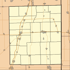
L'Erable is found in the state of Illinois, which is in the central part of the United States. Specifically, it's in the eastern section of Iroquois County.
Understanding L'Erable's Coordinates
The exact spot of L'Erable can be described using geographic coordinates: 40 degrees, 54 minutes, 12 seconds North latitude and 87 degrees, 50 minutes, 49 seconds West longitude. These numbers are like an address on a global map, helping us pinpoint its precise location on Earth.
How High is L'Erable?
The land where L'Erable sits is about 627 feet (which is about 191 meters) above sea level. Sea level is the average height of the ocean's surface. Knowing a place's elevation helps us understand its landscape and how high it is compared to other areas.
Local Landmarks: Cemeteries
In L'Erable, there is a significant local landmark called the L'Erable Catholic Cemetery. Cemeteries are special grounds set aside for burials.
 | Janet Taylor Pickett |
 | Synthia Saint James |
 | Howardena Pindell |
 | Faith Ringgold |


