La Macarena, Meta facts for kids
Quick facts for kids
La Macarena, Meta
|
||
|---|---|---|
|
Municipality and town
|
||
 |
||
|
||

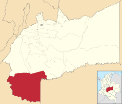
Location of the municipality and town of La Macarena, Meta in the Meta Department of Colombia.
|
||
| Country | ||
| Department | Meta Department | |
| Founded | November 1954 | |
| Area | ||
| • Municipality and town | 11,229 km2 (4,335.54 sq mi) | |
| Elevation | 233 m (764 ft) | |
| Population
(2015)
|
||
| • Municipality and town | 32,861 | |
| • Urban | 4,458 | |
| Time zone | UTC-5 (Colombia Standard Time) | |
| Climate | Am | |
| Official Website | ||
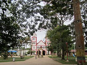
La Macarena is a town and municipality in the Meta Department of Colombia. It is located about 280 kilometers (170 miles) south of Bogotá, the capital city.
This town was once part of a special zone called the El Caguan DMZ. Today, the Colombian Army and Police Force are in control. La Macarena is now a growing place for Ecotourism. Many people visit to see the amazing five-colored river, Caño Cristales. This river is considered one of the most beautiful in the world. La Macarena also has its own airport, La Macarena Airport, which helps visitors arrive.
Contents
Climate in La Macarena
La Macarena has a tropical monsoon climate. This means it is generally hot and humid all year round. The area experiences a lot of rain, especially during certain months. This type of climate helps the unique plants and animals in the region to grow and thrive.
Ecotourism and Natural Wonders
La Macarena is famous for its incredible natural beauty. It is a top spot for ecotourism, which means traveling responsibly to natural areas. Visitors come from all over the world to explore its unique ecosystems.
Caño Cristales: The Five-Colored River
The most famous attraction is Caño Cristales, often called the "River of Five Colors." This river is truly special because of a unique plant that grows on its bed. This plant, called Macarenia clavigera, turns bright red, pink, purple, yellow, and green under the right conditions. This creates a stunning rainbow effect in the water.
Best Time to Visit Caño Cristales
The best time to see the river's vibrant colors is usually between June and November. During these months, the water levels are just right for the plants to show their brightest hues. It's an amazing sight that looks like something out of a painting!
Local Wildlife and Nature
Beyond the river, La Macarena is home to diverse wildlife. You can find many different kinds of birds, monkeys, and other animals in the surrounding forests. The area is part of a larger natural region, making it important for conservation.
Getting to La Macarena
Most visitors arrive in La Macarena by air. La Macarena Airport connects the town to other parts of Colombia. This makes it easier for tourists to access this beautiful and remote area.
See also
 In Spanish: La Macarena (Meta) para niños
 | John T. Biggers |
 | Thomas Blackshear |
 | Mark Bradford |
 | Beverly Buchanan |


