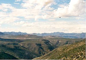
La Mixteca facts for kids
La Mixteca is a special region in south-central Mexico. It covers parts of Oaxaca, Puebla, and Guerrero. This area is the traditional home of the Mixtec people. In their own languages, they call their land Ñuu Djau, Ñuu Davi, or Ñuu Savi.
About two-thirds of all Mixtec people live in this region. In 1999, there were about 500,000 Mixtecs in Mexico. The Mixteca region is quite large, covering about 40,000 square kilometers. It's where two major mountain ranges meet: the Neo-Volcanic Belt and the Sierra Madre del Sur.
Geography of La Mixteca
La Mixteca is a land of many different landscapes. It has tall mountains and coastal areas. The Sierra Madre del Sur and the Neo-Volcanic Belt form its northern edge. To the east, you'll find the Cuicatlán Ravine and the Central Valleys of Oaxaca.
To the west, the Mixteca region borders the valleys of Morelos and central Guerrero. To the south, it stretches for about 200 miles along the Pacific Ocean coastline. Because of the large mountains of the Sierra Mixteca, it can be hard to travel to and from this region.
Three Main Areas of La Mixteca
The Mixteca region is usually split into three main parts. These parts are named based on how high the land is.
- Mixteca Baja (Low Mixteca): This area is in northwest Oaxaca and southwest Puebla. It's generally lower in elevation.
- Mixteca Alta (High Mixteca): This part is in northeast Guerrero and western Oaxaca. It has higher mountains and plateaus.
- Mixteca de la Costa (Coastal Mixteca): This area is also known as the Costa Chica. It's the remote Pacific coastline of eastern Guerrero and western Oaxaca. This coastal area is home to Mixtec, Amuzgo, and Afro-Mexicans.
See also
 In Spanish: La Mixteca para niños
 | Sharif Bey |
 | Hale Woodruff |
 | Richmond Barthé |
 | Purvis Young |


