Ladysmith, Kansas facts for kids
Quick facts for kids
Ladysmith, Kansas
|
|
|---|---|

|
|
| Country | United States |
| States | Kansas |
| County | Clay |
| Elevation | 1,312 ft (400 m) |
| Time zone | UTC-6 (CST) |
| • Summer (DST) | UTC-5 (CDT) |
| ZIP code |
67432
|
| Area code | 785 |
| FIPS code | 20-37625 |
| GNIS ID | 484768 |
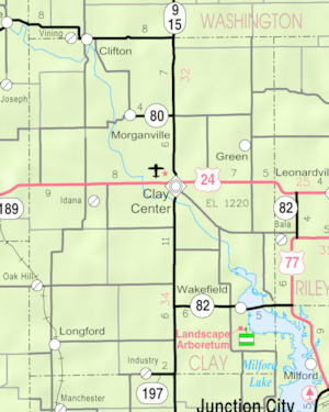
Ladysmith is a small, unincorporated community in Clay County, Kansas, United States. An unincorporated community is a place that does not have its own local government. It is located about 6.5 miles southwest of Clay Center along Kiowa Road.
History of Ladysmith
Ladysmith once had its own post office. This post office opened in the year 1900. However, it only stayed open for a few years. The post office closed down in 1906.
Education in Ladysmith
Students living in Ladysmith attend public schools. These schools are part of the Clay County USD 379 school district. This district serves the community's educational needs.
Black History Month on Kiddle
Famous African-American Civil Rights Activists
 | Roy Wilkins |
 | John Lewis |
 | Linda Carol Brown |

All content from Kiddle encyclopedia articles (including the article images and facts) can be freely used under Attribution-ShareAlike license, unless stated otherwise. Cite this article:
Ladysmith, Kansas Facts for Kids. Kiddle Encyclopedia.


