Lafayette, Chippewa County, Wisconsin facts for kids
Quick facts for kids
Lafayette, Wisconsin
|
|
|---|---|

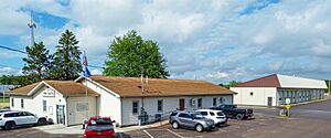
Lafayette Town Hall
|
|

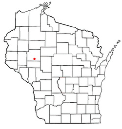
Location of Lafayette, Wisconsin
|
|
| Country | |
| State | |
| County | Chippewa |
| Area | |
| • Total | 39.1 sq mi (101.3 km2) |
| • Land | 34.5 sq mi (89.4 km2) |
| • Water | 4.6 sq mi (11.9 km2) |
| Elevation | 974 ft (297 m) |
| Population
(2010)
|
|
| • Total | 5,765 |
| • Density | 150.6/sq mi (58.1/km2) |
| Time zone | UTC-6 (Central (CST)) |
| • Summer (DST) | UTC-5 (CDT) |
| Area code(s) | 715 & 534 |
| FIPS code | 55-40900 |
| GNIS feature ID | 1583502 |
| PLSS township | East half of T28N R8W, west half of T28N R7W, and bits of the two townships to the north |
Lafayette is a town located in Chippewa County, in the state of Wisconsin in the United States. In 2010, about 5,765 people lived there.
Within the town of Lafayette, you'll find a special area called Lake Wissota. This is a "census-designated place," which means it's a community that the government counts separately for population information. Another small community called Bateman is also part of the town.
Contents
Education in Lafayette
Students in Lafayette attend schools from two different districts. Some go to schools in the School District of Cadott Community. Others attend schools that are part of the Chippewa Falls Area Unified School District.
Geography of Lafayette
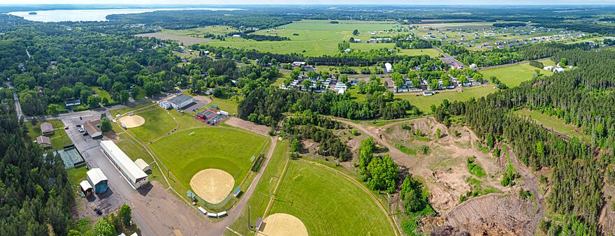
Lafayette is shaped mostly like a square, about six miles by six miles. However, its northern border is not straight. It follows the path of the Yellow River.
The town covers a total area of about 39.1 square miles (which is about 101.3 square kilometers). Most of this area, about 34.5 square miles (89.4 km2), is land. The rest, about 4.6 square miles (11.9 km2), is water. This means about 11.74% of Lafayette is covered by water!
History of Lafayette
The land that makes up Lafayette was first measured and mapped in the fall of 1848. This was done by teams working for the U.S. government. They were creating detailed maps of the land.
In 1849, another team of surveyors walked through the woods and swamps. They marked all the important corners of land sections in the eastern part of what is now Lafayette. They used tools like a chain and a compass to measure everything carefully.
After their work, the main surveyor wrote a description of the land. He said that the northeastern part of the area was flat and wet, with poor soil. Trees like tamarack, aspen, birch, maple, and pine grew there.
The southern and northwestern parts of the town were gently rolling hills. The soil there was good for farming. The trees were smaller, including maple, birch, oak, elm, ash, and some small pine trees. The area also had plenty of water, but the riverbanks were often low and could flood. The riverbeds were sandy and gravelly, and the water moved slowly.
Population of Lafayette
| Historical population | |||
|---|---|---|---|
| Census | Pop. | %± | |
| 1980 | 3,825 | — | |
| 1990 | 4,448 | 16.3% | |
| 2000 | 5,199 | 16.9% | |
| 2010 | 5,765 | 10.9% | |
| 2020 (est.) | 6,033 | 4.6% | |
In the year 2000, there were 5,199 people living in Lafayette. The population density was about 150.6 people for every square mile.
The people living in Lafayette were spread out in terms of age. About 26.5% of the population was under 18 years old. The median age, which is the middle age of all the people, was 39 years old. This means half the people were younger than 39 and half were older.
Notable People from Lafayette
Some important people who lived in Lafayette include:
- Thomas A. Roycraft: He was a Wisconsin State Representative, meaning he helped make laws for the state of Wisconsin.
- Cadwallader Jackson Wiltse: He also served as a Wisconsin State Representative.
See also
 In Spanish: Lafayette (condado de Chippewa, Wisconsin) para niños
 | Emma Amos |
 | Edward Mitchell Bannister |
 | Larry D. Alexander |
 | Ernie Barnes |


