Lafleur River facts for kids
Quick facts for kids Lafleur River |
|
|---|---|

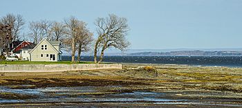
Mouth of Lafleur River
|
|
| Country | Canada |
| Province | Quebec |
| Region | Capitale-Nationale |
| MRC | L'Île-d'Orléans Regional County Municipality |
| Municipality | Saint-Jean-de-l'Île-d'Orléans |
| Physical characteristics | |
| Main source | Agricultural and forestry streams (Les Savanes marsh) Saint-Jean-de-l'Île-d'Orléans 68 m (223 ft) 46°56′29″N 70°55′27″W / 46.94139°N 70.92417°W |
| River mouth | Chenal des Grands Voiliers (Saint Lawrence River) Saint-Jean-de-l'Île-d'Orléans 4 m (13 ft) 46°54′14″N 70°55′51″W / 46.90389°N 70.93083°W |
| Length | 5.2 km (3.2 mi) |
The Lafleur River (also known as Rivière à la Fleur) is a small river on Île d'Orléans in Quebec, Canada. It flows entirely within the town of Saint-Jean-de-l'Île-d'Orléans. This river is located between the Maheu River and the village of Saint-Jean-de-l'Île-d'Orléans.
The Lafleur River empties into a small harbor that connects to the Saint Lawrence River. For a long time, the river's mouth has been a safe spot for fishing boats. They could find shelter there when the tide was low.
The lower part of the river valley is served by Chemin Royale (Route 368). This road runs along the southeast side of Île d'Orléans. Farming is the main activity in the upper part of the valley.
The river usually freezes over from early December to late March. It's generally safe to walk on the ice from mid-December to mid-March. The amount of water in the river changes with the seasons and how much rain falls. The biggest flood of the year happens in March or April.
River's Journey: Where it Starts and Ends
The Lafleur River begins in a marshy area called "Les Savanes." This spot is about 68 metres (223 ft) (223 feet) above sea level. It's where the forest meets the farmland in Saint-Jean-de-l'Île-d'Orléans.
The source of the river is about 0.34 kilometres (0.21 mi) (0.21 miles) southwest of Mitan road. It's also about 3.4 kilometres (2.1 mi) (2.1 miles) northeast of the Saint Lawrence River.
From its start, the Lafleur River flows for 5.2 kilometres (3.2 mi) (3.2 miles). It drops about 64 metres (210 ft) (210 feet) in height along its path.
- For the first 2.9 kilometres (1.8 mi) (1.8 miles), it flows southwest. It mostly follows the edge of the forest, then moves into farmland.
- The last 2.3 kilometres (1.4 mi) (1.4 miles) of the river flow south. This part is mainly through agricultural areas until it reaches its mouth.
The Lafleur River ends in a small harbor in the village of "Rivière Lafleur." This harbor is in Saint-Jean-de-l'Île-d'Orléans. The bridge for Route 368 crosses the river near where it meets the Saint Lawrence River.
Naming the River: The Story Behind "Lafleur"
The name "Lafleur River" comes from a person named Dumont dit Lafleur. He was a French settler who owned land in this area in 1681. His land was in the southeast part of Île d'Orléans.
On a map made by Robert de Villeneuve in 1689, the river was called "Rivière à la Fleur." This is an older way of spelling "Lafleur River."
Later, in 1709, a map by Gideon of Catalonia called it "Ruiso at the Fountain." But the original name soon came back. Over time, the spelling changed a bit.
- In 1831, the geographer Joseph Bouchette called it "Rivière La Fleur."
- In 1914, a dictionary of Quebec rivers and lakes listed it as "Lafleur River."
- In 1969, the Geographic Directory of Quebec used "Rivière à la Fleur."
- Finally, in 1978, the Toponymic Directory of Quebec officially named it "Rivière Lafleur."
The current spelling of the name was made official on March 28, 1974. This was done by the Commission de toponymie du Québec, which is in charge of place names in Quebec.
 | Anna J. Cooper |
 | Mary McLeod Bethune |
 | Lillie Mae Bradford |

