Lagrange Creek (Rappahannock River tributary) facts for kids
Quick facts for kids Lagrange Creek |
|
|---|---|

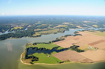
Lagrange Creek near Urbanna, on the Rappahannock River, Virginia
|
|
|
Location of Lagrange Creek mouth
|
|
| Other name(s) | Tributary to Rappahannock River |
| Country | United States |
| State | Virginia |
| County | Middlesex |
| Physical characteristics | |
| Main source | Briery Swamp and Wyatt Swamp divide about 2 miles southeast of Jamaica, Virginia 70 ft (21 m) 37°41′28″N 076°41′00″W / 37.69111°N 76.68333°W |
| River mouth | Rappahannock River Long Point, Virginia 0 ft (0 m) 37°40′08″N 076°35′13″W / 37.66889°N 76.58694°W |
| Length | 6.51 mi (10.48 km) |
| Basin features | |
| Progression | southeast |
| River system | Rappahannock River |
| Basin size | 16.89 square miles (43.7 km2) |
| Tributaries |
|
| Waterbodies | Burch Pond |
| Bridges | Burchs Mill Road |
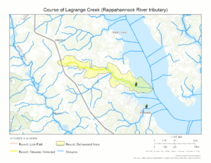
Lagrange Creek is a small river, about 6.51 mi (10.48 km) long, located in Middlesex County, Virginia. It's a "tributary," which means it's a smaller stream that flows into a larger river. Lagrange Creek flows into the Rappahannock River.
Where Lagrange Creek Starts and Ends
Lagrange Creek begins its journey in an area between two swamps, called Briery Swamp and Wyatt Swamp. This spot is about 2 miles southeast of a town named Jamaica, Virginia.
From its starting point, Lagrange Creek flows towards the southeast. It continues its path until it reaches and joins the larger Rappahannock River near a place called Long Point, Virginia.
Lagrange Creek's Surroundings
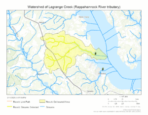
The area that Lagrange Creek drains, known as its "watershed," covers about 16.89 square miles (43.7 km2). This means all the rain that falls in this area eventually flows into Lagrange Creek.
On average, this region gets about 45.7 inches of rain each year. A large part of the watershed, about 40.9%, is covered by forests. This helps keep the water clean and provides homes for many plants and animals.
Maps of Lagrange Creek
 | Misty Copeland |
 | Raven Wilkinson |
 | Debra Austin |
 | Aesha Ash |


