Lake Matahina facts for kids
Quick facts for kids Lake Matahina |
|
|---|---|

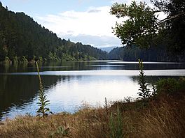
Lakeside view of Lake Matahina
|
|
| Location | Bay of Plenty, North Island, New Zealand |
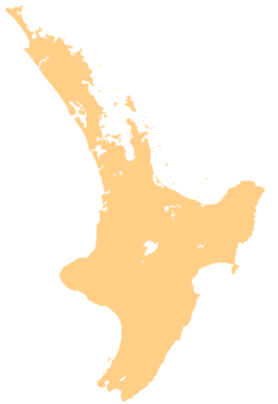
| Coordinates | 38°7′5″S 176°49′0″E / 38.11806°S 176.81667°E |
| Type | reservoir |
| River sources | Rangitaiki River |
| First flooded | 1967 |
| Surface area | 2.5 km2 (0.97 sq mi) |
| Max. depth | 50 m (160 ft) |
| Water volume | 55,000,000 m3 (1.9×10⁹ cu ft) |
Lake Matahina is a special lake in the Bay of Plenty region of New Zealand. It is not a natural lake, but a "reservoir." This means it was created by people! It sits just south of a place called Te Mahoe. It is also about 50 kilometers east of Rotorua.
Contents
Lake Matahina: A Man-Made Lake
Lake Matahina is an important example of a man-made lake. These types of lakes are called reservoirs. They are built to store water for different uses. This lake helps with power generation and managing water flow.
What is a Reservoir?
A reservoir is like a big, artificial lake. People build them by putting a dam across a river. The dam holds back the water, creating a large body of water behind it. Reservoirs are very useful for many reasons.
- Water Supply: They can store drinking water for towns and cities.
- Electricity: The water can flow through turbines in the dam to make electricity. This is called hydroelectric power.
- Flood Control: Reservoirs can hold extra water during heavy rains. This helps prevent floods downstream.
- Recreation: Many reservoirs are also used for boating, fishing, and other fun activities.
How Lake Matahina Was Formed
Lake Matahina was created by building a large dam. This dam is called the Matahina Dam. It was built across the Rangitaiki River. The construction of the dam was finished in 1967. Once the dam was complete, the river water began to fill the area behind it. This process formed Lake Matahina.
The Matahina Dam is very tall. It stands about 86 meters high. That's taller than many buildings! The dam helps control the river's flow. It also helps generate power for the region.
Facts About Lake Matahina
Lake Matahina is a significant body of water in the Bay of Plenty. It covers a large area and holds a lot of water.
- Area: The lake covers about 2.5 square kilometers. That's quite a big space!
- Depth: At its deepest point, the lake is about 50 meters deep. That's like stacking ten five-meter tall buses on top of each other!
- Volume: The lake can hold a massive amount of water. It holds about 55,000,000 cubic meters of water. Imagine that much water!
The lake's location in the North Island of New Zealand makes it a part of a beautiful natural landscape. It plays a key role in the local environment and power supply.
 | Calvin Brent |
 | Walter T. Bailey |
 | Martha Cassell Thompson |
 | Alberta Jeannette Cassell |


