Lake Ngatu facts for kids
Quick facts for kids Lake Ngatu |
|
|---|---|
 |
|
| Location | Northland Region, North Island |
| Coordinates | 35°01′55″S 173°11′53″E / 35.032°S 173.198°E |
| Type | Class 1 Perched dune lake |
| Catchment area | 177.9 hectares (440 acres) |
| Basin countries | New Zealand |
| Surface area | 55.54 hectares (137.2 acres) |
| Average depth | 2.67 metres (8 ft 9 in) |
| Max. depth | 6.26 metres (20.5 ft) |
| Water volume | 1,548,165.50 cubic metres (54,672,949 cu ft) |
| Residence time | 1.565 years |
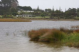
Lake Ngatu is a beautiful lake found in the Northland Region of New Zealand. It is a special type of lake called a dune lake. This means it formed among sand dunes.
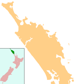
You can find Lake Ngatu northwest of a town called Awanui. It is also close to Waipapakauri. The lake does not have any rivers flowing into it or out of it. The land around the lake is mostly covered with native plants like manuka and kanuka. There are also some farms with fences and houses nearby.
Contents
Fun Things to Do at Lake Ngatu
Lake Ngatu is a great spot for outdoor fun! Many people enjoy visiting this area. It is easy to get to by car using West Coast Road and Sweetwater Road.
Walking and Exploring
One of the best things to do is walk around the lake. There is a 4-kilometre (2.5 mi) walking track. This path goes all the way around the lake. It is a perfect way to see the lake's beauty and get some exercise.
Keeping Lake Ngatu Healthy
It is important to keep Lake Ngatu clean and healthy. People have been watching its water quality closely. Sometimes, there is a worry about too much algae growing in the summer. This is called an algal bloom.
How We Check the Lake's Health
The Northland Regional Council helps look after the lake. They check the water regularly. You can even see information about the lake's environment online. Just visit the LAWA website to learn more.
 | Kyle Baker |
 | Joseph Yoakum |
 | Laura Wheeler Waring |
 | Henry Ossawa Tanner |


