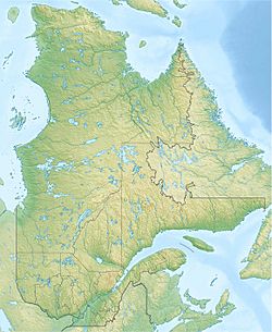
Lake Péribonka facts for kids
Quick facts for kids Lake Péribonka |
|
|---|---|
| Location | Mont-Valin, Le Fjord-du-Saguenay Regional County Municipality, Quebec |
| Coordinates | 50°06′56″N 71°14′57″W / 50.11556°N 71.24917°W |
| Primary inflows | Péribonka River |
| Primary outflows | Péribonka River |
| Basin countries | Canada |
| Max. length | 59 kilometres (37 mi) |
| Max. width | 11 kilometres (6.8 mi) |
| Surface area | 264 kilometres (164 mi) |
| Surface elevation | 435 metres (1,427 ft) |
Lake Péribonka is a large freshwater lake located in Quebec, Canada. It's found in a wild, unorganized area called Mont-Valin. For a long time, cutting down trees (forestry) was the main activity around the lake.
This big lake usually freezes over from mid-November until the end of April. However, it's generally safe to travel on the ice from mid-December to the end of March.
Contents
About Lake Péribonka
Lake Péribonka is about 140 kilometers (87 miles) northeast of another large lake called Lac Saint-Jean. It's like a huge, wide part of the Péribonka River. The lake is about 59 kilometers (37 miles) long from north to south and 11 kilometers (7 miles) wide. It covers a large area of 264 square kilometers (102 square miles).
Rivers Flowing into the Lake
Many rivers and streams flow into Lake Péribonka. Some of the main ones include:
- On the west side: The Serpent River, Brodeuse River, and Épinette Rouge River.
- On the east side: The Carp River, Cocoumenen River, and the Manouane River.
The Péribonka River itself flows into the lake from the north. It brings water from rivers like the Cocoumenen and Saint-Onge. Lake Péribonka has many islands, peninsulas (land sticking out into the water), and bays (parts of the lake that curve inward).
How the Lake Grew Bigger
During World War II, a company called Alcan built a hydroelectric power plant on the Péribonka River. This was done to create more electricity for making aluminum in the Saguenay region.
Between 1941 and 1943, a dam was built about 15 kilometers (9 miles) south of Lake Péribonka. This dam caused the lake's area to grow much larger than it was before. This hydroelectric power plant is located at the southern end of the lake.
The Name of the Lake
Old Names and New Names
Long ago, this lake was called "Manouan" by the native people. This name meant "where we collect eggs."
In 1926, the Quebec Geography Commission decided to change the name. There was another lake called "Manouan Lake" about 40 kilometers (25 miles) northeast, which caused confusion. So, this lake was renamed "Lake Péribonka," taking the name from the river that flows through it.
In 1987, all similar old names were officially replaced with "Lake Péribonka." The Montagnais people also used to call it "Unistakan Shakikan," which means "lake where we get up with a load on our back."
The name "Lake Péribonka" was officially recognized on December 18, 1986, by the Commission de toponymie du Québec (Quebec Place Names Commission).
 | George Robert Carruthers |
 | Patricia Bath |
 | Jan Ernst Matzeliger |
 | Alexander Miles |


