Lakina River facts for kids
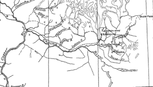
The Lakina River is a river in the U.S. state of Alaska. It flows into the Chitina River. You can find the Lakina River inside the huge Wrangell–St. Elias National Park and Preserve.
River's Journey
The Lakina River starts in an area where glaciers melt. It flows between two much larger glacier areas: the Kuskulana Glacier to the west and the Kennicott Glacier to the east. The Lakina River is not as big or as fast-moving as the Kuskulana or Kennicott rivers.
A path that people used long ago reaches the Lakina River about 6 to 7 miles (9.7 to 11.3 km) below where the two main glaciers end. The valley of the Lakina River is a bit different from the valleys of the Kuskulana and Kennicott rivers. It widens out like a bowl in its lower half.
This wide, bowl-shaped area is about 2 miles (3.2 km) across along the old path. It slowly gets narrower, becoming a mountain gorge about 0.5 miles (0.8 km) wide as you get closer to the glaciers where the river begins. The bottom of this valley is covered with gravel, sand, and mud.
Valley Rocks
As you go up the Lakina River from the main path, you start to see solid rock along the edges of the flat valley floor. The first type of rock you see is called Nikolai greenstone. This rock appears on both sides of the valley where it starts to get narrower, about 3 miles (4.8 km) below the glaciers. It forms steep mountain slopes.
Above the greenstone, you'll find Chitistone limestone, which forms tall, cliff-like walls. Even higher than the limestone, on the east side of the valley, there are layers of shale and thin limestone. These form bare slopes. You can also see them on the western side of the river, but they are not as clear.
River Details
The Lakina River is the first important river that flows into the Chitina River after the Nizina River. It is about 28 miles (45 km) long. The river drops about 70 feet (21 m) for every mile it flows.
The Lakina River starts from small glaciers. These glaciers are located between the Kennicott Glacier to the east, the Kuskulana Glacier to the north, and the Gilahina River to the west. The highest point in the river's basin (the area of land that drains into the river) is Castle Peak, which is 10,514 feet (3,205 m) high.
The area where the river begins is very rugged and rocky. However, the river's basin does not reach as far north as the main part of the Wrangell Range mountains. The Lakina River carries less rock and dirt from glaciers compared to the Nizina or Kuskulana rivers.
During the summer, much of the river's water likely comes from melting snow on the high mountain peaks. It depends less on melting glaciers for its water than most other rivers that flow into the Chitina River from the north, except for the Gilahina River.
 | Leon Lynch |
 | Milton P. Webster |
 | Ferdinand Smith |


