Lallie, North Dakota facts for kids
Quick facts for kids
Lallie, North Dakota
|
|
|---|---|
| Country | United States |
| State | North Dakota |
| County | Benson |
| Elevation | 1,562 ft (476 m) |
| Time zone | UTC-7 (Mountain (MST)) |
| • Summer (DST) | UTC-6 (MDT) |
| Area code(s) | 701 |
| GNIS feature ID | 1033871 |
Lallie is a small, unincorporated community located in Benson County, North Dakota, in the United States. An unincorporated community is a place that doesn't have its own local government, like a city or town. Instead, it's usually managed by the larger county it's in.
Contents
Discovering Lallie's History
Lallie has an interesting past, with its name changing a few times before it became what it is today.
How Lallie Got Its Name
The area that is now Lallie was first named by the Northern Pacific Railroad in 1885.
From Fort Totten to Lallie
- In 1885, the railroad called it Fort Totten.
- Two years later, in 1887, the name was shortened to just Totten.
- Finally, in 1889, the community was renamed Lallie. This new name honored the sister of A.J. McCabe, who was a superintendent for the railroad at that time.
Where is Lallie Located?
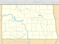
Lallie is found in the state of North Dakota, which is in the northern part of the United States.
Geographic Details of Lallie
The community sits at an elevation of about 476 meters (1,562 feet) above sea level. This means it's quite a bit higher than places right next to the ocean.
Understanding Lallie's Coordinates
You can find Lallie on a map using its coordinates: 47 degrees, 58 minutes, 42 seconds North latitude and 99 degrees, 12 minutes, 57 seconds West longitude. These numbers help pinpoint its exact location on Earth.
 | Tommie Smith |
 | Simone Manuel |
 | Shani Davis |
 | Simone Biles |
 | Alice Coachman |


