
Lambroughton Loch facts for kids
Quick facts for kids Lambroughton Loch |
|
|---|---|

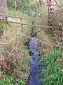
Site of Lambroughton Loch below West Lambroughton Farm
|
|

Lambroughton Loch
Location in North Ayrshire
|
|
| Location | North Ayrshire, Scotland |
| Coordinates | 55°39′8.1″N 4°33′8.0″W / 55.652250°N 4.552222°W |
| Type | Drained freshwater loch |
| Primary inflows | Lochridge Burn |
| Primary outflows | Garrier Water |
| Basin countries | Scotland |
| Settlements | Kilmaurs |
Lambroughton Loch, also known as Wheatrig Loch, was once a freshwater loch in North Ayrshire, Scotland. It was located in a low-lying area between several farms, including Hillhead, Lambroughton, Wheatrig, Titwood, and Lochridge. The loch was mainly fed by the Lochridge Burn and the Garrier Burn. Water also flowed in from surface runoff, like from old farm fields. The water from the loch flowed out through the Lochridge Burn, which then joined the Garrier Burn. This burn eventually flows into the River Irvine.
Contents
History of Lambroughton Loch

Lambroughton Loch was mostly drained a long time ago, even before the 1700s. It got its water from the Lochridge and Garrier Burns. The water that flowed out of the loch joined the Bracken Burn. After that, it became known as the Garrier Burn, which flows into the River Irvine near Gatehead.
The loch was mainly located on the lands of Lambroughton, Hillhead, and Wheatrig. There was a 'cut' or channel through a natural ridge that used to hold back the loch's water. This cut was near an old house called Lochend. It seems there might have also been an artificial dam there.
Sometimes, maps have mixed up the names of the Garrier Burn and the Bracken Burn. Even today, the area can flood a lot in winter. In the 1800s, people used to go curling on the frozen loch.
Place names nearby, like Lochend, Cranshaw (which means 'Wood of the Cranes or Herons'), Langmuir, and Lochridge, help us know that a loch used to be here. A bog was marked on maps as existing below Mid Lambroughton in the late 1700s.
Why the Loch Was Drained
The draining of Lambroughton Loch might have started in the early 1700s. This was when Alexander Montgomerie, 10th Earl of Eglinton, began making many improvements to his large farms. More drainage work might have happened in the 1740s. This was done to give jobs to Irish workers from Montgomerie's estates during the potato famines. Many drainage projects also took place after World War I. This was when many soldiers returned home and needed work.
Who Owned the Land
In 1320, King Robert the Bruce gave the lands of Lambroughton to Sir Robert Cuninghame of Kilmaurs. Later, in 1675, Sir John Cunninghame sold parts of these lands to Robert Cunningham, a druggist from Edinburgh. His family seemed to own them until 1820. From 1520 until the late 1900s, these lands were part of the Eglinton Estate.
Understanding Place Names


The name 'Garrier' is thought to come from a Gaelic word meaning 'fast running water'. The Scots word 'Gaw' also means a 'cut made by a plough' or a channel to drain water.
The Garrier Burn now only flows at certain times of the year. This is because its main water source, Buiston Loch, has been drained. Locals still pronounce 'Garrier' as 'Gawreer'.
A track used to run from Wheatrig Farm across the Garrier Burn to Hillhead Farm. A place called Cranshaw was marked on maps in the early 1800s. A cran in Scots means a "crane" or "heron," and a 'shaw' is a small wood. Cranes or herons are still often seen in the area. They might have nested in the wood near Hillhead Farm, which is how Cranshaw got its name.
Habitats and Wildlife Today
The area where the loch once was is now a low, marshy place. Maps from the mid-1800s show it as farmland, not marsh. However, today it is a wetland.
This site is away from busy human activity. It is a favorite spot for migratory birds to rest and feed. You can often see birds like Canada geese, greylag geese, and pink-footed geese here.
Interesting Facts
The Royal Caledonian Curling Club has a record of a curling match that happened on Wheatrig Loch. It took place on December 11, 1856.
On January 27, 2009, a train carrying liquid fuels derailed near Peacockbank Farm. Several wagons caught fire. The Lochridge Burn was badly polluted by the fuels. A lot of work was done to clean it up. Luckily, the Garrier Burn did not get as much pollution.
Images for kids
-
The Garrier Burn at Titwood

