Las Palmas, Texas facts for kids
Quick facts for kids
Las Palmas, Texas
|
|
|---|---|
| Country | United States |
| State | Texas |
| County | Zapata |
| Area | |
| • Total | 0.07 sq mi (0.18 km2) |
| • Land | 0.07 sq mi (0.18 km2) |
| • Water | 0 sq mi (0.0 km2) |
| Elevation | 505 ft (154 m) |
| Population
(2010)
|
|
| • Total | 67 |
| • Density | 960/sq mi (372/km2) |
| Time zone | UTC-6 (Central (CST)) |
| • Summer (DST) | UTC-5 (CDT) |
| Zip Code |
78076
|
| FIPS code | 48-41579 |
Las Palmas is a small community in Zapata County, Texas. It is a special type of place called a census-designated place (CDP). This means it's an area that the United States Census Bureau defines for counting people. It helps them collect information about how many people live in different areas.
Las Palmas was first recognized as a CDP in the 2010 census. At that time, 67 people lived there. It is part of the larger Zapata area, which is considered a Micropolitan Statistical Area. This term describes a small city or town and its surrounding areas that are closely connected.
Where is Las Palmas?
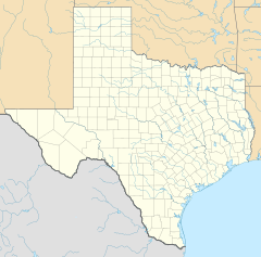
Las Palmas is located in the western part of Zapata County. It is about 4 miles (6 kilometers) north of Zapata. Zapata is the main town and the county seat for Zapata County.
Land Area
The United States Census Bureau has measured the size of Las Palmas. The total area of the Las Palmas CDP is about 0.18 square kilometers (0.07 square miles). All of this area is land, meaning there are no large bodies of water like lakes or rivers within its boundaries.
Who Lives in Las Palmas?
The number of people living in Las Palmas is counted during the U.S. Decennial Census. This census happens every ten years.
Population Count
- 2010: The population of Las Palmas was 67 people.
This community is a quiet place where people live and contribute to the local area.
See also
 In Spanish: Las Palmas (Texas) para niños
 | Emma Amos |
 | Edward Mitchell Bannister |
 | Larry D. Alexander |
 | Ernie Barnes |


