Laurentian River System facts for kids
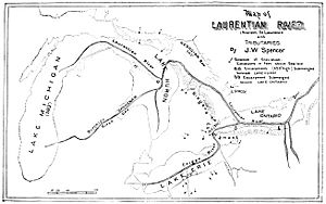
The Laurentian Channel is like a secret, ancient river flowing deep underground in southern Ontario, Canada. It's not a river you can see on the surface today. This hidden waterway is much older than the last Ice ages, which covered much of Canada with thick ice.
During those ice ages, giant glaciers moved across the land. They filled up the old river valley with lots of rocks, sand, and dirt, called glacial debris. Even though the valley was buried, water still finds its way through this old path, flowing deep beneath the ground. This underground water system is called an aquifer. The water in this aquifer comes all the way from Georgian Bay, which is about 200 kilometres (120 mi) away!
Contents
The Ancient Laurentian Channel
The Laurentian Channel is a fascinating example of how Earth's landscape changes over millions of years. It shows us that even though glaciers can reshape the surface, ancient features can still exist hidden beneath.
Where is this Hidden River?
In 2003, scientists made an exciting discovery. They found that the southern part of this underground river system flows right under High Park in Toronto, Ontario. Experts believe this is where the Laurentian Channel finally empties its water into Lake Ontario.
If you visit High Park, you might spot an overflow pipe that runs into Spring Creek. This pipe always has a steady flow of water coming out of it. This water helps keep the creek cool for local wildlife, like fish. It also helps release pressure from the underground water system. The area around the pipe looks reddish because the water has a lot of iron in it. The water itself is naturally pure and cool, usually between 6 and 9 degrees Celsius (42-48 degrees Fahrenheit).
How Was it Discovered?
The discovery of the Laurentian Channel was quite dramatic! To learn more about this hidden river, scientists drilled a well. As they were drilling, a huge burst of water, mud (silt), and gravel suddenly shot out of the well.
This powerful burst showed something important: the channel's flow into Lake Ontario was somehow blocked. This blockage caused a massive buildup of pressure underground, like a giant water balloon ready to burst!
What Does the Channel Look Like?
The bedrock, which is the solid rock beneath the soil, under Toronto has several dips and valleys. Scientists believe these were carved out by the Laurentian River long, long ago.
The Laurentian Channel is very large. In some places, it's about 25 to 30 kilometers wide, and it stretches for about 100 kilometers in length. It's also more than 100 meters deep! Even with these measurements, scientists are still working to find out its exact total size and what kind of materials fill it. Most of what we know comes from studying the soil and rock samples taken from wells drilled into the channel. The materials inside the channel range from sand and gravel near the bottom to clay-like mud (silts) closer to the top.
 | Mary Eliza Mahoney |
 | Susie King Taylor |
 | Ida Gray |
 | Eliza Ann Grier |


