Lauriston, New Zealand facts for kids
Quick facts for kids
Lauriston
|
|
|---|---|
|
Township
|
|

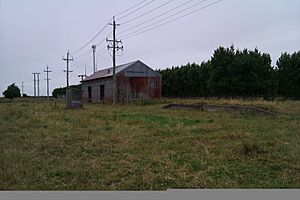
Lauriston goods shed
|
|
| Country | New Zealand |
| Region | Canterbury |
| Territorial authority | Ashburton District |
| Postcode |
7776
|
| Area code | 03 |
Lauriston is a small community located in the Canterbury region of New Zealand's South Island. It is found on the flat Canterbury Plains, south of the Rakaia River. Lauriston is about 20 kilometers (12 miles) inland from the town of Rakaia. The area was named after one of its first settlers, who had the last name Laurie.
Lauriston Solar Farm
The Lauriston Solar Farm is a large power station that uses sunlight to create electricity. This type of power station is called a photovoltaic power station. The construction of this solar farm was completed in 2025. It helps to provide clean energy for the region.
Black History Month on Kiddle
Influential African-American Artists:
 | James Van Der Zee |
 | Alma Thomas |
 | Ellis Wilson |
 | Margaret Taylor-Burroughs |

All content from Kiddle encyclopedia articles (including the article images and facts) can be freely used under Attribution-ShareAlike license, unless stated otherwise. Cite this article:
Lauriston, New Zealand Facts for Kids. Kiddle Encyclopedia.
