Lents, Portland, Oregon facts for kids
Quick facts for kids
Lents
|
|
|---|---|
|
Neighborhood
|
|
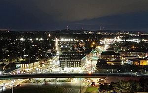
Lents Town Center at night, April 2021
|
|
| Country | United States |
| State | Oregon |
| City | Portland |
| Area | |
| • Total | 3.03 sq mi (7.86 km2) |
| Population
(2010)
|
|
| • Total | 20,156 |
| • Density | 6,642/sq mi (2,564.4/km2) |
| Housing | |
| • No. of households | 7169 |
| • Occupancy rate | 93% occupied |
| • Owner-occupied | 3192 households (55%) |
| • Renting | 2564 households (45%) |
| • Avg. household size | 2.81 persons |
Lents is a neighborhood in the southeast part of Portland, Oregon. It is bordered by SE Powell Blvd. to the north and the Clackamas County line to the south. To the west, it meets SE 82nd Ave., and to the east, it's near SE 112th.
Lents is one of Portland's largest and oldest neighborhoods. It covers about 3.75 square miles (9.7 square kilometers). In recent years, it has become a very diverse place. Many families from Asia, Eastern Europe, and Latin America now call Lents home. It is located about 6 miles (10 km) southeast of downtown Portland.
Contents
Exploring the History of Lents
Lents started as the Town of Lent in 1892. It was founded by Oliver P. Lent, who came to Oregon from Ohio. The original town was located between SE Foster Rd., SE Duke St., SE 92nd Ave., and SE 97th Ave.
How Lents Joined Portland
Oliver Lent wanted his town to be a self-sufficient community, like a small town near Portland. By 1912, Lents had almost 10,000 people. At that time, the city of Portland decided to make Lents a part of Portland.
Challenges and Changes in Lents
Because Lents was far from central Portland, it took a long time to get important city improvements. Things like paved streets and sewer systems were delayed. Later, a big highway called Interstate 205 was planned. It was supposed to go through other neighborhoods first. However, people in wealthier areas like Laurelhurst successfully asked for the highway route to be changed.
Eventually, in the 1970s, the city decided to build the freeway even further out, right through the middle of the Lents neighborhood. This split the community in half.
Who Lives in Lents?
In 2010, Lents had a population of 20,156 people. The neighborhood is very diverse. About 60% of residents identified as white. Many others identified as Asian (14.1%), Black (4.5%), or Native American (1.0%). About 15.8% of residents identified as Hispanic or Latino.
Getting Around Lents
Lents is an important place for transportation in Portland. A major highway, Interstate 205, runs through it. Also, three key roads for Portland traffic—Powell Boulevard, Foster Road, and 82nd Avenue—pass through the neighborhood.
Public Transportation in Lents
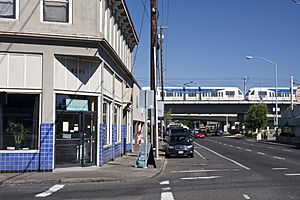
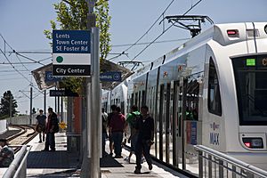
Lents is also served by the MAX Green Line, which is Portland's light rail system. There's also the Springwater Corridor trail, which is great for walking and biking.
Long ago, in 1892, a streetcar used to run from downtown Portland to Lents. It followed a winding path, connecting the two areas. Today, Lents has many bus lines that help people get around.
- 9-Powell Blvd
- 10-Harold St
- 14-Hawthone
- 17-Holgate/Broadway
- 19-Woodstock/Glisan
- 71-60th/122nd Avenue
- 72-Killingsworth/82nd Avenue
What's Next for Lents?
The city of Portland sees a lot of potential in the Lents neighborhood. They have made it an "Urban Renewal Area." This means the city can invest money to improve the area. They use future property taxes to fund projects in the Lents Town Center.
Improving the Lents Community
Many new homes and businesses have already been built in Lents, and more are planned. The MAX light rail system has also been extended through Lents.
The city has worked with local groups to create plans for Lents. These plans aim to:
- Create new jobs for families.
- Help new and existing businesses grow.
- Improve local streets and parks.
- Build new homes and improve older ones.
- Give residents more chances to find good jobs.
- Provide housing options for everyone in the community.
In 1998, the City Council officially created the Lents Town Center Urban Renewal Area. This was done to help achieve the community's goals. The plan started in 1999–2000. In 2008, the city approved expanding the area and increasing the money available for projects. This will help Lents continue to grow and improve until at least 2020.
People from Lents
- Lucia H. Faxon Additon (1847-1919), a social reformer and clubwoman.
- Woody Guthrie, a famous folk singer, lived in Lents for a short time in 1941. An apartment complex in Lents is named after him.
Parks and Green Spaces
Lents has many parks and green areas for residents to enjoy:
- Lincoln Memorial Park Cemetery (1909)
- Lents Park (1914)
- Bloomington Park (1940)
- Glenwood Park (1941)
- Lents Community Garden (1976)
- Ed Benedict Park (1986), which includes the Portland Memory Garden (2002)
- Earl Boyles Park (1986)
- Springwater Corridor Trail (1990)
- Tenino Property (1994)
- Beggars Tick Wildlife Refuge
- Zenger Property
- I-205 Bike Path
 | Delilah Pierce |
 | Gordon Parks |
 | Augusta Savage |
 | Charles Ethan Porter |


