Lime Ridge, Pennsylvania facts for kids
Quick facts for kids
Lime Ridge, Pennsylvania
|
|
|---|---|

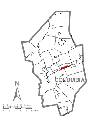
Location within Columbia County
|
|
| Country | United States |
| State | Pennsylvania |
| County | Columbia |
| Township | South Centre |
| Area | |
| • Total | 1.39 sq mi (3.60 km2) |
| • Land | 1.13 sq mi (2.92 km2) |
| • Water | 0.26 sq mi (0.68 km2) |
| Elevation | 508 ft (155 m) |
| Population
(2020)
|
|
| • Total | 823 |
| • Density | 730.91/sq mi (282.31/km2) |
| Time zone | UTC-5 (Eastern (EST)) |
| • Summer (DST) | UTC-4 (EDT) |
| ZIP code |
17815
|
| FIPS code | 42-43320 |
| GNIS feature ID | 1179348 |
Lime Ridge is a small community in Columbia County, Pennsylvania, United States. It is known as a census-designated place (CDP), which means it's a special area defined by the government for counting people. Lime Ridge is part of Northeastern Pennsylvania. In 2020, about 823 people lived there. It is also part of the Bloomsburg-Berwick micropolitan area.
The name "Lime Ridge" comes from the limestone deposits found in the area.
History of Lime Ridge
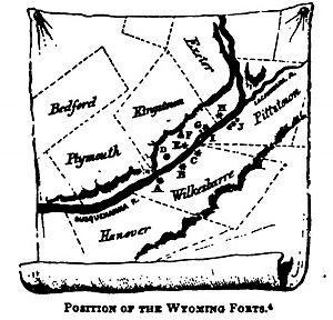
Lime Ridge has an interesting past. A fort called Fort Jenkins was built here in 1778. This was during an important time in American history.
In the early 1800s, people discovered a lot of limestone in Lime Ridge. This limestone was very useful. It was sent to nearby places like Wilkes-Barre to help build brick houses. Limestone was also used in a process called smelting, which helps separate metal from its ore.
Geography and Location
Lime Ridge is located in the east-central part of Columbia County. It sits in the southern area of South Centre Township. The community covers about 4.1 square kilometers (1.6 square miles). Most of this area is land, but about 0.7 square kilometers (0.26 square miles) is water.
The Susquehanna River forms the southern border of Lime Ridge. To the north, you'll find U.S. Route 11. Interstate 80 is to the east, and the community of Almedia is to the west. The land in Lime Ridge is mostly flat.
Several schools are located within Lime Ridge. These include Central Columbia High School, the middle school, and the elementary school, all part of the Central Columbia School District.
Population and People
| Historical population | |||
|---|---|---|---|
| Census | Pop. | %± | |
| 2020 | 823 | — | |
| U.S. Decennial Census | |||
In 2020, the population of Lime Ridge was 823 people. This number helps us understand how many people live in the area.
Looking back at the year 2000, there were 951 people living in Lime Ridge. There were 404 households, which are groups of people living together in one home. About 28% of these households had children under 18 years old. The average household had about 2.35 people.
The population was spread out across different age groups. About 21.1% of the people were under 18 years old. About 15.5% were 65 years old or older. The average age in Lime Ridge was 40 years.
See also
 In Spanish: Lime Ridge (Pensilvania) para niños
 | Misty Copeland |
 | Raven Wilkinson |
 | Debra Austin |
 | Aesha Ash |


