List of Indiana state historical markers in Jasper County facts for kids
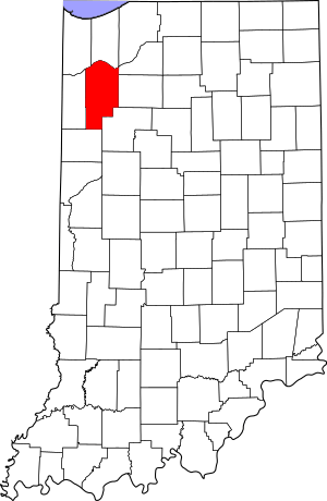
This is a list of the Indiana state historical markers in Jasper County.
This is intended to be a complete list of the official state historical markers placed in Jasper County, Indiana, United States by the Indiana Historical Bureau. The locations of the historical markers and their latitude and longitude coordinates are included below when available, along with their names, years of placement, and topics as recorded by the Historical Bureau. There are 6 historical markers located in Jasper County.
Historical markers
| Marker title | Image | Year placed | Location | Topics |
|---|---|---|---|---|
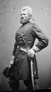
| General Robert H. Milroy 1816-1890 |  |
1964 | Milroy Park, 3 blocks west of downtown surrounded by Washington and Milroy Streets and College Avenue in Rensselaer 40°56′4″N 87°9′18.6″W / 40.93444°N 87.155167°W |
Military |
| La Salle Expedition |  |
1966 | U.S. Route 231 at the Kankakee River in northern Jasper County 41°15′33″N 87°11′56″W / 41.25917°N 87.19889°W |
Early Settlement and Exploration |
| St. Joseph's Indian Normal School 1888-1896 |  |
1971 | Eastern side of U.S. Route 231, across from the main entrance to Saint Joseph's College on the southern side of Rensselaer 40°55′16.6″N 87°9′18″W / 40.921278°N 87.15500°W |
Education, American Indian/Native American, Religion |
| Fountain Park Chautauqua |  |
1992 | Central grounds of Fountain Park Chautauqua, located along County Road 1600S approximately 0.3 miles west of U.S. Route 231 in Remington 40°46′44″N 87°9′30″W / 40.77889°N 87.15833°W |
Special Events |
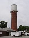
| Remington Water Tower |  |
2006 | 3 E. Michigan Street in Remington 40°45′43″N 87°9′2″W / 40.76194°N 87.15056°W |
Buildings and Architecture, Government Institutions |
| James Frederick Hanley |  |
2008 | Southeastern corner of the junction of Front and Washington Streets in Rensselaer 40°56′7″N 87°9′11″W / 40.93528°N 87.15306°W |
Arts and Culture |

All content from Kiddle encyclopedia articles (including the article images and facts) can be freely used under Attribution-ShareAlike license, unless stated otherwise. Cite this article:
List of Indiana state historical markers in Jasper County Facts for Kids. Kiddle Encyclopedia.

