Jasper County, Indiana facts for kids
Quick facts for kids
Jasper County, Indiana
|
|
|---|---|

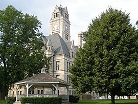
Jasper County Courthouse in Rensselaer
|
|

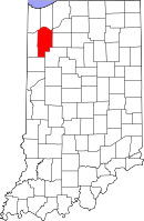
Location in the state of Indiana
|
|

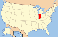
Indiana's location in the United States
|
|
| Country | United States |
| State | Indiana |
| Region | Northwest Indiana |
| Metro area | Chicago Metropolitan |
| Created | February 7, 1835 |
| Established | March 15, 1838 |
| Named for | Sgt. William Jasper |
| County seat | Rensselaer |
| Largest city | Rensselaer |
| Boroughs |
List
|
| Government | |
| • Type | County |
| • Body | Board of Commissioners |
| Area | |
| • County | 561.39 sq mi (1,454.0 km2) |
| • Land | 559.62 sq mi (1,449.4 km2) |
| • Water | 1.76 sq mi (4.6 km2) |
| • Metro | 10,874 sq mi (28,160 km2) |
| Area rank | 3rd largest county in Indiana |
| • Region | 2,726 sq mi (7,060 km2) |
| Elevation | 696 ft (212 m) |
| Population
(2020)
|
|
| • County | 32,918 |
| • Estimate
(2023)
|
33,535 |
| • Rank | 49th largest county in Indiana |
| • Density | 58.6366/sq mi (22.6397/km2) |
| • Metro | 9,618,502 |
| Time zone | UTC−6 (Central) |
| • Summer (DST) | UTC−5 (Central) |
| ZIP Codes |
46310, 46341, 46374, 46392, 47922, 47943, 47946, 47948, 47957, 47959, 47977-78, 47995
|
| Area code | 219 |
| Congressional district | 4th |
| Indiana Senate districts | 5th and 7th |
| Indiana House of Representatives districts | 4th, 16th and 20th |
| FIPS code | 18-073 |
| GNIS feature ID | 0450494 |
| Interstate and U.S. Route | |
| State Routes | |
| Airport | Jasper County
|
| Waterways | Iroquois River – Kankakee River
|
| Amtrak station | Rensselaer |
| Website | www.jaspercountyin.gov |
|
|
| Demographic | Proportion |
|---|---|
| White | 95.8% |
| Black | 0.6% |
| Asian | 0.4% |
| Islander | 0.0% |
| Native | 0.2% |
| Other | 3.0% |
| Hispanic (any race) |
5.4% |
Jasper County is a county in the state of Indiana. It's located in the northwestern part of the state. As of 2020, about 32,918 people live here. The main city and county seat is Rensselaer. Jasper County is also part of the larger Chicago Metropolitan Area, which includes cities in Illinois, Indiana, and Wisconsin.
Contents
History of Jasper County
Early Explorers and Native American Lands
Long ago, French explorer Robert de LaSalle explored the lands that are now northwestern Indiana. At that time, the Miami Confederation of Indians lived in this area. Over time, as more settlers arrived, different Native American groups had to give up their claims to the land.
In October 1818, the Pottawattamies, Weas, and Delawares gave up their lands west of the Tippecanoe River. Later, in October 1826, the Pottawattamies and Miamis gave up all their lands east of the Tippecanoe River. Finally, in October 1832, the Pottawattamies gave up control of the northwestern part of Indiana.
First Settlers and County Formation
Before 1832, the area that would become Jasper County was not open for new settlers. The land was often described as swamps, sandy ridges, and wet prairies. However, it had a lot of wild game, which attracted some people. The first recorded settler was William Donahue, who settled in what is now Gillam Township.
The state government decided to create two counties in this area: Jasper and Newton. For a while, they were connected to White County for official purposes. In 1836, the area north of the Kankakee River became Porter County.
The Jasper County government officially started on March 15, 1838. The county was named after Sergeant William Jasper. He was a brave scout for the Continental Army during the American Revolutionary War. Sergeant Jasper became famous in 1776 for putting up a new American flag during a battle after the old one was shot down. He died in 1779 during the Siege of Savannah. Jasper County's neighboring county, Newton County, was named after Jasper's friend, John Newton.
In 1839, Jasper and Newton counties were combined, keeping the name Jasper. The county seat was set at the Falls of the Iroquois River. This community was first called Newton but changed its name to Rensselaer in 1844. In 1840, Benton County was formed from part of Jasper's area. Then, in 1859, Newton County was created again, but with a smaller area, leaving Jasper County in its current shape.
Jasper County During the Civil War
By 1825, most people in Indiana were against slavery. When the Civil War began, Jasper County was one of the few counties in Indiana that already had a military group. The war had a big impact on Jasper County. About 935 soldiers from the county joined the Union army. This was a large number, considering the county's population was around 5,000 people at the time.
One famous person from Indiana was Robert H. Milroy, known as the "Gray Eagle of the Army." He was part of the 9th Indiana Infantry Regiment. Milroy became well-known for fighting against Confederate mountain rangers. The 9th Indiana Infantry Regiment was also involved in the Battle of Philippi, one of the first battles of the Civil War. Indiana sent more soldiers to the Union army than any other state.
Geography and Nature
Jasper County covers about 561 square miles. Most of this area, about 559 square miles, is land. The rest is water. Until the mid-1800s, this county was part of a very large freshwater wetland. It was full of different plants and animals. This wetland was created by the Iroquois River, which flows through Jasper County. The Iroquois River is a main branch of the Kankakee River, and it's an important water source for the area.
Major Roads and Transportation
Jasper County has several important roads that help people travel through the area.
- Interstate 65
- U.S. Route 24
- U.S. Route 231
- Indiana State Road 10
- Indiana State Road 14
- Indiana State Road 16
- Indiana State Road 49
- Indiana State Road 110
- Indiana State Road 114
Railroads Serving Jasper County
Several railroad lines pass through Jasper County, helping to move goods and people.
- CSX Transportation
- Norfolk Southern Railway
- Toledo, Peoria and Western Railway
Neighboring Counties
Jasper County shares borders with several other counties:
- Porter County (north)
- La Porte County (northeast)
- Starke County (northeast)
- Pulaski County (east)
- White County (southeast)
- Benton County (south)
- Newton County (west)
- Lake County (northwest)
Cities and Towns
Here are the main cities and towns in Jasper County, along with their populations from the 2020 census:
Cities
- Rensselaer – 5,733 people
Towns
- De Motte – 4,168 people
- Remington – 1,356 people
- Wheatfield – 904 people
Other Communities
There are also smaller communities in Jasper County:
- Collegeville – 84 people
- Roselawn – 4,132 people
Unincorporated Communities
Many smaller places in the county don't have their own local government:
- Aix
- Asphaltum
- Baileys Corner
- Deer Park
- Dunns Bridge
- Egypt
- Fair Oaks
- Forest City
- Fountain Park
- Gifford Park
- Kersey
- Kniman
- Laura
- Lewiston
- McCoysburg
- Moody
- Newland
- Parr
- Pleasant Ridge
- Stoutsburg
- Surrey
- Tefft
- Virgie
Townships
Jasper County is divided into 13 townships. Here are their populations from the 2020 census:
- Barkley – 915 people
- Carpenter – 1,925 people
- Gillam – 619 people
- Hanging Grove – 209 people
- Jordan – 326 people
- Kankakee – 913 people
- Keener – 10,625 people
- Marion – 6,648 people
- Milroy – 256 people
- Newton – 825 people
- Union – 1,588 people
- Walker – 3,692 people
- Wheatfield – 4,377 people
Education in Jasper County
Students in Jasper County attend public schools managed by different school districts.
High Schools
- Kankakee Valley High School
- Rensselaer Central High School
- Covenant Christian High School in DeMotte (for grades 9–12)
Middle Schools
- Kankakee Valley Middle School
- Rensselaer Central Middle School
Elementary Schools
- DeMotte Christian Elementary School (preschool through 8th grade)
- DeMotte Elementary School
- Kankakee Valley Intermediate School
- St. Augustine Catholic School
- Tri-County Primary School (Kindergarten to 2nd grade)
- Van Rensselaer Elementary School
- Wheatfield Elementary School
Colleges and Universities
- Saint Joseph's College (This college is currently closed.)
Hospitals
- Franciscan Health Rensselaer, located in Rensselaer, has 46 beds.
Climate and Weather
| Weather chart for Rensselaer, Indiana | |||||||||||||||||||||||||||||||||||||||||||||||
|---|---|---|---|---|---|---|---|---|---|---|---|---|---|---|---|---|---|---|---|---|---|---|---|---|---|---|---|---|---|---|---|---|---|---|---|---|---|---|---|---|---|---|---|---|---|---|---|
| J | F | M | A | M | J | J | A | S | O | N | D | ||||||||||||||||||||||||||||||||||||
|
2
30
14
|
1.7
36
19
|
3.1
47
29
|
3.5
60
39
|
4.2
72
50
|
4.3
81
60
|
3.8
85
64
|
3.5
83
61
|
3.3
76
53
|
3
64
41
|
3.2
49
32
|
2.7
36
21
|
||||||||||||||||||||||||||||||||||||
| temperatures in °F precipitation totals in inches source: The Weather Channel |
|||||||||||||||||||||||||||||||||||||||||||||||
|
Metric conversion
|
|||||||||||||||||||||||||||||||||||||||||||||||
The weather in Rensselaer changes a lot throughout the year. In January, the average low temperature is about 14°F (minus 10°C). In July, the average high temperature is about 85°F (29°C). The coldest temperature ever recorded was minus 25°F (minus 32°C) in January 1985. The hottest was 104°F (40°C) in August 1988.
The amount of rain and snow also varies. February usually has the least precipitation, about 1.67 inches. June typically has the most, with about 4.34 inches.
Population and People
| Historical population | |||
|---|---|---|---|
| Census | Pop. | %± | |
| 1840 | 1,267 | — | |
| 1850 | 3,540 | 179.4% | |
| 1860 | 4,291 | 21.2% | |
| 1870 | 6,354 | 48.1% | |
| 1880 | 9,464 | 48.9% | |
| 1890 | 11,185 | 18.2% | |
| 1900 | 14,292 | 27.8% | |
| 1910 | 13,044 | −8.7% | |
| 1920 | 13,961 | 7.0% | |
| 1930 | 13,388 | −4.1% | |
| 1940 | 14,397 | 7.5% | |
| 1950 | 17,031 | 18.3% | |
| 1960 | 18,842 | 10.6% | |
| 1970 | 20,429 | 8.4% | |
| 1980 | 26,138 | 27.9% | |
| 1990 | 24,960 | −4.5% | |
| 2000 | 30,043 | 20.4% | |
| 2010 | 33,478 | 11.4% | |
| 2020 | 32,918 | −1.7% | |
| 2023 (est.) | 33,535 | 0.2% | |
| US Decennial Census 1790-1960 1900-1990 1990-2000 2010 |
|||
In 2010, Jasper County had 33,478 people living in 12,232 households. Most people (95.8%) were white. About 5.4% of the population identified as Hispanic or Latino. Many residents have German (27.6%), Irish (16.5%), or Dutch (9.6%) backgrounds.
The average age in the county was 38 years old. About 35.8% of households had children under 18 living there. The average household had 2.66 people.
The median income for a household was $47,697. For families, it was $63,842. This means half of the households earned more than this amount, and half earned less. About 9% of the population lived below the poverty line.
Religious Groups in Jasper County
The largest religious group in Jasper County is the Catholic Church, with 4,341 members. The second largest is the Reformed Church in America with 1,502 members. The United Methodist Church is third with 1,300 members. The Christian Reformed Church in North America has 1,013 members across three churches.
See also
 In Spanish: Condado de Jasper (Indiana) para niños
 | Claudette Colvin |
 | Myrlie Evers-Williams |
 | Alberta Odell Jones |

