
Wheatfield, Indiana facts for kids
Quick facts for kids
Wheatfield, Indiana
|
|
|---|---|

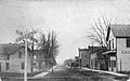
Main Street in Wheatfield
|
|

Location of Wheatfield in Jasper County, Indiana.
|
|
| Country | United States |
| State | Indiana |
| County | Jasper |
| Township | Wheatfield |
| Area | |
| • Total | 0.59 sq mi (1.53 km2) |
| • Land | 0.59 sq mi (1.53 km2) |
| • Water | 0.00 sq mi (0.00 km2) |
| Elevation | 666 ft (203 m) |
| Population
(2020)
|
|
| • Total | 904 |
| • Density | 1,529.61/sq mi (590.80/km2) |
| Time zone | UTC-6 (Central (CST)) |
| • Summer (DST) | UTC-5 (CDT) |
| ZIP code |
46392
|
| Area code(s) | 219 |
| FIPS code | 18-83528 |
| GNIS feature ID | 2397738 |
Wheatfield is a small town located in Jasper County, Indiana, in the United States. In 2020, about 904 people lived there. It is part of Wheatfield Township, Jasper County, Indiana.
Contents
A Look Back: Wheatfield's History
Wheatfield started in the early 1880s. This happened when a railroad was built through the area. The town's post office opened in 1882. Wheatfield got its name because a field of swamp grass nearby looked like a field of wheat.
Where is Wheatfield?
Wheatfield is a small town. It covers about 0.56 square miles (1.45 square kilometers) of land. There is no water area within the town limits.
People of Wheatfield
| Historical population | |||
|---|---|---|---|
| Census | Pop. | %± | |
| 1900 | 366 | — | |
| 1910 | 357 | −2.5% | |
| 1920 | 382 | 7.0% | |
| 1930 | 401 | 5.0% | |
| 1940 | 439 | 9.5% | |
| 1950 | 496 | 13.0% | |
| 1960 | 679 | 36.9% | |
| 1970 | 713 | 5.0% | |
| 1980 | 755 | 5.9% | |
| 1990 | 621 | −17.7% | |
| 2000 | 772 | 24.3% | |
| 2010 | 853 | 10.5% | |
| 2020 | 904 | 6.0% | |
| U.S. Decennial Census | |||
In 2010, there were 853 people living in Wheatfield. These people lived in 322 homes. About 221 of these were families. The town had 353 housing units in total.
Most people in Wheatfield were White (95.8%). A small number were African American, Asian, or Pacific Islander. Some people were from other races, or a mix of two or more races. About 5.9% of the population was Hispanic or Latino.
Many homes (39.4%) had children under 18 living there. About 48.1% of homes were married couples. The average home had 2.65 people. The average family had 3.20 people.
The average age in Wheatfield was 31.8 years. About 29.1% of residents were under 18. About 11.5% were 65 or older. The town had slightly more females (50.6%) than males (49.4%).
Learning in Wheatfield
The Kanakee Valley School Corporation helps educate students in Wheatfield. Wheatfield Elementary School is located right in town. It serves the younger students.
Older students go to schools located in Wheatfield Township. These include Kankakee Valley Intermediate School, Kankakee Valley Middle School, and Kankakee Valley High School.
Wheatfield also has a public library. It is a branch of the Jasper County Public Library.
Images for kids
-
Wheatfield in 1915
.jpg)
See also
 In Spanish: Wheatfield (Indiana) para niños
