
List of cemeteries in Sonoma County, California facts for kids
A cemetery is a special place where people are laid to rest after they pass away. It's a quiet area, often with beautiful trees and plants, where families can visit and remember their loved ones. In Sonoma County, California, there are many different kinds of these resting places. Some are still in use today, while others are historical, meaning they are no longer accepting new burials. There are even some "defunct" ones, which means the graves might have been moved or the area is no longer used as a cemetery.
This article will help you learn about the various cemeteries in Sonoma County. It includes places where people are buried in the ground (traditional cemeteries), buildings where ashes are kept in urns (called columbaria), and large tomb-like buildings for burials (called mausolea). We won't be talking about pet cemeteries here, just those for people.
Contents
What is a Cemetery?
A cemetery is a dedicated area for burying the dead. It's a place for remembrance and respect. Cemeteries can look very different depending on their history and the culture of the people who use them.
Types of Cemeteries
- Operating Cemeteries: These are cemeteries that are still open for new burials. People can choose these places for their loved ones today.
- Historical Cemeteries: These cemeteries are no longer accepting new burials, but they are still maintained and respected. They often hold important history about the community.
- Defunct Cemeteries: In some rare cases, a cemetery might become "defunct." This means the graves may have been moved, or the land is no longer used for burials.
Other Resting Places
- Columbaria: These are buildings or walls with small spaces, called niches, where urns containing the ashes of people who have been cremated are kept.
- Mausolea: These are large, often grand, buildings that serve as tombs for one or more people. They can be for a single family or for many individuals.
Notable Cemeteries in Sonoma County
Sonoma County is home to many interesting cemeteries, each with its own story. Here are a few examples:
Santa Rosa Rural Cemetery
The Santa Rosa Rural Cemetery is a very old and important historical cemetery in Santa Rosa, California. It has two main entrances: the McDonald Entrance and the Franklin Gate Entrance. This cemetery is special because it also contains two smaller cemeteries within its grounds: the Fulkerson Cemetery and the Moke Cemetery. It's a beautiful place to learn about the history of the area.

Sonoma Mountain Cemetery
Located in Sonoma, California, the Sonoma Mountain Cemetery is known for being the final resting place of Mariano Guadalupe Vallejo. He was a very important historical figure in California, especially during the time when California was becoming part of the United States. Visiting his grave can connect you to a significant part of the state's past.
Historical Landmarks
Several cemeteries in Sonoma County are recognized as Sonoma County Historic Landmarks and Districts. This means they are important historical sites that are protected and preserved. Some of these include:
- Bennett Valley Cemetery in Santa Rosa
- Bloomfield Cemetery in Bloomfield
- Sonoma State Home Cemetery in Eldridge
- Two Rock Presbyterian Church Cemetery in Two Rock
These landmarks help us remember the people and events that shaped Sonoma County over many years.
Images for kids
-
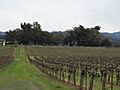
Beeson Cemetery in Geyserville.
-
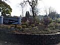
The entrance to Calvary Catholic Cemetery in Santa Rosa.
-
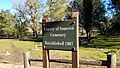
The Sonoma County Cemetery.
-
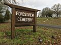
The entrance to Forestview Cemetery in Forestville.
-
Fulton Cemetery in Fulton.
-
McPeak Cemetery in Hacienda.
-
The entrance to Oak Mound Cemetery in Healdsburg.
-
Olive Hill Cemetery in Healdsburg.
-
Steele Family Cemetery in Santa Rosa.


See also
- List of cemeteries in California
