
Sonoma County Historic Landmarks and Districts facts for kids
This article is about special places in Sonoma County, California that have been chosen as Sonoma County Landmarks. These landmarks are picked by the Sonoma County's Landmark Commission because they are important to the area's history.
These landmarks are mostly in the parts of Sonoma County that aren't inside specific cities or towns. Cities and towns usually choose their own landmarks. For example, the town of Windsor, California now takes care of its own historic sites, even though some were first chosen by the county before Windsor became a town. You can find information about Windsor's historic places in the Windsor historical landmarks article.
The County of Sonoma's Permit and Resource Management Department helps protect these special places. They make sure that changes to these landmarks respect their historic look and feel.
Contents
What Are Sonoma County Landmarks?
Sonoma County Landmarks are buildings, areas, or even natural spots that are important because of their history, architecture, or culture. They tell us stories about how people lived, worked, and built things in the past.
Exploring Freestone's Past
Freestone, California is a small town with several historic landmarks.
Freestone Historic District
- The Freestone Historic District was named a landmark in 1974. It includes about 30 different properties that show the town's history.
Historic Buildings in Freestone

The Freestone House at 306 Bohemian Highway was named a landmark in 1974. It has been known by many names, like the Hinds Hotel and the Wayside Inn.

The Freestone Schoolhouse at 201 Bohemian Highway became a landmark in 1974. It was once where kids in Freestone went to learn.

The Freestone Country Store at 500 Bohemian Highway was also named a landmark in 1974. It was a central spot for the community.
Historic Spots Around Sonoma
Many important landmarks are found in and around the city of Sonoma, California.
Old Homes and Estates
- The C.F. Leiding House at 19772 8th Street East was named a landmark in 1975.
- The Cutter House at 1275 MacArthur Street became a landmark in 1975.
- The Magnolia Farm at 19745 8th Street East was named a landmark in 1975. It was also called the McCracken Home.
- The Nicholas Carriger Grand View at 2151 Grove Street was named a landmark in 1979. It's also known as the Nicholas Carriger Ranch or House.

The Nicholas Carriger Estate at 18880 Carriger Road was named a landmark in 1979. It is also listed on the National Register of Historic Places.
- The Cooper House at 600 Harris Road was designated in 1980.

Temelec Hall, along with its guest cottages and carriage house, at 220 and 221 Temelec Circle, became a landmark in 1981 and 1998.
- The Kiser House at 755 Watmaugh Road was named a landmark in 1980. It was also called Agnew Ranch.
- The Rosser Ranch at 405 Watmaugh Road was designated in 1980.
- The Laidlaw House at 22101 Arnold Drive was named a landmark in 1980.
- The Kiser Residence at 23450 Highway 121 was designated in 1980.
- The Kenny Residence at 19280 Riverside Drive was named a landmark in 1981.
- The Leveroni Ranch at 601 Leveroni Road was designated in 1980.
Wineries and Resorts

The Buena Vista Winery at 18000 Old Winery Road was named a landmark in 1975. It's also a California Historic Landmark and on the National Register of Historic Places.
- The Count Haraszthy Villa at 1990 Castle Road was designated in 1975. It is also a California Historic Landmark.
- The Fetter’s Hot Springs Depot at 215 Depot Road was named a landmark in 1975.
- The Agua Caliente Springs Hotel at 17250 Vailetti Drive was designated in 1975 and 1980. It was also known as Agua Caliente Villa.
- The Haraszthy Ranch at 27000 Ramal Road was named a landmark in 1980. It's located at Carneros Hills Winery.
- The Sonoma Mission Inn at 18140 Highway 12 was designated in 1986.
Other Sonoma Landmarks
- The Circle Bar Ranch Barn at 25730 Arnold Drive was named a landmark in 1980.
- The Salt Ranch & Residence at 24737 Arnold Drive was designated in 1980. It's located at Cline Cellars.
- The Schellville Baptist Church at 23109 Central Road was named a landmark in 1980. It's also known as New Life Assembly of God Church and Chula Vista School.
- The Cavedale Road Marker at 255 Cavedale Road was designated in 1981.
- The General Joseph Hooker’s Ranch at 16601 Meadow Oaks Drive was named a landmark in 1981.
- The Sobre Vista Farm at 1225 Sobre Vista Drive was designated in 1981.
- The Watmaugh Road Bridge on Watmaugh Road was named a landmark in 1981.
Landmarks in Other Towns
Healdsburg Area
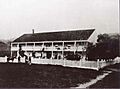
,_May_2012.jpg)
The Sweetwater Springs Historic District in Healdsburg, California was named a landmark in 1976. It includes four buildings and two properties, like the old Hop Kiln Winery.
- The Cyrus Alexander Adobe and Cemetery at 8640 Highway 128 in Healdsburg, California was designated in 1977. It's located at Alexander Valley Vineyards.

The Madrona Knolls Rancho at 1001 Westside Road in Healdsburg, California was named a landmark in 1978. It's also on the National Register of Historic Places.
- The Wohler Ranch at 10630 Wohler Road in Healdsburg, California was designated in 1980.
- The Dry Creek Store at 3485 Dry Creek Road in Healdsburg, California was named a landmark in 1979. It's now called Dry Creek General Store.
- The Rose Villa at 644 Grant Street in Healdsburg, California is also called Powell’s Place.
- The Chalk Hill Road Over Maacama Creek Bridge on Chalk Hill Road in Healdsburg, California was designated in 1998.
- The Lambert Bridge on Lambert Bridge Road in Healdsburg, California was designated in 1998.
Occidental Area

The Church of Occidental at 3637 Church Street in Occidental, California was named a landmark in 1980.
- The Union Hotel at 3639 Church Street in Occidental, California was designated in 1980. It was also known as the Union Saloon and Hotel.
- The Taylor Building at 3611 Main Street in Occidental, California was named a landmark in 1980.
- The St. Philip's Church at 3730 Bohemian Highway in Occidental, California was designated in 1978.
- The Coleman Valley Ranch at 17220 Coleman Valley Road in Occidental, California was named a landmark in 1984.

The Occidental Historic District was named a landmark in 1982. It includes 27 properties.
Glen Ellen Area
- The Wegenerville Resort at 1883 London Ranch Road in Glen Ellen, California was named a landmark in 1979. It's located at Benziger Family Winery.
- The Thompson Ranch and Cemetery at 7301 Enterprise Road in Glen Ellen, California was designated in 1979.
- The Joshua Chauvet House at 13760 Arnold Drive in Glen Ellen, California was named a landmark in 1980.
- The Gaige House at 13540 Arnold Drive in Glen Ellen, California was designated in 1980.
- The Mervyn Hotel Site at 13751 Arnold Drive in Glen Ellen, California was named a landmark in 1990. The hotel was demolished in the 1930s.
- The Shone’s Country Market at 13750 Arnold Drive in Glen Ellen, California was designated in 1981. It was also called C.J. Poppe’s Store.
- The Chauvet Building at 13740 Arnold Drive in Glen Ellen, California was named a landmark in 1981.
- The Hotel Chauvet at 13756 Arnold Drive in Glen Ellen, California was designated in 1981. It was also called the Glen Ellen Hotel.
- The Stone Winery Building at 14301 Arnold Drive in Glen Ellen, California was named a landmark in 1981. It's now the site of Aventine.
- The Calabezas Creek Bridge on O'Donnell Lane in Glen Ellen, California was designated in 1981. It's also called O’Donnell Lane Bridge.
- The Zane House at 3443 Warm Springs Road in Glen Ellen, California was demolished.
- The Wake Robin Lodge at 4100 Wake Robin Drive in Glen Ellen, California was named a landmark in 1981.
- The Glen Oaks at 13255 Highway 12 in Glen Ellen, California was designated in 1981. It's also called Glen Oaks Vineyards.
- The Ten Oaks Ranch at 12783 Dunbar Road in Glen Ellen, California was named a landmark in 1981. It has many names, including Kate Warfield Ranch.
- The Triniti School at 11790 Dunbar Road in Glen Ellen, California was named a landmark.
Petaluma Area
- The Haystack Ranch at 3355 Petaluma Boulevard South in Petaluma, California was named a landmark in 1976. It was also called Haystack Landing but has been demolished.

The Washoe House at 2840 Roblar Road in Petaluma, California was designated in 1979.
- The Watson Ranch at 498 Pepper Road in Petaluma, California is also called Garden Valley Ranch and Pepper Farm.
- The Sweeney Ranch at 156-155 San Antonio Rd. in Petaluma, California is a landmark.
- The Dunham School at 4001 Roblar Road in Petaluma, California is a landmark.
- The Bloomfield Masonic Lodge Hall at 6640 Bloomfield Rd. in Petaluma, California is a landmark.
- The Bloomfield Cemetery at 13051 Sutton Street in Petaluma, California is a landmark.
- The Two Rock Grange Hall at 7065 Bodega Avenue in Petaluma, California is a landmark.
- The Kastania Ranch at 4412 Kastania Road in Petaluma, California was designated in 1985.
- The Octagon House at 3925 Spring Hill Road in Petaluma, California is a landmark.
- The Bloomfield IOOF Hall at 6600 Bloomfield Road in Petaluma, California is also called the Bloomfield Town Hall.
- The Bloomfield School at 6691 Moro Street in Petaluma, California is a landmark.
- The Presbyterian Church Cemetery at 7063 Bodega Avenue in Petaluma, California is also called Two Rock Cemetery.
- The Liberty Cemetery on Liberty Road in Petaluma, California is a landmark.
- The Holy Ghost Hall at 4649 Bodega Avenue in Petaluma, California was designated in 1996.

The Penngrove Historic District was named a landmark in 1982. It includes 27 properties.
Santa Rosa Area
- The Massey House at 4845 Grange Road in Santa Rosa, California was named a landmark in 1979. It's also known as Tara.
- The Bennett Valley Grange Hall at 4145 Grange Road in Santa Rosa, California was designated in 1979. It's also called Bennett Valley Guild.
- The Benjamin Ranch at 4232 Grange Road in Santa Rosa, California was named a landmark in 1979.
- The Bennett Valley Cemetery at 4760 Bennett Valley Road in Santa Rosa, California was designated in 1979.
- The James Kruse House at 4918 Old Redwood Highway in Santa Rosa, California was named a landmark in 1980. It's also called the Jim Voss Ranch.
- The Jim Voss Commemorative Cottonwood Grove at 4600 Lavell Road in Santa Rosa, California was designated in 1980. It's a grove of cottonwood trees at Mark West School.
- The Maddux Home at 5063 Old Redwood Highway North in Santa Rosa, California was named a landmark in 1980.
- The John Rosseter Stables at 4900 Carriage Lane in Santa Rosa, California was designated in 1980. It's also called Wikiup Stables.
- The Finley Hop Ranch at 208 Ursuline Road in Santa Rosa, California was named a landmark in 1980.
- The The Gables at 4257 Petaluma Hill Road in Santa Rosa, California was designated in 1983.
- The Laughlin House at 414 Aviation Boulevard in Santa Rosa, California was named a landmark in 1984. It's also called Kenny Residence.
Bodega and Valley Ford Areas
- The Watson School at 15000 Bodega Highway in Valley Ford, California was named a landmark in 1976.

The Running Fence at 14459 Valley Ford Road in Valley Ford, California was designated in 1976. This was a temporary art installation.
- The Potter School at 17110 Bodega Lane in Bodega, California was named a landmark in 1978.
- The Witham House at 14201 Bodega Highway in Bodega, California was designated in 1979.

The Bodega Historic District was named a landmark in 1982. It includes 34 properties.
- The James Watson-Hollis Hitchcock Ranch at 14100 Bodega Highway in Bodega, California is also called Mache Dairy Ranch.
- The Greek Revival Cottage at 14210 Highway 1 in Valley Ford, California was designated in 1982.
- The James Fowler House at 14270 Valley Ford Road in Valley Ford, California was named a landmark in 1982.
- The Italianate Cottage at 14395 Mill Street in Valley Ford, California was designated in 1982.
- The Kirkland House at 14380 Valley Ford Road in Valley Ford, California was named a landmark in 1982.
- The Valley Ford Hotel at 14415 Valley Ford Road in Valley Ford, California was designated in 1982. It's also called Sandy's and Rocker Oysterfellers.
- The Mills-Stump Ranch at 12528 Valley Ford Road in Valley Ford, California is a landmark.
- The Stage Stop at 255 McChristian Avenue in Bodega Bay, California was designated in 1982.
- The Kee Ranch House at 1895 Bay Flat Road in Bodega Bay, California was designated in 1996.
Kenwood Area
- The Kenwood Depot at 314 Warm Springs Road in Kenwood, California was named a landmark in 1980. It's also known as the Kenwood Railroad Depot.

The Chateau Saint Jean at 843 Saint Jean Court in Kenwood, California was designated in 1981. It was also called the Goff Residence.
- The Partis Residence at 98 Shaw Avenue in Kenwood, California was named a landmark in 1981.

The Kenwood Winery at 9592 Highway 12 in Kenwood, California was designated in 1981.
- The Wildwood Vineyards at 11011 Highway 12 in Kenwood, California was named a landmark in 1981. It's also called James Shaw Ranch.

The Kenwood Community Church at 9655 Channing Row in Kenwood, California was designated in 1981. It was also called First Congregational Church of Los Guilicos.
Geyserville Area
- The Geyserville School at 21225 Geyserville Avenue in Geyserville, California was named a landmark in 1978 but has been demolished.

The Bosworth Residence at 21238 Geyserville Avenue in Geyserville, California was designated in 1981. It's also called Bosworth House and The Palms.

The Old Geyserville Hotel on Geyserville Avenue in Geyserville, California was named a landmark in 1981.

The Heart’s Desire Nursery & Trentadue Winery at 19165 Redwood Highway in Geyserville, California was designated in 1981. It's also called Trentadue Vineyards.

The Alexander Valley Community Church at 6650 Alexander Valley Road in Geyserville, California was named a landmark in 1981. It was also called the People’s Protestant Church.
- The Preston Ranch at 33000 Geysers Road in Geyserville, California was designated in 1990. This ranch includes a cemetery, a home, and a church.
- The Alexander Valley Community Hall at 5512 Highway 128 in Geyserville, California was named a landmark in 1992.
Coastal Areas
- The Fort Ross School at Stillwater Cove Regional Park, 22455 Highway 1 in Stewarts Point, California was designated in 1978.
- The Old Horicon School at 33300 Annapolis Road in Annapolis, California was named a landmark in 1981. It's also called Horicon Schoolhouse.
- The The Sea Ranch Stable & Barn at 37600 Highway 1 in Sea Ranch, California was designated in 1981.
- The The Sea Ranch Condominium #1 at 110-128 Sea Walk Dr. in Sea Ranch, California was named a landmark in 1981.
- The Stewarts Point Hotel, School & Store at 31000 Highway 1 in Stewarts Point, California was designated in 1982.
- The Saw Mill Teepee at 31090 Seaview Road in Cazadero, California was named a landmark in 1982.
- The Bufano Statue at 21780 CA-1 in Jenner, California was designated in 1982.

The Fort Ross State Historic Park at 19005 Highway 1 in Jenner, California was named a landmark in 1981.
- The Duncans Mills Depot at 23600 Moscow Road in Duncans Mills, California was designated in 1982.
- The Duncans Mills School at 25250 Main Street in Duncans Mills, California was named a landmark in 1982.
- The Superintendent’s House at 24951 Highway 116 in Duncans Mills, California was designated in 1982.

The Duncans Mills Historic District was named a landmark in 1982. It includes 27 properties.
- The Gleason Ranch at 6000 Highway 1 in Carmet, California was designated in 1982. It's also called Mann Ranch.
- The Carrington Ranch at 4300 Highway 1 in Salmon Creek, California was named a landmark in 1982. It's also called Genazzi Dairy Ranch.
- The North Fork Bridge on Old Highway 1 in Gualala, California was designated in 1998.
- The Del Mar Ranch at 40500-40600 Leeward Road in Sea Ranch, California was designated in 1996. It includes two buildings.
Other Notable Landmarks
- The Our Lady of Mount Carmel Church at 26270 Asti Road in Cloverdale, California was named a landmark in 1976. It has many names, including Asti Chapel.
- The Calvin H. Holmes House at 13540 Arnold Drive in Calistoga, California was designated in 1980.
- The Jackson Place at 12001 Franz Valley Road in Calistoga, California was named a landmark in 1980. It's also called the Bavarian Lion Company Property.
- The Franz Valley District School at 9295 Franz Valley School Road in Calistoga, California was designated in 1980.
- The Laufenburg Barn & Residence at 17104 Spencer Lane in Calistoga, California was named a landmark in 1980.
- The Superintendent’s House, Sonoma State Hospital at 15000 Arnold Drive in Eldridge, California was designated in 1981. It's also called the Mansion.
- The Denman Creamery at 5433 Old Redwood Highway North in Penngrove, California was designated in 1984.
- The Sobre Vista Overview Farm at 15650 Arnold Drive in Sonoma, California was named a landmark in 1984.
- The Green Valley School at 4060 Green Valley School Road in Sebastopol, California was designated in 1992.
- The Walker-Case House at 7446 Poplar Drive in Forestville, California was designated in 1995.
- The Highland Dell Resort at 21058-21050 River Blvd. in Monte Rio, California was designated in 1997.
- The Sanders House at 2020 Sanders Rd. in Sebastopol, California was designated in 2000.
- The Arnold Drive Bridge on Arnold Drive in Sonoma, California was designated in 1998.
- The Geysers Road Over Big Sulphur Creek Bridge on Geysers Road in Cloverdale, California was designated in 1998.
- The Guerneville Bridge on Highway 116 / River Road in Guerneville, California was designated in 1998.
- The Hacienda Bridge on River Road in Guerneville, California was designated in 1998.
- The Haupt Creek Bridge on Skaggs Springs Road in Annapolis, California was designated in 1998.
- The Clarks Crossing Bridge on Annapolis Road in Annapolis, California was designated in 1998.
Images for kids
-
The Cyrus Alexander Adobe and Cemetery.

