Petaluma, California facts for kids
Quick facts for kids
Petaluma, California
|
||
|---|---|---|
|
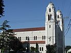
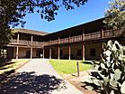
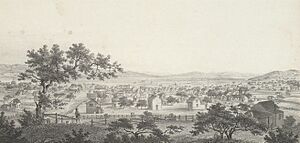
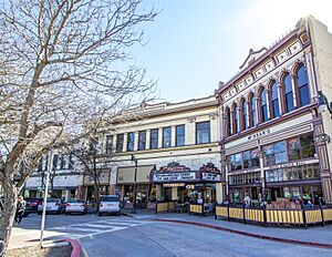
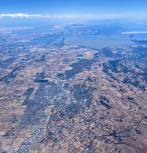
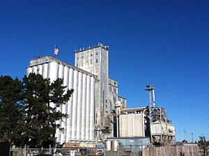
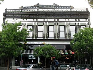
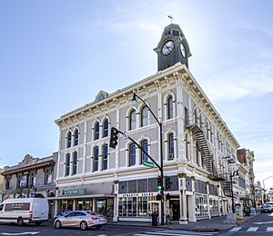
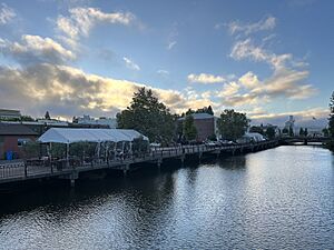
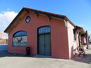
Clockwise from top left: St. Vincent de Paul Church; Rancho Petaluma, Petaluma Historic Commercial District; Petaluma Historical Library and Museum
|
||
|
||
| Etymology: Péta Lúuma, Coast Miwok for "Backside of the Hill" | ||
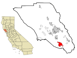
Location in Sonoma County and the state of California
|
||
| Country | United States | |
| State | California | |
| County | Sonoma | |
| Incorporated | April 12, 1858 | |
| Government | ||
| • Type | Council–manager | |
| Area | ||
| • Total | 14.52 sq mi (37.61 km2) | |
| • Land | 14.41 sq mi (37.34 km2) | |
| • Water | 0.11 sq mi (0.28 km2) 0.74% | |
| Elevation | 13 ft (4 m) | |
| Population
(2020)
|
||
| • Total | 59,776 | |
| • Density | 4,146.8/sq mi (1,601.1/km2) | |
| Time zone | UTC−8 (Pacific) | |
| • Summer (DST) | UTC−7 (PDT) | |
| ZIP code |
94952–94954
|
|
| Area code | 707 | |
| FIPS code | 06-56784 | |
| GNIS feature IDs | 277575, 2411407 | |
Petaluma is a city in Sonoma County, California, United States. It is located in the North Bay area of the San Francisco Bay Area. In 2020, its population was 59,776 people.
The city's name comes from the Miwok village called Péta Lúuma. This village was located on the banks of the Petaluma River. The name means "backside of the hill" or "sloping ridge." The modern city began with Rancho Petaluma. This land was given in 1834 to Mariano Guadalupe Vallejo, who is seen as the founder of Petaluma. Today, Petaluma is famous for its old, well-kept buildings. It is also a main center for the Petaluma Valley area in Sonoma County.
Contents
- Exploring Petaluma's Past: A Look at Its History
- Petaluma's Location and Natural Surroundings
- Who Lives in Petaluma? A Look at Its People
- Petaluma's Economy: Businesses and Jobs
- Arts and Culture in Petaluma
- Parks and Recreation: Enjoying Nature in Petaluma
- Education in Petaluma: Schools and Learning
- Infrastructure: Getting Around Petaluma
- Notable People from Petaluma
- See also
Exploring Petaluma's Past: A Look at Its History

The Coast Miwok people lived throughout Marin and southern Sonoma County. The village of Péta Lúuma was east of the Petaluma River. Other Coast Miwok villages were also nearby. These included Wotoki, Etem, Likatiut, Tuchayalin, Tulme, and Susuli.
The Petaluma area was part of a large Mexican land grant in 1834. Governor Jose Figueroa gave this land, called Rancho Petaluma, to Mariano Guadalupe Vallejo. In 1836, Vallejo built his Rancho Petaluma Adobe. This ranch house was often used as a summer home by his family. Vallejo's power in the region began to fade after his arrest during the Bear Flag Revolt in 1846.
Growth and Industry: Petaluma's Early Development
Many pioneers moved to Petaluma from the eastern United States. This happened after James Marshall discovered gold in the Sierra Nevada in 1848. The city's location on the Petaluma River was key to its growth. The river was in the middle of rich farmland.
During the California Gold Rush, boats like scows and steamers traveled the river. They carried farm products and raw materials between Petaluma and San Francisco. This helped San Francisco grow quickly.
Petaluma became known for its grain mills and chicken processing. These industries are still part of its economy today. At one time, Petaluma was called the "Egg Capital of the World." This led to nicknames like "Chickaluma." Petaluma even had the only known poultry drugstore. The coal lamp egg incubator was invented here by Lyman Byce in 1879.
One of the largest old chicken processing plants is still in the city center. This brick building from the 1930s is no longer used for chickens. However, it is being considered for preservation and new uses. Petaluma still has a strong farming base. It has dairy farms, olive groves, vineyards, and berry and vegetable farms.
Surviving Disasters: The 1906 Earthquake and City Renewal
Petaluma was mostly unharmed during the 1906 San Francisco earthquake on April 18, 1906. This was because the area has strong bedrock. Since few other communities were left standing, Petaluma became a center for rescue efforts in Sonoma County.
Many buildings from before 1906 and Victorian homes are still on the western side of the river. The downtown area has had many river floods over the years. During the Great Depression, businesses slowed down. There wasn't enough money to tear down old homes and buildings.
In the 1960s, people moved from San Francisco to nearby areas like Marin County. They were looking for cheaper homes and a less city-like environment. Old Victorian, Queen Anne, and Eastlake-style houses were fixed up. Historic iron-front buildings downtown were also saved. New roads, like Highway 101, helped direct traffic away from the old downtown.
Modern Planning and Innovation: Shaping Petaluma's Future
Petaluma was a leader in managing city growth. After Highway 101 became a freeway in 1955, building permits for homes tripled. To control this, the city created the "Petaluma Plan" in 1971. This plan limited new building permits to 500 per year for five years. The city also set up a "redbelt" around the town. This was a boundary to stop urban growth for a set number of years.
The goal of Petaluma's growth plan was to ensure organized growth. It also aimed to protect the city's small-town feel and green spaces. The plan wanted to offer different housing options. It also worked to keep enough water supply and sewage treatment.
This growth plan gained national attention in 1975. The Construction Industry Association took the city to court. However, the plan was upheld by the 9th Circuit Court in 1975. The Supreme Court also supported it in 1976. This court decision still guides many local growth rules in California.
In the late 1990s, Petaluma was known as Telecom Valley. Many telecom startup companies started there. Two successful companies were Advanced Fibre Communications (AFC) and Cerent. Some Cerent employees later bought the Phoenix Theater, a local entertainment spot.
In 2021, Petaluma set a goal to become carbon neutral by 2030. That year, the city banned building new gas stations. This made it the first city in the world to do so. The city also made it easier to build EV charging stations and possible hydrogen filling stations.
Petaluma's Location and Natural Surroundings
Petaluma covers a total area of about 14.5 square miles (37.6 square kilometers). Most of this is land, with a small part being water. It is located about 32 miles (51 kilometers) north of San Francisco.
The city is next to the communities of Penngrove to the north and Lakeville to the south.
Petaluma sits at the northern end of the Petaluma River. This river is a tidal estuary that flows south to San Pablo Bay. The city is partly in the river's flood plain. The river sometimes overflows its banks, especially in the Payran neighborhood.
Understanding Petaluma's Climate

Petaluma has a mild Mediterranean climate. This means it has warm, dry summers and cool, rainy winters. Summer mornings often start foggy and cool. However, the fog usually clears by midday, leading to clear, warm afternoons.
August is usually the warmest month. Temperatures often range from 53°F (12°C) at night to 82°F (28°C) during the day. December is usually the coldest month. Temperatures typically range from 39°F (4°C) at night to 57°F (14°C) during the day. Frost can happen on clear winter nights.
The highest temperature ever recorded in Petaluma was 111°F (44°C) on September 6, 2020. The lowest was 16°F (-9°C) in 1916 and 1932. Snow is rare in Petaluma. However, about 1.5 inches fell in January 1916, and about 3 inches fell in January 2002.
| Climate data for Petaluma, CA (1991–2020 normals, extremes 1913–present) | |||||||||||||
|---|---|---|---|---|---|---|---|---|---|---|---|---|---|
| Month | Jan | Feb | Mar | Apr | May | Jun | Jul | Aug | Sep | Oct | Nov | Dec | Year |
| Record high °F (°C) | 85 (29) |
86 (30) |
93 (34) |
97 (36) |
101 (38) |
110 (43) |
110 (43) |
105 (41) |
109 (43) |
106 (41) |
91 (33) |
81 (27) |
110 (43) |
| Mean maximum °F (°C) | 67.4 (19.7) |
72.0 (22.2) |
77.2 (25.1) |
88.5 (31.4) |
87.7 (30.9) |
95.6 (35.3) |
96.2 (35.7) |
96.2 (35.7) |
97.1 (36.2) |
90.4 (32.4) |
77.8 (25.4) |
66.8 (19.3) |
100.6 (38.1) |
| Mean daily maximum °F (°C) | 57.6 (14.2) |
61.3 (16.3) |
64.5 (18.1) |
67.8 (19.9) |
71.9 (22.2) |
78.1 (25.6) |
80.8 (27.1) |
81.2 (27.3) |
81.6 (27.6) |
76.4 (24.7) |
65.5 (18.6) |
57.9 (14.4) |
70.4 (21.3) |
| Daily mean °F (°C) | 48.3 (9.1) |
50.8 (10.4) |
53.2 (11.8) |
55.8 (13.2) |
59.6 (15.3) |
64.3 (17.9) |
66.6 (19.2) |
67.0 (19.4) |
66.5 (19.2) |
62.0 (16.7) |
53.9 (12.2) |
48.1 (8.9) |
58.0 (14.4) |
| Mean daily minimum °F (°C) | 39.0 (3.9) |
40.4 (4.7) |
41.9 (5.5) |
43.8 (6.6) |
47.4 (8.6) |
50.4 (10.2) |
52.4 (11.3) |
52.8 (11.6) |
51.4 (10.8) |
47.6 (8.7) |
42.3 (5.7) |
38.4 (3.6) |
45.7 (7.6) |
| Mean minimum °F (°C) | 28.1 (−2.2) |
30.6 (−0.8) |
33.4 (0.8) |
35.6 (2.0) |
40.6 (4.8) |
44.5 (6.9) |
47.2 (8.4) |
47.6 (8.7) |
44.7 (7.1) |
39.2 (4.0) |
31.4 (−0.3) |
27.4 (−2.6) |
25.6 (−3.6) |
| Record low °F (°C) | 18 (−8) |
18 (−8) |
24 (−4) |
26 (−3) |
27 (−3) |
32 (0) |
39 (4) |
39 (4) |
31 (−1) |
25 (−4) |
20 (−7) |
16 (−9) |
16 (−9) |
| Average precipitation inches (mm) | 4.77 (121) |
5.23 (133) |
3.32 (84) |
1.68 (43) |
0.93 (24) |
0.28 (7.1) |
0.01 (0.25) |
0.05 (1.3) |
0.09 (2.3) |
1.27 (32) |
2.74 (70) |
5.19 (132) |
25.56 (649) |
| Average precipitation days (≥ 0.01 in) | 12.0 | 10.4 | 9.9 | 6.4 | 3.7 | 1.3 | 0.1 | 0.3 | 1.0 | 3.7 | 8.0 | 12.1 | 68.9 |
Who Lives in Petaluma? A Look at Its People
| Historical population | |||
|---|---|---|---|
| Census | Pop. | %± | |
| 1880 | 3,326 | — | |
| 1890 | 3,692 | 11.0% | |
| 1900 | 3,871 | 4.8% | |
| 1910 | 5,880 | 51.9% | |
| 1920 | 6,226 | 5.9% | |
| 1930 | 8,245 | 32.4% | |
| 1940 | 8,034 | −2.6% | |
| 1950 | 10,315 | 28.4% | |
| 1960 | 14,035 | 36.1% | |
| 1970 | 24,870 | 77.2% | |
| 1980 | 33,834 | 36.0% | |
| 1990 | 43,184 | 27.6% | |
| 2000 | 54,548 | 26.3% | |
| 2010 | 57,941 | 6.2% | |
| 2020 | 59,776 | 3.2% | |
| U.S. Decennial Census | |||
| Racial and ethnic composition | 2000 | 2010 | 2020 |
|---|---|---|---|
| White (non-Hispanic) | 76.99% | 69.43% | 64.47% |
| Hispanic or Latino (of any race) | 14.64% | 21.49% | 22.76% |
| Two or more races (non-Hispanic) | 2.82% | 2.7% | 5.58% |
| Asian (non-Hispanic) | 3.83% | 4.4% | 4.7% |
| Black or African American (non-Hispanic) | 1.07% | 1.24% | 1.3% |
| Other (non-Hispanic) | 0.18% | 0.19% | 0.64% |
| Native American (non-Hispanic) | 0.32% | 0.34% | 0.3% |
| Pacific Islander (non-Hispanic) | 0.16% | 0.21% | 0.25% |
Petaluma's Population in 2020
The 2020 United States Census showed that Petaluma had 59,776 people. There were 22,756 households, with about 2.61 people living in each. The population density was about 4,147 people per square mile.
The main groups were White (75.9%) and Hispanic (21.6%). Other groups included Asians (4.2%), African Americans (1.3%), and Native Americans (0.8%). About 22% of households spoke a language other than English. Also, 14.9% of residents were born outside the U.S.
The population was almost equally split between females (50.1%) and males (49.9%). More than one-fifth (20.6%) of residents were under 18. About 18.7% were 65 or older. Most people (90.5%) had finished high school. About 40.3% had a college degree or higher.
The average household income was $100,379 in 2021. The average income per person was $50,664. The average rent was $2,144. The poverty rate in the city was 5.9%.
Petaluma's Population in 2010
In 2010, Petaluma had a population of 57,941. The population density was about 3,999 people per square mile. The racial makeup was mostly White (80.4%). Hispanic or Latino people made up 21.5% of the population.
Most people (98.8%) lived in households. There were 21,737 households. About 34.7% of these had children under 18. About 52.4% were married couples. The average household size was 2.63 people.
The population was spread out by age. About 23.2% were under 18. About 29.8% were aged 45 to 64. About 13.1% were 65 or older. The median age was 40.3 years.
Petaluma's Economy: Businesses and Jobs
Several well-known companies are based in Petaluma. These include Amy's Kitchen, Calix Inc., CamelBak, Clover Stornetta Farms, Lagunitas Brewing Company, and Petaluma Poultry. Companies like Mesa/Boogie and Enphase Energy also started here.
Major Employers in Petaluma
The city's 2021 financial report lists the top employers:
| # | Employer | # of Employees | % of Total City Employment |
|---|---|---|---|
| 1 | Petaluma School District | 789 | 2.49% |
| 2 | Petaluma Poultry Processors | 425 | 1.34% |
| 3 | Lagunitas Brewing Company | 399 | 1.26% |
| 4 | Petaluma Valley Hospital | 372 | 1.17% |
| 5 | City of Petaluma | 328 | 1.03% |
| 6 | Labcon, North America | 265 | 0.84% |
| 7 | Old Adobe Union School District | 260 | 0.82% |
| 8 | Clover Stornetta Farms | 181 | 0.57% |
| 9 | Hansel Auto | 162 | 0.51% |
| 10 | Sequoia Senior Solutions | 159 | 0.50% |
Military Presence in Petaluma
U.S. Coast Guard Training Center
The U.S. Coast Guard has a training center just outside Petaluma. It's called Training Center Petaluma. Here, the Coast Guard runs several schools. These schools train people for jobs like Electronics Technician, Culinary Specialist, and Information Systems Technician.
The Coast Guard also has its Chief Petty Officer Academy at this center. This academy trains senior non-commissioned officers for both the U.S. Coast Guard and the U.S. Air Force.
California National Guard Facility
The California National Guard also has an armed forces facility in Petaluma.
Arts and Culture in Petaluma
The Petaluma Arts Center is a place for art and creativity.
The city holds an annual Butter and Eggs Day Festival. This event celebrates Petaluma's history and culture.
The Cinnabar Theater is a professional non-profit theater. It is also home to the Young Repertory Theater, which helps young actors.
Parks and Recreation: Enjoying Nature in Petaluma
Just southwest of Petaluma is Helen Putnam Regional Park. This park has 216 acres (87 hectares) of trails. You can hike, bike, or ride horses there. It's named after former mayor Helen Putnam.
Near the city, on the side of Sonoma Mountain, is the Fairfield Osborn Preserve. This is a nature reserve with many different native plants and animals. To the southeast is Tolay Lake. This area was once a seasonal home for Miwok and Pomo tribes long ago.
Education in Petaluma: Schools and Learning
Petaluma has several elementary school districts. All of Petaluma is part of the Petaluma Joint Union High School District. The Petaluma City School District includes both elementary and high schools. Other elementary districts are Old Adobe Union, Wilmar Union, Cinnabar, and Waugh.
There are two main high schools in Petaluma: Petaluma High School and Casa Grande High School. Their sports teams are called the Trojans and Gauchos. Casa Grande High School has a strong Academic Decathlon team. The two public middle schools are Kenilworth Junior High School and Petaluma Junior High School.
St. Vincent de Paul High School is a private Catholic school in Petaluma. Its teams are known as the Mustangs. Santa Rosa Junior College has a second campus in Petaluma. Harvest Christian School is a private Christian school for grades TK-8.
Infrastructure: Getting Around Petaluma
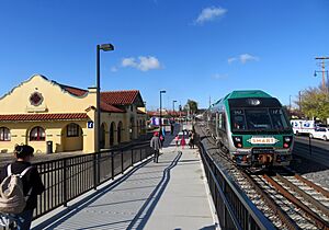
U.S. Highway 101 is the main freeway for the city. State Route 116 also runs through town as Lakeville Highway. Other important streets include East Washington Street and McDowell Boulevards.
Petaluma has bus services from Petaluma Transit, Golden Gate Transit, and Sonoma County Transit. The Sonoma–Marin Area Rail Transit (SMART) train started service in 2017. It stops at the Petaluma–Downtown station. A second station, Petaluma–North, is planned for the future.
The Amtrak Thruway 7 bus connects Petaluma to other cities daily. The closest major airports are San Francisco International Airport and Oakland International Airport. Buses connect Petaluma to these airports. For smaller planes, there is the Petaluma Municipal Airport.
Notable People from Petaluma
Many interesting people have connections to Petaluma.
Actors
- Winona Ryder (born 1971), actor; graduated from Petaluma High School
- Myron Healey (1923–2005), actor
- Lloyd Bridges (1913–1998), actor; graduated from Petaluma High School
Artists and Designers
- David Best (born 1945), sculptor, known for Burning Man creations
- Mark di Suvero (born 1933), sculptor
- Mary Fuller McChesney (1922–2022), sculptor
- Robert P. McChesney (1913–2008), painter
Musicians
- Sean Hayes (born 1969), singer and songwriter
- Em Rossi (born 1998), singer and songwriter
Sports Figures
- Bruce Bochte (born 1950), baseball player
- Steven Cozza (born 1985), professional road bicycle racer
- Jonny Gomes (born 1980), baseball player
- Spencer Torkelson (born 1999), baseball player
- Minna Stess (born 2006), Olympic skateboarder
Writers
- Pauline Kael (1919–2001), movie critic
- Karen Kilgariff (born 1970), comedian and writer
- Bill Pronzini (born 1943), mystery writer
Other Notable People
- Alex Consani (born 2003), model; first transgender person to be named Model of the Year at the annual Fashion Awards in London.
- Nicole Aunapu Mann (born 1977), USMC fighter pilot and NASA astronaut.
See also
 In Spanish: Petaluma para niños
 | Victor J. Glover |
 | Yvonne Cagle |
 | Jeanette Epps |
 | Bernard A. Harris Jr. |


