List of historic landmarks in Petaluma facts for kids
Petaluma is a city in California with many old and important buildings and places. These special spots are called Petaluma Historic Landmarks and Districts. The city decides which places are important enough to be called landmarks. They look at how old the place is, its history, and if it's special to the community.
When a place becomes a landmark, it means it's protected. You can't just tear it down or change it a lot without getting permission first. This helps keep the city's history alive! Some places are so important that the whole country recognizes them, like those on the National Register of Historic Places. Petaluma automatically makes these national sites local landmarks too.
Petaluma's Historic Districts
A historic district is like a neighborhood where many buildings together have a special history. These areas are protected to keep their unique look and feel.
The Petaluma Historic Commercial District is one such area. It was added to the National Register of Historic Places in 1995. This means it's recognized as important across the country. The city also has rules to help keep the buildings in this district looking their best.
Petaluma has also named at least two other historic districts:
- The A Street Historic District, created in 1986.
- The Oakhill-Brewster Historic District, created in 1990.
Petaluma Historic Landmarks
Here are some of the special historic landmarks in Petaluma. These places are important parts of the city's past.
| Number | Landmark Name | Location | Notes | Image |
|---|---|---|---|---|
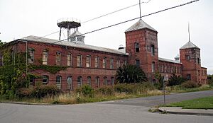
| 16 | Petaluma Silk Mill | 450 Jefferson Street 38°14′10″N 122°37′51″W / 38.236107°N 122.63090°W |
This building was designed by a famous architect named Brainerd Jones. It's also on the National Register of Historic Places. | |
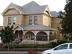
| 17 | Philip Sweed House | 301 Keokuk Street 38°14′10″N 122°38′46″W / 38.236242°N 122.64623°W |
This house is a historic landmark. | |
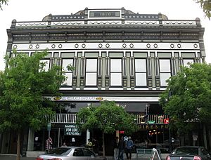
| 18 | Petaluma Historic Commercial District | Petaluma Blvd.: B St. to Prospect St., about 23 acres 38°14′07″N 122°38′27″W / 38.235238°N 122.64096°W |
This whole area is a historic district. It's also listed on the National Register of Historic Places. | |
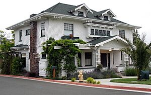
| 19 | Ellis-Martin House | 1197 East Washington Street 38°14′43″N 122°37′49″W / 38.245140°N 122.63015°W |
This beautiful house is a historic landmark. It's also on the National Register of Historic Places. | |
| 20 | Old Petaluma Opera House/The Maclay Building | 147-149 Kentucky Street 38°14′06″N 122°38′31″W / 38.234909°N 122.64199°W |
This building used to be an opera house. It's also on the National Register of Historic Places. | |
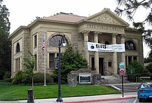
| 21 | Free Public Library of Petaluma | 20 4th Street 38°13′57″N 122°38′24″W / 38.232558°N 122.64002°W |
This old library building is a historic landmark. It's also on the National Register of Historic Places. | |
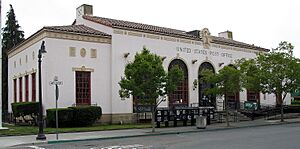
| 22 | U.S. Post Office | 120 4th Street 38°13′54″N 122°38′16″W / 38.231767°N 122.63773°W |
This post office building is a historic landmark. It's also on the National Register of Historic Places. |
Here are some other important landmarks in Petaluma:
- Residence (119 Howard Street)
- Farrell House/River Café Building (222 Weller Street)
- Green Mill Sign (Hwy 101 near Holm Road)
- Coca-Cola Sign (Western Ave. & Kentucky St.)
- Andresen Building (19 Western Ave.)
- WCTU Drinking Fountain (Western Ave. & Petaluma Ave. N)
- Great Petaluma Mill (6-8 Petaluma Blvd.)
- Old Post Office Building (10-22 Petaluma Blvd.)
- McNear Building (15-25 Petaluma Blvd.)
- Koby Residence + Carriage House (901 D St.)
- Hansen House (719 North McDowell Blvd)
- Residence (200 West Street)
- Quinn Residence (503 2nd Street)
- Burdell Building (405 East D Street)
- Lee Residence (206 E Street)
See also


