List of historic places in Kings County, New Brunswick facts for kids
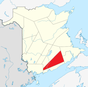
Kings County in New Brunswick, Canada, is full of amazing old buildings and special places that tell stories about the past! These places are called historic places, and they are important because they help us learn about how people lived long ago and what events shaped our communities.
This article lists many of these cool historic spots in Kings County. They are officially recognized on the Canadian Register of Historic Places, which means they are protected and celebrated for their history. Some are important to the whole country (federal), some to the province (provincial), and some are special to their local towns (municipal). Let's explore some of them!
Contents
Historic Places in Kings County
Kings County has many towns and villages, and each one has its own unique history. Here are some of the historic places you can find in different communities across the county.
Grand Bay-Westfield
Grand Bay-Westfield is a town with a rich history, especially along the Saint John River.
- Alwington Manor (15 Station Road): A historic home that shows us how people lived in the past.
- Anglican Church of the Resurrection (20 MacDonald Avenue): A church that has been a part of the community for many years.
- Black Loyalist Land Grants (Douglas Street): This area marks where Black Loyalists, who were formerly enslaved people, were given land after the American Revolution. It's a very important site for understanding their history in Canada.
- 9 Brittain Road: Another historic home in the area.
- George W. Crawford House (2 Brundage Point Road): A significant old house.
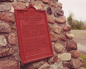
- Fort Nerepis National Historic Site of Canada (Woodman's Point Road): This was an important fort long ago, playing a role in early Canadian history. It's a national historic site, meaning it's important to all of Canada!
- Kirtley-Hayter Homestead (171 Woolastook Drive): An old family farm that tells a story of early settlers.
- Lingley Family Homestead (2 Mallard Drive): Another historic family home.
- Mount Hope Cemetery (700 Nerepis Road): An old cemetery where many early residents are buried.
- Mount Hope Farm (690 Nerepis Road): A historic farm property.
- Nase Cemetery (Next to 273 Nerepis Road): Another old cemetery.
- Nerepis School Site (670 Nerepis Road): The location of an old school, showing how education has changed.
- Old Portage Trail (633 Nerepis Road): This trail was likely used by Indigenous peoples and early settlers for travel.
- Pamdenec Summer Community (Pamdenec Road): An area known for its historic summer homes.
- Porter House (156 Nerepis Road): A historic house in the community.
- 192 River Valley Drive and 241 River Valley Drive: Historic homes along the river.
- St. Augustine's Roman Catholic Church (279 Nerepis Road): A beautiful old church.
- St. James Anglican Cemetery (Nerepis Road): A historic church cemetery.
- Sand Point Lighthouse (Sand Point Wharf Road): A lighthouse that helped guide ships on the river. It's a national historic site.
- Stevens Family Cemetery (Brandy Crescent): A family burial ground.
- Stevens Homestead (268 Woolastook Drive): An old family homestead.
- Westfield Beach: A historic recreational area.
- Westfield Golf and Country Club (8 Golf Club Road): An old golf course with a long history.
- Westfield United Church (268 Woolastook Drive): A historic church building.
- Westfield Wharf Site: The location of an old wharf, important for transportation and trade.
- Wolastoq National Historic Site of Canada (Entire watershed of Saint John River): This huge area recognizes the importance of the Saint John River to the Wolastoqiyik (Maliseet) people. It's a very significant national historic site.
Hampton
Hampton is the shire town of Kings County, meaning it's where the county government is located.
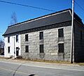
- Hampton Gaol (Jail) (17 Centennial Rd.): This old jail is a provincial historic site, showing what prisons were like in the past.
- Kings County Court House (648 Main Street): The historic courthouse, where important legal decisions were made. It's a provincial historic site.
Kingston
Kingston is a charming community with deep historical roots.
- Kingston Historic District (Crossroads of Routes 845 and 850): This whole area is recognized for its collection of historic buildings and its overall historical feel. It's a provincial historic site.
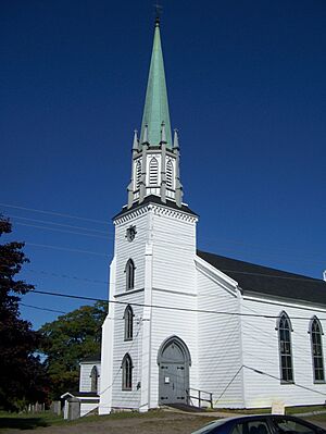
- Trinity Church and Rectory National Historic Site of Canada: This church and its rectory (the minister's house) are very old and important, recognized as a national historic site.
Quispamsis
Quispamsis is a growing town with some important historic landmarks.
- St. Luke's Anglican Church National Historic Site of Canada (12 Quispamsis Road): This church is a national historic site, showing its importance to Canadian history.
- Stoneycroft (255 Hampton Road): A historic property in Quispamsis.
Rothesay
Rothesay is known for its beautiful homes and connection to the Kennebecasis River.
- Belleview Hotel (15 Station Road): An old hotel that was likely a popular spot in its day.
- Brenan House (3189 Rothesay Road): A historic house.
- Brock House (10 Maiden Lane): Another historic home.
- 8 Church Avenue: A historic building on Church Avenue.
- Cleasby (4 Allison Drive): A historic property.
- Crosby House (3197 Rothesay Road): A historic house.
- Duart Hall (19 Station Road): A historic building.
- Firshade (3000 Rothesay Road): A historic property.
- 42 Gondola Point Road: A historic address.
- 18 Hampton Road: A historic building.
- Kennebecasis Rowing Sculpture (Rothesay Road): While a sculpture, its location and connection to the Kennebecasis River's history of rowing make it a recognized site.
- Lewin House (25 Gondola Point Road): A historic house.
- McKnight House (155 Green Road): A historic home.
- Old Crosby House (28 Gondola Point Road): Another historic Crosby family home.
- Old Medical Clinic (12 Gondola Point Road): This building once served as a medical clinic.
- Our Lady of Perpetual Help Catholic Church (33 Gondola Point Road): A historic church.
- Purd's (64 Gondola Point Road): A historic property.
- Rothesay Common (bordered by Gondola Point Road, Old Hampton Road, and Church Avenue): This common area has been a central gathering place for the community for a long time.
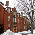
- Rothesay Netherwood School (40 College Hill Road): A historic school with a long educational past.
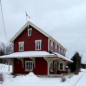
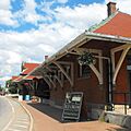
- Rothesay Railway Station (European and North American) National Historic Site of Canada (near Rothesay Road and Tennis Court Road): This old train station is a national historic site, showing the importance of railways in connecting communities.
- 3218 Rothesay Road: A historic property.
- Saint David's United Church (7 Gondola Point Road): A historic church building.
- Saint Paul's Anglican Church (6 Church Avenue): A historic church.
- Satalic House (11 Station Road): A historic house.
- Shadow Lawn (3180 Rothesay Road): A historic property.
- 3 Station Road: A historic building.
- Strathnaver (3105 Rothesay Road): A historic property.
Sussex
Sussex is a vibrant town with many historic buildings, especially in its downtown area.
- Arnold House (811 Main Street): A historic house.
- Black-Palmer Residence (65 Church Avenue): A historic home.
- Brooks Residence (148 Maple Avenue): A historic house.
- Church Avenue Fountain (135 Church Avenue): A historic fountain that has been a landmark in the town.
- Depot Hotel (1 Queen Street): An old hotel.
- Diadema White House (177 Church Avenue): A historic house.
- Dominion Building (524 Main Street): A historic commercial building.
- Fairweather Residence (170 Church Avenue): A historic house.
- Forbes Residence (60 Essex Street): A historic home.
- Gunn House (201 St George Street): A historic house.
- Intercolonial Railway Station (Broad Street): This old train station is a federal historic site, showing the importance of railways in connecting communities.
- Jonah Residence (977 Main Street): A historic house.
- Kirkhill Cemetery (Duke Street): A historic cemetery.
- Old MacDougall Residence (197 Church Avenue): A historic house.
- Sharp's Corner Drug Store (3 Broad Street): An old drug store that was an important part of the town's commerce.
- Slipp/Deichmann/Wallace Residence (34 Sunnyside Drive): A historic home.
- Squarebriggs Residence (2 Paradise Row): A historic house.
- Sussex Ginger Ale Factory (67 Pleasant Avenue): This factory is a historic site, showing the industrial past of Sussex.
- Sutherland Residence (387 Main Street): A historic house.
- Trinity Anglican Church (853 Main Street): A historic church.
- Wallace Twins Houses (376 and 380 Main Street): Two historic houses.
- Williamson Residence (371 Main Street): A historic house.
Images for kids
See also
 | Valerie Thomas |
 | Frederick McKinley Jones |
 | George Edward Alcorn Jr. |
 | Thomas Mensah |


