Carroll County, Arkansas, is home to at least 10 named lakes and reservoirs. While the United States Geological Survey says there are no natural named lakes here, the county has many important reservoirs. These are man-made lakes that are very useful for people and wildlife.
What's the Difference: Lakes and Reservoirs?
A lake is usually a natural body of water. It forms when water collects in a low area of land. A reservoir, on the other hand, is a man-made lake. It is created by building a dam across a river or stream. Reservoirs are built for many reasons. They can store drinking water, help control floods, or create electricity. They are also great places for fishing, boating, and other fun outdoor activities.
Important Reservoirs in Carroll County
Most of the large bodies of water you'll find in Carroll County are reservoirs. They are important for water supply, recreation, and supporting local ecosystems. Here are some of the main reservoirs in the county:

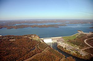
Although Table Rock Dam is actually in
Missouri,
Table Rock Lake extends into three Arkansas counties as well, including Carroll County.
- Beaver Lake, 36°14′08″N 093°56′34″W / 36.23556°N 93.94278°W / 36.23556; -93.94278 (Beaver Lake), sits at about 1,122 feet (342 m) above sea level. It is a very popular spot for fishing and boating.
- Brewer Lake, 36°09′06″N 093°19′43″W / 36.15167°N 93.32861°W / 36.15167; -93.32861 (Brewer Lake), is located at an elevation of about 2,116 feet (645 m).
- Eureka Springs City Lake, 36°23′34″N 093°44′49″W / 36.39278°N 93.74694°W / 36.39278; -93.74694 (Eureka Springs City Lake), is near the town of Eureka Springs. Its elevation is around 1,227 feet (374 m).
- Farwell Spider Creek Lake, 36°26′25″N 093°50′48″W / 36.44028°N 93.84667°W / 36.44028; -93.84667 (Farwell Spider Creek Lake), is at about 955 feet (291 m) high.
- Fuller Lake, 36°26′21″N 093°35′37″W / 36.43917°N 93.59361°W / 36.43917; -93.59361 (Fuller Lake), has an elevation of about 974 feet (297 m).
- Jackson Lake, 36°17′36″N 093°30′49″W / 36.29333°N 93.51361°W / 36.29333; -93.51361 (Jackson Lake), is found at an elevation of about 1,283 feet (391 m).
- Lake Lucerene, 36°22′24″N 093°42′31″W / 36.37333°N 93.70861°W / 36.37333; -93.70861 (Lake Lucerene), sits at about 1,411 feet (430 m) above sea level.
- Lake of No Return, 36°11′24″N 093°22′31″W / 36.19000°N 93.37528°W / 36.19000; -93.37528 (Lake of No Return), is at an elevation of about 1,565 feet (477 m).
- Leatherwood Lake, 36°26′42″N 093°45′01″W / 36.44500°N 93.75028°W / 36.44500; -93.75028 (Leatherwood Lake), is at about 1,030 feet (310 m) high.
- Table Rock Lake, 36°35′44″N 093°18′39″W / 36.59556°N 93.31083°W / 36.59556; -93.31083 (Table Rock Lake), is a very large reservoir. While its dam is in Missouri, a big part of the lake reaches into Carroll County, Arkansas. It is at an elevation of about 791 feet (241 m).
See also


