List of lakes of Clark County, Arkansas facts for kids
There are at least 15 named lakes and reservoirs in Clark County, Arkansas. These bodies of water are important for many reasons, from providing homes for wildlife to offering fun places for people to visit.
Contents
Lakes and Reservoirs in Clark County
Clark County, Arkansas, is home to many beautiful bodies of water. Some are natural lakes, formed over a long time by nature. Others are reservoirs, which are like man-made lakes created by building dams across rivers.
What's the Difference?
A lake is usually a natural body of water, often fed by rivers or streams, or by rainfall. They have been around for a very long time. A reservoir, on the other hand, is a large, artificial lake. People build dams to create reservoirs. These are often made to store water for drinking, to control floods, or to generate electricity.
Natural Lakes
Clark County has several natural lakes. These lakes are part of the natural landscape and offer peaceful spots for nature and recreation. For example, Barton Lake and Salt Lake are natural lakes in the county. The "el." you see next to their names means elevation, which tells you how high above sea level the lake is.
- Barton Lake, 33°47′12″N 092°59′53″W / 33.78667°N 92.99806°W, el. 135 feet (41 m)
- Deceiper Lake, 34°01′48″N 093°01′47″W / 34.03000°N 93.02972°W, el. 171 feet (52 m)
- Horn Lake, 33°48′01″N 093°03′29″W / 33.80028°N 93.05806°W, el. 148 feet (45 m)
- Nowlin Pond, 34°06′49″N 093°02′51″W / 34.11361°N 93.04750°W, el. 174 feet (53 m)
- Salt Lake, 33°47′44″N 093°00′26″W / 33.79556°N 93.00722°W, el. 135 feet (41 m)
Man-Made Reservoirs
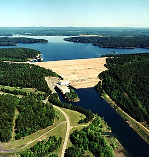
Many of the larger bodies of water in Clark County are reservoirs. These were built for specific purposes, like providing water for towns or controlling river flow. One of the most well-known is De Gray Lake. It's a very popular spot for outdoor activities and even has a state park, DeGray Lake Resort State Park, right on its shores!
- Boswell Lake, 34°02′42″N 093°17′03″W / 34.04500°N 93.28417°W, el. 253 feet (77 m)
- Country Club Lake, 34°08′54″N 093°05′20″W / 34.14833°N 93.08889°W, el. 246 feet (75 m)
- De Gray Lake, 34°15′07″N 093°11′57″W / 34.25194°N 93.19917°W, el. 400 feet (120 m)
- Degray Reregulating Lake, 34°10′42″N 093°06′01″W / 34.17833°N 93.10028°W, el. 213 feet (65 m)
- Dwiggins Lake, 34°14′01″N 093°25′07″W / 34.23361°N 93.41861°W, el. 489 feet (149 m)
- Gross Lake, 34°38′54″N 093°05′31″W / 34.64833°N 93.09194°W, el. 771 feet (235 m)
- Gurdon Pond One, 33°54′44″N 093°10′15″W / 33.91222°N 93.17083°W, el. 220 feet (67 m)
- Gurdon Pond Two, 33°54′18″N 093°09′55″W / 33.90500°N 93.16528°W, el. 217 feet (66 m)
- Kirksey Reservoir, 34°15′12″N 093°26′25″W / 34.25333°N 93.44028°W, el. 505 feet (154 m)
- Lake Barksdale, 34°14′05″N 093°22′00″W / 34.23472°N 93.36667°W, el. 561 feet (171 m)
Why are These Waters Important?
These lakes and reservoirs are vital for Clark County. They provide drinking water, help manage floods, and support local wildlife. They also offer many recreational activities like fishing, boating, and swimming, making them popular places for families and friends to enjoy the outdoors.
See also
 | Selma Burke |
 | Pauline Powell Burns |
 | Frederick J. Brown |
 | Robert Blackburn |


