List of national monuments in County Westmeath facts for kids
The Irish state has a special list of places and buildings that are super important to the country's history. These are called "national monuments." If a place is on this list, it means it's really special and needs to be protected so everyone can enjoy it for a long time. Sometimes, even the land around the monument is protected to keep it safe.
Contents
Discover Westmeath's National Monuments
Westmeath is a county in Ireland with many amazing national monuments. Let's explore some of these cool historical sites!
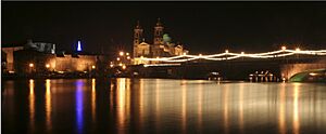
Athlone Castle
Athlone Castle is a big, strong castle located right in the town of Athlone. Castles like this were built a long time ago to protect people and important areas. This castle has stood for centuries, watching over the River Shannon. It's a great place to learn about medieval times in Ireland.
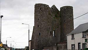
Delvin Castle
Near the village of Delvin, you'll find the remains of Delvin Castle. This was another important castle in Westmeath's past. Castles often changed hands between different powerful families throughout history. Delvin Castle reminds us of those ancient times.
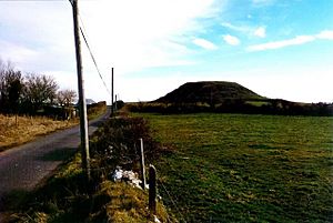
Dunnamona Motte
At Dunnamona, there's a "motte." A motte is a large, raised earth mound. In the past, a wooden or stone castle would have been built on top of it. This gave the people inside a good view and made it harder for enemies to attack. It's a sign of early castle building in Ireland.
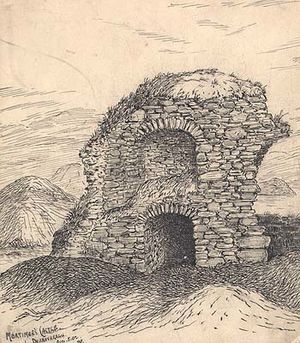
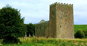
Mortimer's Castle
Mortimer's Castle is another castle ruin found in Faughalstown. Like many old castles, it tells a story of knights, battles, and important families who lived there centuries ago. Even though it's a ruin, it helps us imagine what life was like back then.
Fore Town Gates
In the historic village of Fore, you can see the remains of the old town gates. These gates were once part of the defenses that protected the town. They show how important it was to keep towns safe from invaders in medieval times.
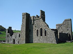
Fore Abbey
Also in Fore is the amazing Fore Abbey. This was a Benedictine monastery, a place where monks lived, prayed, and studied. It also includes a hermitage, a quiet place for a hermit. Abbeys like Fore were centers of learning and religion many centuries ago.
Taghmon Church
Taghmon Church is an old church located in Glebe. Churches have always been important places for communities. This church has stood for a very long time, witnessing many changes in the area. It's a reminder of the religious history of Westmeath.
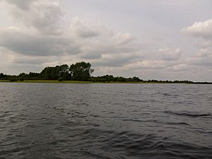
Inchbofin Ecclesiastical Site
Inchbofin is an island in Lough Ree with an Early Medieval Ecclesiastical Site. This means it was an important religious place way back in the early Middle Ages. Monks often chose islands for their quiet and peaceful locations. It's a fascinating look into Ireland's early Christian history.
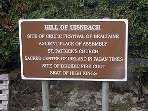
Hill of Uisneach, Catstone
The Hill of Uisneach is a very special place in Ushnagh Hill. It has a ringfort, a barrow, and a stone known as the Catstone. A ringfort is an ancient circular enclosure, often used as a farm or home. A barrow is a burial mound. The Hill of Uisneach was a hugely important ancient meeting place and spiritual center for all of Ireland.
Portlick Motte
Another motte can be found at Portlick. Like the one at Dunnamona, this was a raised mound where a castle or fort would have been built. These mottes are important clues about how people defended themselves and lived in medieval Ireland.
Raharney Ringfort
At Raharney, there's a ringfort. Ringforts are one of the most common types of ancient sites in Ireland. They were usually farmsteads or homes, protected by a circular bank and ditch. They show us how people lived and farmed thousands of years ago.
Bealin High Cross
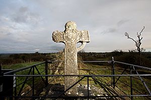
The Bealin High Cross is a tall, stone cross found in Twyford. High crosses are famous Irish artworks from early Christian times. They are often covered in beautiful carvings that tell stories from the Bible or show ancient patterns. The Bealin High Cross is a wonderful example of this ancient art.
Wattstown Barrows
In Wattstown, there are two barrows, also known as tumuli. These are ancient burial mounds. They were built to bury important people long, long ago. Discovering barrows helps archaeologists learn about the burial customs and beliefs of people from the past.
More Information
- National Monuments in County Westmeath
 | John T. Biggers |
 | Thomas Blackshear |
 | Mark Bradford |
 | Beverly Buchanan |


