Inchbofin facts for kids
|
[name]:
Inis Bó Finne
|
|
|---|---|
 |
|
| Geography | |
| Location | River Shannon |
| Coordinates | 53°32′17″N 7°55′12″W / 53.538°N 7.92°W |
| Area | 0.266 km2 (0.103 sq mi) |
| Highest elevation | 41 m (135 ft) |
| Administration | |
| Province | Leinster |
| County | Westmeath |
| Demographics | |
| Population | 0 (2018) |
| Ethnic groups | Irish |
| Inis Bó Finne | |
| Monastery information | |
|---|---|
| Other names | Innisbofin Insula Vaccae Albae |
| Order | Canons Regular of Saint Augustine |
| Established | 530 |
| Disestablished | 1540 |
| Diocese | Meath |
| People | |
| Founder(s) | Ríoch |
| Architecture | |
| Status | Inactive |
| Heritage designation | |
| Official name | Inchbofin |
| Reference no. | 213 |
| Style | Romanesque |
| Site | |
| Location | Lough Ree, County Westmeath |
| Visible remains | two churches |
| Public access | no |
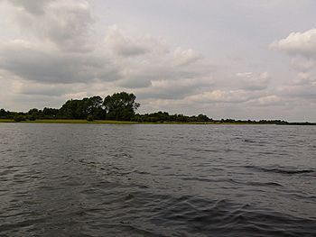
Inchbofin (which means "Island of the White Cow" in Irish) is a small island located in Lough Ree. This large lake is part of the River Shannon in the middle of Ireland. Even though it's small, this island has a long and interesting history, especially with an ancient monastery.
Contents
Exploring Inchbofin
Inchbofin is about 26.6 hectares in size. That's like 266,000 square meters! It sits in the eastern part of Lough Ree. The closest village on the mainland is Tang in County Westmeath.
A Look at Inchbofin's Past
Early History and the Monastery
A Christian monastery was founded on Inchbofin around the year 530 AD. It was started by a person known as Saint Ríoch. The island's name, Inis Bó Finne, means "Island of the white or fair cow" in Irish. This is why it can sometimes be confused with other islands that have the same name, like Inishbofin, County Galway or Inishbofin, County Donegal. Sometimes, the Latin names Īnsula Vaccae Albae or Īnsula Vitulae Albae were also used, which also mean "Island of the White Cow." The monastery was run by a group called the Canons Regular of Saint Augustine.
Life on the Island
In 1837, a book called the Topographical Dictionary of Ireland mentioned Inchbofin. It said that out of the island's 64 acres, about 27 acres were good for farming. Later, in the mid-1800s, records show three families living there: Skelly, Connell, and Heffernan. The island was owned by Susan Galbraith at that time. By 1911, the census showed 13 people still living on the island, belonging to those same three families.
The Last Resident
In the winter of 2009, Lough Ree froze completely solid. This made it impossible for the last farmer on the island, John Connell, to get supplies for his cattle. The Irish Air Corps had to send a helicopter to deliver food for his animals! John Connell was the very last person to live permanently on Inchbofin. He passed away on February 12, 2018.
Ancient Buildings on the Island
Today, you can still see the remains of two old churches on Inchbofin.
- One church, built in the 12th century, is located at the north-eastern tip of the island. It has an unusual shape and includes a main hall (called a nave), a cross-shaped section (a transept), and a small room for church items (a sacristy).
- Inside, to the north of where the altar would have been, there's a beautiful Romanesque window. Above this window, you can see a carving of a bishop's head.
- The second church ruin is smaller and is found to the south. It was built a bit later, between the 12th and 13th centuries.
 | John T. Biggers |
 | Thomas Blackshear |
 | Mark Bradford |
 | Beverly Buchanan |


