List of places on the Victorian Heritage Register in Bass Coast Shire facts for kids
The Victorian Heritage Register is a special list of important places in Victoria, Australia. It's like a hall of fame for buildings, sites, and objects that tell us about Victoria's history. The Heritage Council of Victoria looks after this list. This article tells you about the places in the Bass Coast Shire that are on this important register. As of 2021, seven places in the Bass Coast Shire are listed.
Contents
Historic Places in Bass Coast Shire
Churchill Island: A Historic Farm
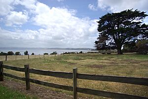
Churchill Island is located in Westernport Bay. It was one of the first farms in Victoria, starting way back in the 1860s. This island is important because it shows us how farming began in the area. It became a state-registered heritage site on August 20, 1982.
Wollamai House: An Old Home
Wollamai House is a historic home found at 7 Cleeland Road in Cape Woolamai. It was built in 1876. This house gives us a peek into what homes were like in the late 1800s. It was added to the heritage register on September 16, 1987.
Wonthaggi Court House: Where Justice Was Served
The Wonthaggi Court House is located at 75 Watt Street in Wonthaggi. It was built in 1856. This building was once a busy place where legal cases were heard and justice was carried out. It became a heritage site on August 5, 1993.
Wonthaggi Railway Station: A Stop in Time
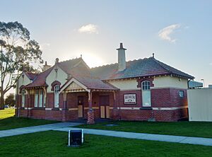
The Wonthaggi railway station is at 8-12 Murray Street in Wonthaggi. It was built in 1912. This station was a key part of the town's history, especially for the coal mining industry. It helped transport coal and people. It was added to the register on August 20, 1982. Today, it serves as a museum.
Wonthaggi State Coal Mine: A Look into the Past
The State Coal Mine in Wonthaggi was a very important part of Victoria's history. It provided coal for many years, helping to power the state. The mine is divided into different areas, called precincts, that are all heritage-listed.
Eastern Precinct
The Eastern Precinct of the Wonthaggi State Coal Mine is on State Coal Mine Access Road in Wonthaggi. This part of the mine was developed around 1919. It shows how coal mining changed over time. It was registered on December 14, 2006.
Central Precinct
The Central Precinct is on Graham Street in Wonthaggi. This area started operating in 1909. It was a central hub for the mining operations. It became a heritage site on February 25, 1999.
Northern Precinct (19 and 20 Shafts)
The Northern Precinct, including the 19 and 20 Shafts, is on Bass Highway in Dalyston. This part of the mine also began in 1909. These shafts were important entry points for miners. It was added to the register on February 18, 1999.


