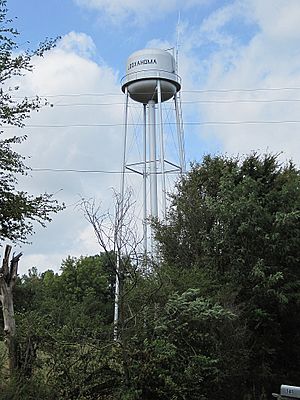
Looxahoma, Mississippi facts for kids
Quick facts for kids
Looxahoma, Mississippi
|
|
|---|---|
 |
|
| Country | United States |
| State | Mississippi |
| County | Tate |
| Elevation | 381 ft (116 m) |
| Time zone | UTC-6 (Central (CST)) |
| • Summer (DST) | UTC-5 (CDT) |
| ZIP code |
38668
|
| Area code(s) | 662 |
| GNIS feature ID | 672865 |
Looxahoma is a small, quiet community in Tate County, Mississippi, United States. It is known as an "unincorporated community." This means it's a place where people live, but it doesn't have its own city government. Instead, the county government handles most of its services.
What's in a Name?
The name Looxahoma is quite special! It comes from the Chickasaw language. The Chickasaw people are a Native American tribe who lived in this area long ago. In their language, "Looxahoma" means "red turtle." Isn't that interesting?
Where is Looxahoma?
Looxahoma is located in the northern part of Mississippi. It's about 8 miles (13 kilometers) east of a town called Senatobia. It's also about 8 miles (13 kilometers) west of another community named Tyro. You can find it close to Mississippi Highway 4.
 | Jewel Prestage |
 | Ella Baker |
 | Fannie Lou Hamer |


