Lorin District, Berkeley, California facts for kids
Quick facts for kids
Lorin
|
|
|---|---|
|
Neighborhood of Berkeley
|
|
| Country | United States |
| State | California |
| County | Alameda |
| City | Berkeley |
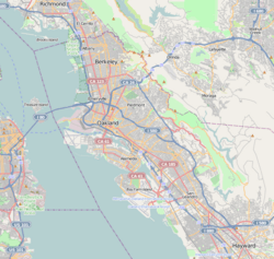
The Lorin District (also known as the Lorin Streetcar District) is a neighborhood in the southern part of Berkeley, California. Today, people often call this area "South Berkeley". It is located between Ashby Avenue to the north and 62nd Street to the south. Adeline Street and Martin Luther King Jr. Way are to the east, and Sacramento Street is to the west.
Contents
A Look Back at Lorin's History
Early Days and Native People
Long ago, the land where Lorin is now was home to the Ohlone Native Americans. They lived there for many years. In the 1700s, Spanish settlers arrived and took over the land. This caused the Ohlone people to be forced from their homes.
Lorin as a Train Stop
Lorin started as a small settlement. It was an important stop on the Berkeley Branch Railroad line. This train line was first run by the Central Pacific Railroad. Later, it became part of the Southern Pacific Railroad. There was a train station at Adeline and Alcatraz streets.
Joining the City of Berkeley
In 1892, the people living in Lorin made a big decision. They voted to become part of the larger City of Berkeley. This meant Lorin was no longer a separate town.
Changes in Population
In the early 1900s, many Japanese immigrant families lived in the Lorin District. However, during World War II, many of these residents were forced to leave their homes. They were sent to special camps far away. This was a difficult time for them.
After this, many African American families moved to the district. They came from the American South during a time called the Second Great Migration. They were looking for new opportunities and a better life.
Challenges for the Community
In the 1930s, the Lorin District faced a challenge called "redlining." This was a government policy that made it hard for people in certain areas to get loans for homes or businesses. Because of this, the Lorin area did not get as much money for improvements. This led to less development for many years.
Lorin in Books and Stories
The Lorin District has even appeared in books! It is the setting for a scene in The Octopus, a book written in 1903 by Frank Norris. He was a student at the University of California.
 | Anna J. Cooper |
 | Mary McLeod Bethune |
 | Lillie Mae Bradford |


