Los Algarrobos, Veraguas facts for kids
Quick facts for kids
Los Algarrobos
|
|
|---|---|
|
Corregimiento
|
|
| Country | |
| Province | Veraguas |
| District | Santiago |
| Established | July 29, 1998 |
| Area | |
| • Land | 63.4 km2 (24.5 sq mi) |
| Population
(2010)
|
|
| • Total | 5,490 |
| • Density | 86.6/km2 (224/sq mi) |
| Population density calculated based on land area. | |
| Time zone | UTC−5 (EST) |
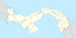
Los Algarrobos is a special kind of local area called a corregimiento in Panama. It's located in the Santiago District, which is part of the Veraguas Province. In 2010, about 5,490 people lived there.
Los Algarrobos became a corregimiento on July 29, 1998. This happened because a new law, Law 58, was created. It replaced an older law from 1982 that was found to be unconstitutional, meaning it didn't follow the country's main rules. Back in 2000, the population of Los Algarrobos was 4,623 people.
Contents
What is a Corregimiento?
A corregimiento is like a small local government area in Panama. It's a bit like a town or a small county. Each corregimiento has its own local leader and helps manage local services.
How Corregimientos Work
Panama is divided into provinces, then districts, and then corregimientos. This system helps organize the country and its communities. It makes sure that local needs are met and that people have a say in their local government.
History of Los Algarrobos
Los Algarrobos was officially established as a corregimiento on July 29, 1998. This was an important step for the community.
The Law That Created It
Before 1998, there was an older law from 1982 that organized these areas. However, this old law was later declared "unconstitutional." This means that parts of it didn't fit with Panama's main laws or constitution. So, a new law, Law 58, was passed to fix this. Law 58 officially created Los Algarrobos as its own corregimiento.
Geography and Location
Los Algarrobos is located in the Veraguas Province of Panama. Its exact coordinates are 8.1167 degrees North and 81.0167 degrees West.
Area and Size
The land area of Los Algarrobos is about 63.4 square kilometers (or about 24.5 square miles). This gives you an idea of how big the area is.
Population Density
In 2010, with a population of 5,490 people living in 63.4 square kilometers, the population density was about 86.6 people per square kilometer. This tells us how many people live in each square kilometer of land.
Population Information
The number of people living in Los Algarrobos has changed over time.
Population Growth
In 2000, the population was 4,623 people. By 2010, it had grown to 5,490 people. This shows that more people moved to or were born in Los Algarrobos during that decade.
See also
 In Spanish: Los Algarrobos (Veraguas) para niños
 | Emma Amos |
 | Edward Mitchell Bannister |
 | Larry D. Alexander |
 | Ernie Barnes |


