Luba, Equatorial Guinea facts for kids
Quick facts for kids
Luba
|
|
|---|---|

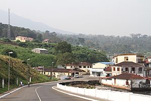
Luba, 2013
|
|
| Country | |
| Province | Bioko Sur |
| Elevation | 181 m (594 ft) |
| Population
(2012)
|
|
| • City | 7,739 |
| • Metro | 24,000 |
| Climate | Am |
Luba is a town in Equatorial Guinea. It used to be called San Carlos. About 7,000 people live there. It is the second-largest town on Bioko island.
Luba is an important port city. It is located on the west coast of the island. The town sits beneath tall mountains that used to be volcanoes.
Welcome to Luba!
Luba is a cool place to visit. It has several nice beaches. You can also see an old hospital there. This hospital was built a long time ago.
Where is Luba?
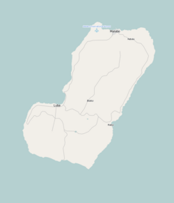
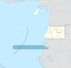
Luba is found on Bioko island. This island is part of the country of Equatorial Guinea. Luba is located in the Bioko Sur province.
Getting Around Luba
You can reach Luba in a few ways. You can travel there by sea on a boat. There is also a main road that connects Luba to Malabo. Malabo is the capital city of Equatorial Guinea.
The road trip from Malabo to Luba takes about one hour. A new highway was being built in 2010. This road goes from Luba through a special nature area. This area is called the Luba Crater Scientific Reserve. The new road will lead to a place called Ureca near the south coast.
Luba's Important Port
Luba has a very important port. In 1999, a special port opened near the town. This port is called a "free port." It has deep water, which means very large ships can easily dock there.
This port is especially useful for ships from the oil industry. It gives them a place to get more fuel, water, and other supplies. It is a good choice instead of the busy port in Malabo.
See also
 In Spanish: Luba (Guinea Ecuatorial) para niños


