
M'Sila Province facts for kids
Quick facts for kids
M'Sila Province
ولاية المسيلة
|
|
|---|---|

Map of Algeria highlighting M'Sila
|
|
| Country | |
| Capital | M'Sila |
| Area | |
| • Total | 18,718 km2 (7,227 sq mi) |
| Population
(2008)
|
|
| • Total | 991,846 |
| • Density | 52.9889/km2 (137.241/sq mi) |
| Time zone | UTC+01 (CET) |
| Area Code | +213 (0) 35 |
| ISO 3166 code | DZ-28 |
| Districts | 15 |
| Municipalities | 47 |
M'Sila (also spelled Msila or M'sila) is a province located in northern Algeria. It is home to about 1 million people. The main city and capital of this province is also called M'Sila. M'Sila Province is mostly known for its important farming activities.
How M'Sila Province is Organized
M'Sila Province is divided into smaller areas to help manage everything. These areas include 15 districts and 47 communes or municipalities. A district is like a larger region, and a commune is a smaller local area, similar to a town or a group of villages.
Districts of M'Sila
The 15 districts that make up M'Sila Province are:
- Aïn El Hadjel
- Aïn El Melh
- Ben S'Rour
- Bou Saâda
- Chellal
- Djebel Messaâd
- Hammam Dhalaâ
- Khoubana
- M'Sila
- Magra
- Medjedel
- Ouled Derradj
- Ouled Sidi Brahim
- Sidi Aïssa
- Sidi Ameur
Images for kids
-
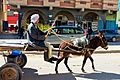
Transport in M'Sila Province

See also
 In Spanish: Provincia de M'Sila para niños

All content from Kiddle encyclopedia articles (including the article images and facts) can be freely used under Attribution-ShareAlike license, unless stated otherwise. Cite this article:
M'Sila Province Facts for Kids. Kiddle Encyclopedia.