Mākara facts for kids
Quick facts for kids
Mākara
|
|
|---|---|
|
Suburb
|
|
 |
|
| Country | New Zealand |
| Local authority | Wellington |
| Electoral ward | Wharangi/Onslow-Western Ward |
|
|
||
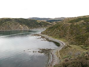
Mākara is a special place located on the western side of Wellington, New Zealand. It's very close to the Tasman Sea. The name Mākara comes from the Mākara Stream. In the Māori language, 'mā' means white, and 'kara' is a type of grey stone.
Even though Mākara Beach is nearby, the Wellington City Council sees it as a separate area. Mākara is a rural spot, meaning it's mostly countryside with not many buildings. You can get there by winding roads from Karori or Ohariu. Many people who want to live in the countryside but still be close to Wellington choose Mākara.
Contents
Mākara's Past
Early History and Gold
In the 1800s, people tried to find gold at a place called Terawhiti Station. However, they never found enough gold to start a big mining operation. You can still see old tunnels from these mining attempts on the hillsides today.
War Memorials
In 1921, the Mākara War Memorial was built. It honors the local people who died in World War I. Later, another name was added for someone who died in World War II.
World War II Defenses
During World War II, people worried about New Zealand being invaded. Because of this, gun positions were built at Fort Opau. These were part of the coastal fortifications of New Zealand. A small area of sand dunes near the coast was flattened by bulldozers. This was done because people thought invaders might hide there. Now, local groups are working to bring back the natural plants and animals to this area.
Cook Strait Cable
The Cook Strait Cable is a huge power cable that connects the North and South Islands of New Zealand. It comes ashore at Oteranga Bay, which is in Mākara. This cable started working in 1965. At that time, it was the biggest underwater power cable in the world!
Radio Station
In 1944, a radio receiving station was set up at Quartz Hill in Mākara. This station listened to shortwave radio broadcasts from other countries. These broadcasts were then sent out again by the New Zealand Broadcasting Service. From 1997 to 2007, a local amateur radio club used the site. They set up equipment and antennas to talk to other radio operators around the world.
Local Government Changes
Before 1973, Mākara was managed by a County Council. But in 1973, Mākara became part of the Wellington City Council. This meant the city council started looking after the area.
West Wind Farm
West Wind is a large wind farm project. In 2005, the Wellington City Council approved a plan by Meridian Energy to build it. Some people, called opponents, felt the wind farm was too close to where people lived.
Construction on the West Wind farm began in 2007 along Terawhiti Ridge. A temporary dock was built at Oteranga Bay. This helped move the giant parts of the wind turbines without having to go through Wellington's busy city center.
The wind farm was finished in 2009. It has 62 wind turbines, each 111 meters tall. The farm covers a large area of 56 square kilometers, including Quartz Hill and Terawhiti Station. There's also a recreation area for people to enjoy.
Official Name Change
In 2019, the official name of the area was formally changed to Mākara.
Mākara's Population
Mākara is part of the Mākara-Ohariu statistical area. This area is used to collect information about how many people live there.
Places to Visit
Parks and Green Spaces
People realized in the 1970s that Mākara could be a great place for outdoor activities. There's a small boat access point at the northern end of Mākara Beach. You can also take a two-hour walk from Mākara to Boom Rock if you cross the Mākara Stream.
Cemeteries and Churches
Mākara Cemetery is the largest cemetery in Wellington. It was started because Karori Cemetery was getting full around 1940. The first burial at Mākara Cemetery happened in 1965. It is currently about one-third full.
There is also a special burial ground within Mākara Cemetery called Ngā Iwi o Te Motu Urupā. This area is for Māori people and their families.
St Patricks Church was built in Mākara in 1873 by the Catholic Diocese. Today, it's a community-owned church that welcomes everyone. It's often used for events, right next to the Mākara Hall.
Learning in Mākara
Makara Model School is a primary school in Mākara. It teaches students from Year 1 to Year 8. It is a state school, meaning it's funded by the government. The school is also an important community emergency hub.
See also
 In Spanish: Makara (Nueva Zelanda) para niños
 | Laphonza Butler |
 | Daisy Bates |
 | Elizabeth Piper Ensley |

